


Refine your search for walks in pla de Laspeyres
pla de Laspeyres walks


 Pic de la Coume d'Enfer circular from Pla de las Peyres
 Visorando Member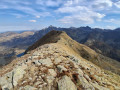
 8.04 mi
 +3,642 ft
 -3,612 ft
 6h 50
6h 50
 Difficult
 Departure from Ariège
A very beautiful hike, wild and rocky, with splendid views of the surrounding peaks, Andorra and the Fontargente lakes.
This isa demanding hike due to the elevation gain, with some passages that may be tricky for inexperienced hikers, and very steep slopes both uphill and downhill. GPS recommended.
Loop from the Étang de Laparan to the Refuge du Rulhe
 11.62 mi
+4,173 ft
-4,180 ft
2 days
11.62 mi
+4,173 ft
-4,180 ft
2 days
 Moderate
Departure from Ariège
Moderate
Departure from Ariège
A very pretty mountain circuit with an overnight stay at the Refuge du Ruhle. The ascent is via the Coume de Varilhes, the Étangs de Fontagente and the Aston to reach the Refuge du Rulhe. The return journey will be via the beautiful Crête des Isards, the Col de la Didorte and the Cabane de Rieutort.
The Fontargente and Joclar ponds in a loop through the Incles Valley
 10.55 mi
+3,806 ft
-3,793 ft
8h 10
Difficult
Departure from Ariège
10.55 mi
+3,806 ft
-3,793 ft
8h 10
Difficult
Departure from Ariège
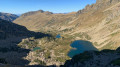
A superb hike between the austere Aston Valley and the equally austere upper part of the Inclès Valley in Andorra. There is a succession of ponds. Don't underestimate the difficulty of this long and technical hike, especially on the Andorran side. But as a group of American hikers we met twice during the hike said, "It is gorgeous."The loop is optimised compared to other routes as it does not descend to the bottom of the Inclès Valley and does not pass by the Refuge du Ruhle. But overall, it is very well marked!
Laparan - La Peyre - Passerelle - Fontargente - Aston - Refuge du Rulhe
 6.31 mi
+2,976 ft
-883 ft
5h 30
Moderate
Departure from Ariège
6.31 mi
+2,976 ft
-883 ft
5h 30
Moderate
Departure from Ariège
Please note: the approach walk along the road is the only part of the hike that is in the shade if you set off early enough in the morning. This is the only way to complete this loop. It may seem tedious, but the landscape is very beautiful.The hike can be classified as quite difficult. After the footbridge over the Ruisseau de la Coume de Varilhes, the path is not easy: steep, with steps, a paved scree slope, a ledge to cross, etc. But once you reach the top, you will be rewarded. Then the GR®T66 from the largest of the Étang de Fontagente lakes to the refuge is more of the same. This is definitely a mountain hike.
Walks near pla de Laspeyres
Refuge du Ruhle - Col de Belh - de la Didorte - Cabane Rieutort - Laparan
5.31 mi
+1,198 ft
-3,297 ft
3h 30
Moderate
Departure from Ariège
From the start of the hike, pay attention to the common white and red GR® T66 and GR®10 markings, as there are several crossroads and forks in the trail. Please note: the hike is in open terrain until the descent into the forest, well after the Rieutort hut.From the refuge, via the Crête des Isards and up to the Col de la Didorte, what a view! Of course, you need to be very careful on this ridge, which is often steep and jagged. But as soon as you stop, you can enjoy a 360° panorama.The steep descent to the Rieutort hut is on a narrow but safe path, offering beautiful views. The return to the road is not easy, but the path (GR®T66), although steep in places, is well marked throughout the descent.
Refuge du Rulhe - Castelet
11.00 mi
+958 ft
-5,958 ft
5h 55
Difficult
Departure from Ariège
This second day is exceptional. Most of it takes place on ridges from which you can see the Ax 3 Domaines resort on one side and the Plateau de Beille on the other. And everywhere, there are lakes and breathtaking landscapes. This stage is long (nearly 18 km), but you'll never want it to end before you descend into the valley through the forest. It's best to have someone waiting for you in the valley, or else you can reach Ax-les-Thermes on foot or by bus. Be aware that as you will be taking photos and spending time admiring the landscape, you should allow 6½ to 7 hours for the whole trip.
Ruhle Mountain Hut – Mérens-les-Vals
 7.75 mi
+1,339 ft
-5,069 ft
4h 45
Moderate
Departure from Ariège
7.75 mi
+1,339 ft
-5,069 ft
4h 45
Moderate
Departure from Ariège
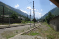
The final stage of the journey. We set off from the refuge to descend back into the valley, passing through spectacular high-mountain scenery whilst following the well-markedGR®10. There are no particular difficulties apart from a few rather tricky scree slopes.
Ascent to the Refuge du Rulhe via the Col de la Didorte and the Crête des Isards
 5.33 mi
+3,002 ft
-902 ft
5h 05
Difficult
Departure from Ariège
5.33 mi
+3,002 ft
-902 ft
5h 05
Difficult
Departure from Ariège
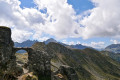
First day of the trip at the Refuge du Rulhe.
This stage can be classified as difficult due to the climb up to the Col de la Didorte and the section along the Crête des Isards.
The route follows paths that are very clearly marked on the ground, whether signposted or not.
In the event of fog or rain: take extra care on the ridge between (4) and (7).
From the Juclar Refuge to Pas de la Case
 9.19 mi
+1,762 ft
-2,421 ft
5h 45
Moderate
Departure from Canillo (Andorra)
9.19 mi
+1,762 ft
-2,421 ft
5h 45
Moderate
Departure from Canillo (Andorra)
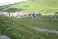
This third stage of the route linking Ax-les-Thermes to Latour de Carol takes you to Pas de la Case… and its hotels and refreshment stops; it is an easy, somewhat long stage that takes place at altitude, mainly along the gentle, grassy ridges of Andorra, but without any difficulty. It is best to tackle this stage in good weather, as landmarks can be misleading, especially if fog sets in.
From the Pra Redoun Refuge to the Juclar Refuge
 5.47 mi
+2,884 ft
-1,168 ft
5h 00
Moderate
Departure from Savignac-les-Ormeaux (Ariège)
5.47 mi
+2,884 ft
-1,168 ft
5h 00
Moderate
Departure from Savignac-les-Ormeaux (Ariège)
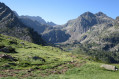
The second stage of the “Ax-les-Thermes to Latour-de-Carol” route; this is a beautiful high-mountain stage with magnificent scenery. Favourable weather is recommended.
This route follows a path which is initially very poorly signposted, climbing steeply towards the first pass, the Col de Behl, before reaching the Refuge de Ruhle, then the beautiful ascent to the Col de Juclar and finally the descent into Andorra towards the manned refuge of the same name.
Étang des Castellasses
4.31 mi
+2,648 ft
-322 ft
4h 15
Moderate
Departure from Ariège
A short, not too difficult hike – very enjoyable. You follow streams all the way, first through the forest, then across a plateau. A very wild, natural atmosphere. Countless spots, ideal for pitching a tent, with trees galore, majestic rocks and a fast-flowing yet calm river. A very good population of brown trout in the river. The lake, too, is teeming with fish – large brown trout and rainbow trout – to potentially delight the palates of food lovers.
From Ax Trois Domaines/Le Saquet to Castelet via the Refuge de Rhule
17.68 mi
+3,251 ft
-7,635 ft
2 days
Difficult
Departure from Ax-les-Thermes (Ariège)
A long hike in Haute Ariège to admire the lakes, ridges and magical landscapes with a stop at the ideally located Refuge de Rulhe, an opportunity to taste the local rataf'. On the second day, you can admire the whole area from the ridges.
Ax 3 Domaines Plateau du Saquet - Rulhe Refuge
6.69 mi
+2,293 ft
-1,677 ft
5h 05
Difficult
Departure from Ax-les-Thermes (Ariège)
This is a magnificent hike that starts from the Plateau du Saquet, and therefore the Ax 3 Domaines ski slopes, and ends at the Refuge de Rulhe, where a good local rataf will do you good. Once you reach the top of the resort, long desert plateaus await you before you descend into the austere scree slopes at the foot of Rulhe and finish sliding down to the Refuge de Rulhe. This first stage is wild and challenging, in the scree slopes. Be careful on the descent from the Col de Lhasse, which is very steep (but the GR® is well marked).
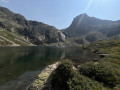
Ascent to the Refuge du Rulhe from the Cascade des Escaliers (Mérens)
 6.01 mi
+3,727 ft
-1,260 ft
6h 00
Difficult
Departure from Mérens-les-Vals (Ariège)
6.01 mi
+3,727 ft
-1,260 ft
6h 00
Difficult
Departure from Mérens-les-Vals (Ariège)
First day’s hike to the Refuge du Rulhe.With a 1,000 m elevation gain over 5.5 km, the average gradient of the climb to the Pyramide de Lherbés is 18%. IBP difficulty rating = 105 (“very difficult” for a hiker of average fitness).Allow 6½ hours with a light rucksack.This day takes place in the high mountains, far from any roads, tracks, etc.The landscapes and environments you’ll pass through are majestic.