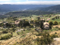
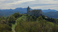
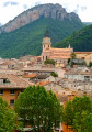
The Pic d’Oise, an almost perfect three-sided pyramid, is a topographical feature nestled between the Duyes valley and the village of Champtercier.
Its unusual shape is an invitation to climb it and explore its ridges and surroundings.
Note: please read the practical information carefully.
There is space to park three or four cars opposite the house known as ‘Le Colombier’, to the west of Champtercier.
(S/E) Take the tarmac road on the left when facing the house.
(1) Turn right at the first Fork in the road 100 metres further on and continue along the road until you reach a farm.
(2) At the farm, turn right, staying on the tarmac road, and
walk to the end of the tarmac road at Arbez Farm.
(3) Go through the gate marked with fire safety warnings. There is a wooden latch at the bottom of the gate. Make sure to close it properly after passing through. Carry on and climb up the embankment on the right as soon as possible. Head towards the peak. Wooden arrows point the way. As you follow the path to the left of the peak, there is an arrow indicating that you should leave the path and turn right.
(4) Climb the small slope until you reach a step-over, a device for safely crossing an electric fence by stepping onto an iron bar fixed to a blue-painted post. Once you have crossed the step-over, follow the path to the summit of the Pic d’Oise.
(5) Return via the same route as on the way there to (S/E).
Waypoints
S/E : mi 0 - alt. 2,474 ft - Parking is available opposite Le Colombier house.
1 : mi 0.15 - alt. 2,569 ft - Fork
2 : mi 0.58 - alt. 2,740 ft - Farm
3 : mi 1.3 - alt. 3,051 ft - Gate to pass through
4 : mi 1.51 - alt. 3,209 ft - Step-up - Electric fence
S/E : mi 3.66 - alt. 2,464 ft - Parking is available opposite Le Colombier house.
Notes
For the very steep climb covered in pebbles, shoes with good grip are essential, especially on the descent.
Access conditions
This walk is frustrating because, apart from the Pointe du Pic, all the surrounding land is private and off-limits to the public as it is used for grazing. It is clear from the map that there are numerous access paths, but it remains to be seen whether there are any other routes apart from the one via the Arbez farm.
One of these paths has a sign at the entrance reading ‘rifle adjustment’. That’s quite clear.
Even the Arbez farm only allows limited access. For example, at the start of the final climb towards the Pic d’Oise, there is a wire mesh fence to the left of the path and an electric fence to the right. Visitors will therefore understand that access to the peak is more a matter of courtesy than a right.
Route information
Due to the restrictions mentioned above, I haven’t found a way to do a proper walk around the Pic d’Oise off the tarmac.
You should therefore not attempt to combine the ascent of this peak with a standard hike; it’s a take-it-or-leave-it sort of thing.
The unpaved section is tiny, lying between the fence and the summit. It takes less than 30 minutes to walk this distance of under 500 metres.
So if you’re looking for a proper off-road walk, don’t go to the Pic d’Oise.
The ascent
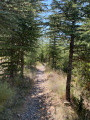
The southern path becomes steeper and steeper from the start right up to the summit. It consists mainly of white pebbles. On the final stretch, it’s helpful to use your hands; you can grip the vegetation growing firmly on the rocks. There are a few brambles and thorns.
The summit consists of a small, open platform measuring approximately 4 m by 4 m. The view is interesting but somewhat limited, as the surrounding peaks are often higher.
The path to the east is easier than the southern route, less steep and on earth, but it leads onto private property.
Warning: take care on the descent along the southern path, which is very steep and covered in smooth, round pebbles. Avoid the ascent altogether in wet weather.
It is solely this slope that means the route is classified as moderate rather than easy; indeed, this classification is debatable given how short the climb is.
Reviews and comments
4.7 / 5
Based on 1 review
Reliability of the description 5 / 5
Ease of following the route 5 / 5
Route interest 4 / 5
atraver
Overall rating :
4.7 / 5
Date of your route : Oct 24, 2024 Reliability of the description : ★★★★★ Very good Ease of following the route : ★★★★★ Very good Route interest : ★★★★☆ Good Very busy route : No
To open this route on your smartphone, you must have the Visorando app installed. If not, got to the Apple Store (iPhone) or Google Play Store (Android) to download the app.



 Country:

 City:


 Visorando Member

 Difficult


 Easy