Visorando Visorando
Visorando Visorando
  •  Tools 
    • Walking route planner
    • Import a GPX file
  • Walks
  • Help ↗
  • Visorando Premium
  • Sign up
  • Log in
  1. Visorando
  2. Walks
  3. Provence-Alpes-Côte d'Azur
  4. Alpes-de-Haute-Provence
  5. Champtercier
  6. Pic d’Oise
Refine your search for walks in Pic d’Oise
Filters NEW

Filters

Close
Duration
Distance
Difficulty
Ascent NEW
Activities
Route type

Pic d’Oise walks

fr de

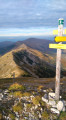
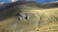
Walking The Pic d’Oise as seen from Le Colombier

Visorando Member
Le Pic d’Oise depuis le Colombier
↔3.66 mi ↗+1,234 ft ↘-1,243 ft ◔2h 45 ▲Moderate
⚑Departure from Champtercier (Alpes-de-Haute-Provence)
The Pic d’Oise, an almost perfect three-sided pyramid, is a topographical feature nestled between the Duyes valley and the village of Champtercier. Its unusual shape is an invitation to climb it and explore its ridges and surroundings. Note: please read the practical information carefully.
Download PDF  PDF Download GPX  GPX

Walks near Pic d’Oise

Walking Authon - Clapouse pastures

Visorando Member
Authon - Paturages de Clapouse
↔6.73 mi ↗+2,559 ft ↘-623 ft ◔5h 20 ▲Moderate
⚑Departure from Authon (Alpes-de-Haute-Provence)
First stage of a two-day circuit in the Montagne des Monges.
Download PDF  PDF Download GPX  GPX

Walking Clapouse pastures - Authon

Visorando Member
Paturages de Clapouse - Authon
↔6.46 mi ↗+879 ft ↘-2,808 ft ◔3h 45 ▲Moderate
⚑Departure from Barles (Alpes-de-Haute-Provence)
Second stage of the two-day trip to the Montagne des Monges.
Download PDF  PDF Download GPX  GPX
Back to top
  • Privacy policy
  • Contact
  • Manage my cookies
  • Visorando community

Download the app now and go on an adventure!

App storeApp Store
Google playGoogle Play

Checking services status…© 2026 Visorando
 Loading…