From Digne-les-Bains to the summit of Martignon and back via Courbons

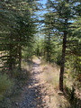
The route starts right in the town centre, but the path climbs rapidly, taking us into the beautiful Bès forest.
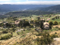
The Caguerenard viewpoint offers a breathtaking view of the ancient Roman city of Dinia (Digne-les-Bains), whilst at the summit of Martignon, a 360° panoramic view stretches across the surrounding mountain ranges – a true natural spectacle. To round off this wonderful adventure, the return journey takes you through the charming village of Courbons, adding a picturesque and authentic touch to this unforgettable day.

Details

n°68929817
Creation:
Last update:
Last review:
  • Walking
    Activity: Walking
  • ↔
    Distance: 8.37 mi
  • ◔
    Average duration: 6h 35 
  • ▲
    Difficulty: Difficult

  • ⚐
    Back to start: Yes
  • ↗
    Ascent: + 3,176 ft
  • ↘
    Descent: - 3,156 ft

  • ▲
    Highest point: 4,678 ft
  • ▼
    Lowest point: 1,949 ft

Photos

Description of the walk

At the 1851 Insurgents’ roundabout, head towards the station and park as soon as possible in the herringbone-style car park along the road. Alternatively, park in the station car park.

(S/E) Head towards the ‘Rond-point des Insurgés’ and continue along the Bléone to the climb up to the hospital.

(1) At the signpost, head towards L’Andran.

(2) Enjoy the views from the Gaguerenard viewpoint, then take the path which climbs steeply towards the Hubac de Saumon. When you reach the road, follow it to the right for 200 m, then take the path branching off to your right. The path crosses the access road to the antennae several times.

(3) When you reach the Pied du Relais, turn right towards the antennae visible on the hills above, go round them on the left and continue along the exposed ridge to the summit of the Andran (elevation 1218). Stay on the ridge and descend to the Baisse des Chatières (elevation 1138).

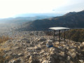
(4) Directly in front of you, look out for the GRP® path which winds its way up the ridge. Reach the summit of Martignon (elevation 1,430) and enjoy the 360° view, then descend to the Col de Martignon.

(5) At the signpost, turn sharply left towards Courbons. The path descends gradually (south) to the village.

(6) Walk up to the magnificent bell tower overlooking Courbons, then retrace your steps and head down the Chemin empierré de la Bigue, continuing via the Place du Cercle to the sign (below the village) marking the start of the trail. After crossing the road twice, head down towards the Marches de Courbons.

(7) Leave the Route de Courbons, which heads downhill, and take the road on your left that winds steeply uphill; continue until you reach the sign for the Chemin de la Bonnette.

(8) At the three-way junction, ignore the path leading off to your right and continue down the slope to join the tarmac Chemin des Oliviers. Enjoy the views of the neighbourhood’s beautiful properties, all surrounded by magnificent olive trees.

(9) At the telecoms mast, turn right onto Rue Pasteur and join Avenue de Saint-Véran, which runs alongside the railway tracks. Return to your car. (S/E) 

Waypoints

  1. S/E : mi 0 - alt. 1,952 ft - Angled parking
  2. 1 : mi 0.21 - alt. 1,978 ft - Signpost
  3. 2 : mi 0.59 - alt. 2,116 ft - Gaguerenard viewpoint
  4. 3 : mi 2.1 - alt. 3,583 ft - Foot of the Relais
  5. 4 : mi 2.8 - alt. 3,734 ft - Baisse des Chatières
  6. 5 : mi 3.86 - alt. 4,560 ft - Col de Martignon
  7. 6 : mi 5.98 - alt. 3,068 ft - Corbons bell tower
  8. 7 : mi 6.75 - alt. 2,392 ft - The Marches de Courbons
  9. 8 : mi 7.43 - alt. 2,556 ft - Three-Way Junction
  10. 9 : mi 7.88 - alt. 2,126 ft - The antenna
  11. S/E : mi 8.37 - alt. 1,952 ft - Angled parking

Notes

At the Col de Martignon, you can carry on to the summit of La Bigue (1,652 m), which adds about 250 m of elevation gain.

A very lovely walk on a winter’s day with a mix of sunshine, clouds and a few gusts of wind.

Reviews and comments

5 / 5
Based on 1 review

Reliability of the description
5 / 5
Ease of following the route
5 / 5
Route interest
5 / 5
User 15994551

Overall rating : 5 / 5

Date of your route : Aug 03, 2026
Reliability of the description : ★★★★★ Very good
Ease of following the route : ★★★★★ Very good
Route interest : ★★★★★ Very good
Very busy route : Yes

It’s great to be able to record them.
Thank you

Machine-translated

Other walks in the area

For more walks, use our search engine .

The GPS track and description are the property of this route's author. Please do not copy them without permission.