Country:
 City:
City:


Park at the GPS point; there are around ten spaces available. For those who’d like to save a few hundred metres, it’s also possible to park further along the track, between this starting point and the point (1).
(S/E) Head north along the main road, ignoring the side tracks leading off to neighbouring properties.
(1) On the right is a white gate; this is the way to go. On this first section, follow the River Yahoué, which features some very impressive waterfalls in places. The climb is steep from the outset; a considerable physical effort awaits you all the way to the Pic de Malaoui. Many sections are equipped with ropes. There’s only one path in this area, so you shouldn’t have any trouble finding your way.
(2) A red sign pointing to Pic Malaoui on the right; follow the path on the right and continue climbing with determination. After 250 m, the rainforest gives way to scrubland; there is no shade from this point onwards.
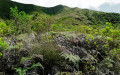
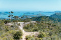
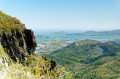
(3) There’s an unobstructed view from here; enjoy the magnificent panorama for the rest of the climb up to Pic de Malaoui. Keep going and stay alert.
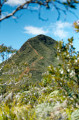
(4) Pic Malaoui. The end of the main climb. A sublime panorama.
(The usual alternative is to turn back and descend from here; you can always choose this option depending on how tired you are, which will save you about 2.5 km.)
To continue, descend the north face; a very steep path is on your left as you reach the ‘platform’ at the summit. Take care – the descent is very steep here. Then follow the ridge path.
(5) Junction: take the path that climbs in steps to your left. (If you come across a chain with a ‘private property’ sign, you’ve missed the junction; retrace your steps for about 30 metres to find it.)
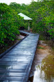
A little further on, you’ll enter a section of damp woodland, which is very shady and pleasant when it’s hot, but can also be very muddy depending on the weather; take care on the downhill sections.
(6) At the junction, turn right. You can also turn left; the two paths rejoin further on, but there’s nothing of particular interest there.
Final (much gentler) climb to reach the highest point of the walk; unfortunately, there’s no view from here. Stay on the same path as you begin the descent towards Yahoué. You’ll pass several signposts (inn, ridge trail); ignore them.
(7) Junction: turn left at the hairpin bend, following the sign for “Vallée des Houps”. Please note that the rainforest is very dense along this stretch; finding the path can be tricky at times, but red ribbons are tied at regular intervals to help you along. If in doubt, refer to the GPS track.
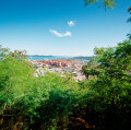
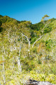
(8) As you leave the rainforest, you’ll emerge into a magnificent area of dry forest a little further down, with stunning Niaouli trees dotted throughout; above all, the view opens up once more to Grand Nouméa, the sea and Pic Malaoui.
Stay very alert on this descent, which is very steep in places. The path passes through very tall ferns at times, but remains generally easy to follow.
(9) An inconspicuous fork: leave the main path heading south-west (this is not the one we want, as it would take us back down the wrong side of the valley).
The path to follow is slightly to the left, due south, a little further on. Again, be careful throughout the descent – it’s easy to slip. You’ll eventually rejoin the starting path at a large, graffiti-covered concrete building; turn right towards the car park. Return to the car park (S/E) via the road.
 Visorando Member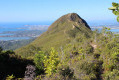
 Moderate

 Easy
Easy 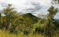
 Difficult
  Association / Club / Walk leader