Country:
 City:


At Logis Neuf, follow the D901 towards Peypin. Before reaching La Fève, turn right onto the narrow tarmac road (Chemin des Grands Louis). Further on, turn right onto Chemin des Maurins and keep to the right at the Fork in the road shortly afterwards. Park on the right-hand side of the road before the Maurins hairpin bend: there is space for five to six vehicles without any problem.
YellowPR® signposting
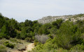
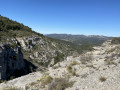
(S/E) Head towards the bend, then leave Chemin des Maurins and turn onto the very narrow road opposite signposted ‘Vallon de l’Oule’. Once you reach the last houses, pass a dirt car park and go through a forest gate. Continue along the track, which is now unpaved and winds through the picturesque, deeply incised rocky valley.
You’ll come to a section of tarmac road and, just as it begins to curve to the left, leave it to follow a stony track uphill to the right (concrete marker GB 200). Reach the first hairpin bend.
No signposting
(1) Leave the track and turn left onto the path that starts at a rusty gate. Then cross the chain blocking access to two-wheeled vehicles and gradually emerge from the steep-sided valley into a more open landscape where the path becomes a trail.
(2) Keep to the right, ignoring another path branching off to the left. After a steep section, which is gullied in places, you’ll reach the Col de l’Amandier.
YellowPR® markings
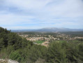
(3) Take in the exceptional view of Marseille, Notre-Dame de la Garde and the Frioul Islands. Walk a few metres to the left, then leave the track and turn left onto a small path, following the markings (sign on the ground: la Parloire). You’ll soon reach a large junction where several paths meet.
No signposting
Leave the signposted route by turning right, then veer left a few metres further on towards the rocky outcrop. Cross the outcrop at its narrowest point, the Pas du Figuier, and continue walking on almost level ground through the heath, keeping the long ridge of the Taoumé in sight. You’ll reach a wide dirt track opposite a pretty grove of pine trees (cairn).
YellowPR® signposting
(4) Turn left and follow the track, which begins a steady, sustained climb up to the Col de Baume Sourne, a vast flat area at the bottom of which you can make out a signpost.
(5) There’s no need to go right up to it: turn right, following the signposting, which you must watch carefully on the ground due to the many different tracks in this area. After a short section where you’ll need to use your hands, you’ll emerge onto the broad Taoumé ridge and follow it to the summit, taking in the sweeping panoramic views on either side.
(6) Pic du Taoumé: exceptional 360° views. Then descend a short rocky section requiring care and, once at the bottom, head left to visit the Grotte du Grosibou, where the young Marcel Pagnol used to come and play with his friend Lili des Bellons.
(7) Retrace your steps.
(6) Continue to the left, following the signposts. Carefully begin a steep descent where stones roll underfoot to reach large rock slabs where three imposing cairns stand. Cross this area in line with the cairns to rejoin the signposted path, which curves further to the left towards the summit of the Pounche des Escaouprés. Enter a lovely grove of pine trees and reach a junction where several paths meet, with a signpost to the left and slightly higher up.
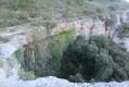
(8) A tricky change of direction, not signposted on the ground: do not continue straight on along the most obvious path, but veer right, descending slightly over stony and slippery ground to reach the top of a rocky crevice, which you must climb down using your hands. Once at the bottom, head slightly to the right towards a wide track, which you’ll reach at a point where three tracks meet on the ground: in the opposite direction, you’ll see the sign for ‘La Treille’, a blue circle and a yellow marker.
No signposting
Cross the track diagonally to the right to reach the start of a path that heads left into the heath and then turns into a footpath at a hunting post. The slope becomes much steeper and the ground slippery before opening out onto a track which you must follow to the left until the first hairpin bend.
(9) Take the path on the right, which further on makes a 90° left-hand bend, passes close to an electricity pylon and eventually joins a track after a short, steep climb. Turn right and follow this track to a junction where you must turn right again.
(10) At the left-hand bend (wooden electricity pole), leave the track and head down to the right, quickly coming out onto a cross-country path. Turn right and follow this path, which widens and winds its way to the entrance of the Vallon de l’Amandier. After a short, fairly steep climb, ignore the path on the left and continue to the right along a virtually flat section where there is a junction that is not very visible on the ground but can be spotted by the pretty solitary pine tree marking its corner.
(11) Leave the main track and turn left onto another path which immediately leads to a small cultivated plot. Turn right to skirt around it and head up a narrow valley before veering sharply to the left to emerge onto a track opposite the ruins of a sheepfold.
YellowPR® signposting
(12) Walk a few metres to the right, then take a path on the left, following the signposting. A little further on, take a short detour to the left to see the pretty Boude well, restored in 2019 by a hunting society, then rejoin the route which leads downhill to a track suitable for vehicles.
(13) Turn right and follow this track, which winds pleasantly before rejoining the junction for the Vallon de l’Oule.
(1) Continue to the left, rounding the bend, to reach the car park at Chemin des Maurins (S/E).

 Visorando Member

 Difficult