Country:
 City:
City:


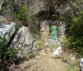
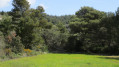
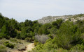
At Logis Neuf, follow the D901 towards Peypin. Before reaching La Fève, turn right onto the narrow tarmac road (Chemin des Grands Louis). Further on, turn right onto the Chemin des Maurins and keep to the right at the Fork in the road shortly afterwards, letting the Ancien Chemin de Pichauris branch off to the left. At the hairpin bend leading to Les Maurins, turn left onto the Chemin du Vallon de l’Oule; as the track is narrow, please drive with care. Park at the last unpaved car park, situated just before a forest gate.
YellowPR®® signposting
(S/E) Go through the forest gate (usually open) and continue along the track, which is unpaved and winds through the very picturesque rocky valley. You’ll come to a section of tarmac road; just as it begins to curve to the left, leave it and follow a stony track uphill to the right (concrete marker GB 200). You’ll reach the first hairpin bend.
No signposting
(1) Leave the track and turn left onto the path that starts at a rusty gate. Then cross the chain blocking access to two-wheeled vehicles and gradually emerge from the steep-sided valley into a more open landscape where the path becomes a footpath. You’ll reach a junction just before arriving directly below a hunting hide high up on the hillside (cairn).
(2) Turn left. After a fairly steep start, the slope levels out before the path joins a wide, motorable track at Les Grands Chênes.
YellowPR®® markings
(3) Do not take this track but turn immediately right at a signpost, following the signs for ‘Circular Route of the Grands Ubacs’ and ‘Pic du Taoumé via the Col du Tubé’, amongst others. After several short rocky sections where you may need to use your hands, the path makes a hairpin bend and reaches a junction marked by a signpost.
(4) Continue straight ahead, cross the rocky ridge and reach a flat area where there is an old stone shelter. Do not hesitate to turn round to enjoy an exceptional view of Marseille, then continue for about thirty metres.
No signposting
(5) Just before a wooden post, turn right onto a stony path that climbs gently and joins a wider track, along which you should continue straight on. After a long straight stretch, you’ll reach the Col du Tubé, where there is an underground cistern and a picnic table under the pine trees.
(6) Cross the junction, heading for the start of the tarmac section. Take a narrow path which is initially hard to spot, though a fluorescent green marker on a tree can serve as a guide.
Blue markings
Continue through the west-facing valley towards the Puits du Mûrier, keeping the Pic du Taoumé in your sights. Pass the well, tucked away beneath the vegetation, and walk for about thirty metres.
YellowPR®® Markings
(7) Take the path on the right (cairn). Further on, ignore the path on the left which descends into the Vallon de Précatori and go straight on to quickly reach the entrance to the Baume Sourne cave. It is possible to visit this cave, but you will need to negotiate the narrow rocky passage leading to it and be equipped with a head torch to make the most of it. Otherwise, carry on to reach the large, shaded area of the Col de Baume Sourne, situated at the junction of several tracks and paths (signpost).
(8) Turn left, following the sign for “La Treille” painted in black on a rock. The lovely balcony-like path runs along the south-east face of the Pic du Taoumé, offering some stunning views. You’ll reach the Pas du Loup junction, where the wooden post has been completely stripped of its directional signs (!).
No signposting
(9) Ignore the two obvious paths to the left and right and head straight ahead onto a path that is very difficult to make out, but whose start is fortunately marked by a cairn. Begin a very steep descent over particularly unstable stony ground and join the cross-country path coming from the Source du Chien.
Blue markings
Turn right and head up the final section of the Vallon des Escaouprés. The very dense ground markings lead directly to the signpost at the foot of the Pounche des Escaouprés.
No markings
(10) Veer very slightly to the left, following the sign for “Allauch” painted in black on a small metal plate. Walk along the base of the rocky ridge and, after a final rocky section, emerge onto a wide track suitable for vehicles, which you should follow to the left until the first junction.
(11) Turn right, immediately ignore a path branching off to the left and carry on straight ahead along the track which winds its way up to the Col de l’Amandier.
YellowPR®® markings
(12) Continue straight on along the same track, which remains flat. Pass under the power line and, further on, look out for the cairn on the right-hand side, which marks the start of a path with two distinct tracks.
No markings
(13) Turn right. You’ll come to a hunting blind; carry on straight ahead to continue along a much narrower path. Continue the descent and pass a second hunting blind, where the path widens into a track again before rejoining the track you left earlier.
YellowPR®® markings
(14) Follow it to the right.
(1) Continue along the same track, rounding the bend, and return to the starting car park (S/E).

 Visorando Member
 Difficult