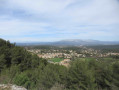
The Garlaban via the Vallon de l’Oule in Allauch

A lovely circular route along DFCI tracks and footpaths. You’ll pass two almost identical rocky outcrops which may unsettle those particularly prone to vertigo. After crossing a pass, the back of the Garlaban comes into view… you just need to reach it! From the summit, the view takes in Marseille, Aubagne, Cap Canaille, Sainte-Baume, the Étoile range and Sainte-Victoire!

Details

32330057
Creation:
Last update:
Last review:
  • Walking
    Activity: Walking
  • ↔
    Distance: 11.98 mi
  • ◔
    Average duration: 7h 25 
  • ▲
    Difficulty: Difficult

  • ⚐
    Back to start: Yes
  • ↗
    Ascent: + 2,188 ft
  • ↘
    Descent: - 2,188 ft

  • ▲
    Highest point: 2,356 ft
  • ▼
    Lowest point: 758 ft
  • ⚐ Country: France
  • ⚐ City: Allauch (13190)
  • ⚑
    Start/End: N 43.363846° / E 5.509144°
  • ❏
    IGN map(s): Ref. 3145ET
  • Hour-by-hour weather

Photos

Description of the walk

The start is at the end of the Chemin du Vallon de l’Oule, in the Maurins neighbourhood of Allauch. Park in the space on the right as you arrive, before the barrier, without blocking the way. The main part of the route is marked in yellow.

(S/E) Take the path, which soon leads to a large open area where, on the left, there is a concrete structure providing access for maintenance of the underground canal of Provence; then continue past this flat area.

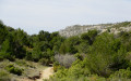
(1) As the circular path curves to the left, take the DFCI path on the right, which starts in the pine forest and then passes through a rocky gorge. Continue on to the top of the hill.

(2) Continue along the DFCI track to the left, passing over an underground cistern. After reaching the other side of the hill, from where you can begin to see Marseille, follow the track round the hill and across the Plaine de la Grosse.

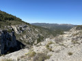
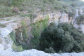
(3) Take a path to the left, leaving the DFCI track: don’t miss the junction! The path climbs and narrows slightly. Walk alongside two almost identical rocky outcrops.

(4) After the first rocky outcrop, the path continues. When you reach the second rocky outcrop, carry on along the path as it climbs up to a crossroads with signposts.

(5) Turn right and follow the signposting for Garlaban.

(6) Pass the Goi steps, then continue along a path that is often shaded. When the view opens up again to the left, the path veers slightly to the right and climbs up to a sort of square drystone shelter used for hunting.

(7) From here, carry on straight ahead downhill to join a DFCI track.

(8) Take this path on the right. Reach the Col du Tubé.

(9) The back of the Garlaban is in sight: continue in that direction at every junction until you reach the Col du Garlaban.

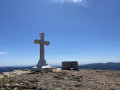
(10) Turn left up through the pines, pass a small wayside shrine and climb straight up to the summit.

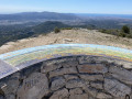
(11) From the summit, the view takes in Marseille, Aubagne, Cap Canaille, Sainte-Baume, the Étoile range and Sainte-Victoire! The return journey initially follows the reverse route of the outward journey

(8) Do not take the path on the left that you took on the way up; instead, continue along the main DFCI path, still heading downhill.

(12) Turn left at a place called Les Grands Chênes and carry on until you reach a tarmac road closed to traffic.

(13) Take the road on the left to reach the first junction you passed on the way out.

(1) Turn right to return to the car park (S/E).

Waypoints

  1. S/E : mi 0 - alt. 758 ft - Car park
  2. 1 : mi 0.24 - alt. 787 ft - Junction of the circular loop
  3. 2 : mi 1.64 - alt. 1,309 ft - Viewpoint over Marseille
  4. 3 : mi 2.79 - alt. 1,447 ft - Path leading uphill to the left
  5. 4 : mi 3.53 - alt. 1,601 ft - First rocky outcrop
  6. 5 : mi 3.84 - alt. 1,693 ft - Crossroads – Signposts
  7. 6 : mi 3.94 - alt. 1,716 ft - Goi Staircase
  8. 7 : mi 4.47 - alt. 2,136 ft - Square drystone shelter (hunting hut)
  9. 8 : mi 4.61 - alt. 2,139 ft - DFCI resumption
  10. 9 : mi 5.17 - alt. 2,257 ft - Col du Tubé (691m)
  11. 10 : mi 6.1 - alt. 2,060 ft - Col de Garlaban (628m)
  12. 11 : mi 6.34 - alt. 2,326 ft - Garlaban
  13. 12 : mi 9.8 - alt. 1,401 ft - Les Grands Chênes
  14. 13 : mi 11.41 - alt. 942 ft - Tarmacked road on the left
  15. S/E : mi 11.98 - alt. 758 ft - Car park

Notes

Sturdy walking shoes are essential, water is a must, and walking poles are optional depending on your preference.

Worth a visit

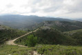
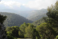
During the walk, there are magnificent views of the Étoile mountain range, Marseille, Sainte-Victoire, Aubagne, the Alps, the Étang de Berre, Sainte-Baume and even Cap Canaille!

Reviews and comments

4.7 / 5
Based on 2 reviews

Reliability of the description
5 / 5
Ease of following the route
5 / 5
Route interest
4 / 5
Théodore
Théodore

Machine-translated

Théodore
Théodore
• Edited:

Overall rating : 5 / 5

Date of your route : Jul 18, 2024
Reliability of the description : ★★★★★ Very good
Ease of following the route : ★★★★★ Very good
Route interest : ★★★★★ Very good
Very busy route : No


Make sure you take plenty of water with you.

Machine-translated

Julie3826
Julie3826

Overall rating : 4.3 / 5

Date of your route : Mar 25, 2024
Reliability of the description : ★★★★★ Very good
Ease of following the route : ★★★★★ Very good
Route interest : ★★★☆☆ Average
Very busy route : Yes

If you enjoy walking along track-like paths, then this walk is just the thing for you!
Apart from the two sections near the ‘cliffs’ – which were magnificent and followed a lovely little path – the rest is, in my view, rather uninteresting.
In any case, that’s not my idea of a hike: walking along a track rather than a ‘single track’.
The view from the summit is very beautiful, however, and the information provided is very reliable 👍🏼

Machine-translated

Other walks in the area

For more walks, use our search engine .

The GPS track and description are the property of this route's author. Please do not copy them without permission.