From the Vallon de l’Oule to the Vallon de l’Amandier

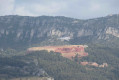
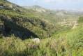
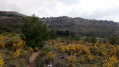
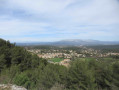
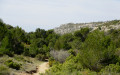
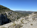
A pleasant, undemanding route starting from La Fève, ascending the wooded Vallon de l’Oule – a haven for numerous game species – towards the Col de l’Amandier, before descending the Vallon de l’Amandier, a wilder valley with its limestone slabs and potholes. The return route via the Puits de Boude leads back to the starting point along a wide DFCI track, offering beautiful views of Allauch, Marseille and the entire Étoile mountain range.

Details

23283858
Creation:
Last update:
Last review:
  • Walking
    Activity: Walking
  • ↔
    Distance: 6.37 mi
  • ◔
    Average duration: 4h 15 
  • ▲
    Difficulty: Moderate

  • ⚐
    Back to start: Yes
  • ↗
    Ascent: + 1,512 ft
  • ↘
    Descent: - 1,512 ft

  • ▲
    Highest point: 1,437 ft
  • ▼
    Lowest point: 610 ft
  • ⚐ Country: France
  • ⚐ City: Allauch (13190)
  • ⚑
    Start/End: N 43.363118° / E 5.497974°
  • ❏
    IGN map(s): Ref. 3145ET
  • Hour-by-hour weather

Photos

Description of the walk

Coming from Logis Neuf, follow the D908. In the centre of the village of La Fève, just after the terminus of bus no. 142, turn right at the traffic lights onto the Chemin des Grands Louis, towards the Vallon de l’Oule, then left onto the Chemin des Maurins. Keep right at the junction just after this and park at the side of the road after the Fork in the road: there are five to six spaces available.

(S/E) Retrace your steps back to the Fork in the road and turn right onto the Ancien Chemin de Pichauris, which climbs alongside some houses. Pass a fire brigade access gate, go past a large water tank, then turn right onto the tarmac road which descends and leads to an open area with several paths.

(1) Follow the DFCI GB200 track. Head along the path flanked by cliffs until you reach a hairpin bend to the right.

(2) Leave the track and turn left onto the path that leads into the Oule valley, where you’ll need to go through a barrier and over a chain. Note the areas set aside for animals and the numerous ‘Traps’ signs hanging from the trees. The path then narrows before reaching a junction with an observation post (lookout) perched on a tree opposite.

(3) Keep to the right, heading south, then south-west. After a mirador on the right and an old well on the left, the path becomes steeper as it climbs to the Col de l’Amandier. Cross the pass’s clearing and take the path opposite, which descends steeply, running along the right-hand side of the Amandier valley. Walk for about 100 m until you see, on the left, the start of a very overgrown path (marked by a cairn) which descends towards the bottom of the valley.

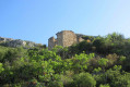
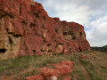
(4) Take this path, using as a landmark on the right a large, isolated rock in the middle of the vegetation, which you’ll need to head towards in order to pass alongside it (see photo). The path then becomes pleasant and clear. Pass by a ruin and descend to the clearly visible bottom of the valley. Cross a few rocky sections and potholes without difficulty.

(5) Leave the valley floor on the right, returning to it further down. Then keep to the left at the Y-junction. Head towards the large rocky outcrops and keep to the left.

(6) Further down, rejoin the path that branches off to the right into a valley, heading west-north-west. You’ll come to a track.

(7) Turn right, go through the gate and follow the path which, after a bend to the left and another to the right, joins the top of the Amandier valley on the left.

(8) Turn left onto the path heading north-east, which alternates between shaded and stony sections. You’ll reach a crossroads.

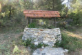
(9) Turn left and walk for about 50 metres to reach a DFCI track opposite a ruin. Follow the track a few metres to the right, then turn left onto the yellow-marked path heading north. You’ll reach the Boude well, which has been restored by a hunters’ association. Continue northwards, with the Étoile range and the Pilon du Roi in your sights. Join the DFCI track again.

(10) Turn right onto the track.

(2) Carry on, negotiating the bend, and arrive at the open area with numerous path junctions.

(1) Turn left towards the west onto the main track, which passes by the Fenêtre des Maurins (a viewing point on the Canal de Provence) and then, after a barrier, joins the tarmac road of the Vallon de l’Oule. Follow this road straight on to return to the car park at the start (S/E).


Waypoints

  1. S/E : mi 0 - alt. 610 ft - Chemin des Maurins car park. Near the - Jarret (rivière)
  2. 1 : mi 0.97 - alt. 794 ft - Elevation 242 – Trail GB200
  3. 2 : mi 1.17 - alt. 866 ft - Elevation 266 – Start of the Vallon de l’Oule
  4. 3 : mi 1.79 - alt. 1,027 ft - Crossroads, viewpoint – on the right
  5. 4 : mi 2.24 - alt. 1,365 ft - Cairn, on the left
  6. 5 : mi 2.9 - alt. 866 ft - Turn right at the fork
  7. 6 : mi 3.17 - alt. 850 ft - Junction, turn right
  8. 7 : mi 3.33 - alt. 797 ft - Track with barrier
  9. 8 : mi 3.69 - alt. 981 ft - Turn left at the fork
  10. 9 : mi 4.1 - alt. 1,362 ft - Elevation 419, junction – turn left
  11. 10 : mi 4.5 - alt. 1,171 ft - DFCI track, on the right
  12. S/E : mi 6.37 - alt. 610 ft - Chemin des Maurins car park

Notes

For reference: the author’s time for this route was 3 hours 15 minutes (excluding a lunch break).

Reviews and comments

4.3 / 5
Based on 3 reviews

Reliability of the description
4.7 / 5
Ease of following the route
4.3 / 5
Route interest
4 / 5
Bernard S.
Bernard S.

Overall rating : 4.3 / 5

Date of your route : Mar 01, 2026
Reliability of the description : ★★★★★ Very good
Ease of following the route : ★★★★☆ Good
Route interest : ★★★★☆ Good
Very busy route : No

The parking and departure points are well described, so we had no trouble climbing back up after retracing our steps as indicated to take the path that goes up the "old Pichauris path". It's well worth it.
The climb up the Oule valley is pleasant, with a clear path and few people, whereas on that day it was crowded in Pichauris, which was great for peace and quiet.
We arrived at the Col de l'Amandier, headed straight ahead and very quickly turned off downhill as indicated in the instructions towards a path that was barely visible between the bushes (cairn). I used my secateurs to make the path more visible, at least at the start. Avoid wearing shorts as it scratches your legs!
But it's fine all the way down to the bottom of the valley, with magnificent scenery all the way down.
The climb back up is easier but just as beautiful. Do this at the weekend when the well-known paths are crowded!
We didn't know this Amandier valley via this route, which is really worth it!

Machine-translated

TANAGRETTE
TANAGRETTE

Overall rating : 3.7 / 5

Date of your route : Sep 15, 2025
Reliability of the description : ★★★★☆ Good
Ease of following the route : ★★★★☆ Good
Route interest : ★★★☆☆ Average
Very busy route : No

The entrance to the Amandier valley disappears into the kermes oak trees. We gave up after a few metres and took the path overlooking the valley.

Machine-translated

EMCI13
EMCI13

Overall rating : 5 / 5

Date of your route : Feb 14, 2025
Reliability of the description : ★★★★★ Very good
Ease of following the route : ★★★★★ Very good
Route interest : ★★★★★ Very good
Very busy route : No

A magnificent walk with a superb view of Marseille. You’ll have no trouble following the route with the app downloaded (essential). However, I’d recommend walking poles and long trousers (the vegetation is dense and prickly in places). From point 4 onwards, the path is virtually non-existent and the vegetation is dense. Little paths lost in the wilderness, just the way we like them. We loved the potholes and the limestone slabs. Thanks for sharing.

Machine-translated

Other walks in the area

For more walks, use our search engine .

The GPS track and description are the property of this route's author. Please do not copy them without permission.