Tête du Grand Puech and Mont Julien

Hike in the Étoile massif starting from La Féve.

Details

n°4130498
Creation:
Last update:
Last review:
  • Walking
    Activity: Walking
  • ↔
    Distance: 10.25 mi
  • ◔
    Average duration: 7h 05 
  • ▲
    Difficulty: Difficult

  • ⚐
    Back to start: Yes
  • ↗
    Ascent: + 2,720 ft
  • ↘
    Descent: - 2,694 ft

  • ▲
    Highest point: 2,556 ft
  • ▼
    Lowest point: 577 ft
  • ⚐ Country: France
  • ⚐ City: Allauch (13190)
  • ⚑
    Start/End: N 43.364288° / E 5.496734°
  • ❏
    IGN map(s): Ref. 3145ET, 3244ET
  • Hour-by-hour weather

Description of the walk

Park at the Fève car park by the restaurant La Guinguette.

(S/E) Turn left from the restaurant onto Chemin de la Vieille Fève. At the end, turn right onto Rue de la Forêt until you reach a small car park.

(1) Take the path on the right, marked in blue, which climbs up the hill (do not follow the road to the right). You’ll come to a junction marked by a cairn.

(2) Leave the blue-marked path, which continues to the right; you’ll rejoin it on the way back. Take the path on the left, which is marked in red, and continue to the junction with a track. Carry on straight ahead.

(3) Further up, you’ll cross a forest track; carry on straight ahead to rejoin it a little further on. Follow it to the right, ignore another track on the left further on, and walk for about 150 m.

(4) Leave the track and take a path on the right which takes you round the Aire de la Moure on the right-hand side.

(5) Continue along this signposted path until you rejoin the forest track you left earlier.

(6) Follow this to the right and carry on until you reach a junction with two water tanks.

(7) Take the path on your left opposite the two water tanks: there are no markings here due to the widening of the bend. Walk straight up, past a well-equipped hunting shelter with a table and benches. You’ll rejoin the forest road at another water tank.

(8) Follow this to the left. About a hundred metres further on, take the blue-marked path which branches off to your left and climbs up to the Grand Puech.

(9) Continue northwards towards a building with an aerial.

(10) Just before the building, head down a path to the right to rejoin a forest track below.

(11) Follow this on the right.

(8) Carry on along the track, then, about 150 metres further on, leave it to take the blue-marked path on the left and climb a hill.

(12) Walk past the Grotte des Fées and carry on until you reach a junction of paths.

(13) Carry on straight ahead towards Mont Julien until you reach another junction.

(14) Turn slightly left, then turn right to go round Mont Julien and come out onto a track.

(15) Follow this track to the right for a few metres, then follow the blue-marked path on the left, which crosses the track several times and joins it one last time at the end of the Vallon de la Vache.

(16) Follow the forest track to the left, then turn right, going round the iron gate, and continue until you reach a hairpin bend to the right.

(17) Leave the track to follow the blue-marked path on the left.

Keep to the left to return to the small car park. Head down the Chemin de la Forêt to the left, then turn left again to reach the Fève car park (S/E).

Waypoints

  1. S/E : mi 0 - alt. 581 ft - La Fève car park. Near the - Jarret (rivière)
  2. 1 : mi 0.27 - alt. 610 ft - Small car park
  3. 2 : mi 0.49 - alt. 863 ft - Junction at the end of the circular loop
  4. 3 : mi 1.04 - alt. 1,043 ft - Forest road
  5. 4 : mi 2.4 - alt. 1,453 ft - Path on the right
  6. 5 : mi 2.77 - alt. 1,654 ft - Aire de la Moure
  7. 6 : mi 3.01 - alt. 1,706 ft - Forest road
  8. 7 : mi 3.74 - alt. 1,962 ft - Crossroads – Citernes
  9. 8 : mi 4.03 - alt. 2,241 ft - Forest road – Citerne
  10. 9 : mi 4.37 - alt. 2,552 ft - Tête du Grand Puech
  11. 10 : mi 4.46 - alt. 2,556 ft - Path on the right
  12. 11 : mi 4.65 - alt. 2,264 ft - Forest road
  13. 12 : mi 5.92 - alt. 2,169 ft - Grotte des Fées
  14. 13 : mi 6.23 - alt. 1,759 ft - Crossroads
  15. 14 : mi 6.45 - alt. 2,018 ft - Junction, turn left
  16. 15 : mi 6.75 - alt. 1,873 ft - Track, on the right
  17. 16 : mi 9.06 - alt. 755 ft - Vallon de la Vache
  18. 17 : mi 9.49 - alt. 909 ft - Hairpin bend
  19. S/E : mi 10.25 - alt. 581 ft - La Fève car park

Reviews and comments

4.3 / 5
Based on 2 reviews

Reliability of the description
4.5 / 5
Ease of following the route
4.5 / 5
Route interest
4 / 5
Doremi 13
Doremi 13

Overall rating : 4 / 5

Date of your route : Dec 16, 2024
Reliability of the description : ★★★★☆ Good
Ease of following the route : ★★★★☆ Good
Route interest : ★★★★☆ Good
Very busy route : No

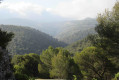
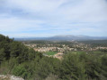
A lovely circular route alternating between ascents and descents, quite a challenge. There are far more footpaths than wide tracks, which is a definite plus. You’re mostly surrounded by pine trees. Breathtaking views of Sainte Victoire and Mont Ventoux. If the weather’s clear, you can see Marseille very clearly, as well as the ‘Grande Étoile’ with its long red and white antenna… Lots of greenery – it was a real pleasure. Thank you to the person who designed this route.

Machine-translated

GMGALD
GMGALD

Overall rating : 4.7 / 5

Date of your route : Oct 25, 2020
Reliability of the description : ★★★★★ Very good
Ease of following the route : ★★★★★ Very good
Route interest : ★★★★☆ Good
Very busy route : No

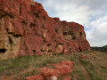
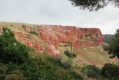
The route is pleasant for a walker, especially the return leg – the climb and the descent – but nothing particularly difficult. There’s a stretch with ochre-coloured rocks that looks a bit out of place in the area; I came across a mountain biker who told me they were fire retardant drops or test runs!
I didn’t see many people apart from at the start, where the car park was packed – but where are all these people going? They certainly weren’t on my route, so I had to park a bit further away by the side of the road.
At this time of year there are hunters about, so I wore a red cap.
A lovely walk – one to do again.

Machine-translated

Other walks in the area

For more walks, use our search engine .

The GPS track and description are the property of this route's author. Please do not copy them without permission.