Country:
 City:
City:


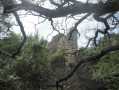
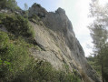
Coming from Allauch, drive through the village of La Fève towards the D908. Pass the canal bridge, then turn left onto the narrow road through the Vallon de la Vache, signposted with a blue sign. Park in the designated car park (recommended) approximately 150 m before the end of the road
(S/E) Continue due north along the road and, at the sharp left-hand bend, go through the gate on the north-east side, towards the houses, and walk on for about 50 m.
(1) Take the small blue-marked path on the right, which climbs steeply through the forest. Pass under two high-voltage power lines and then alongside some fire watch posts. Join a DFCI track. You’ll come to a Fork in the road.
(2) Turn left onto the track and proceed to the next fork.
(3) Pass by two fire cisterns, no. 555. You’ll reach a Y-junction and a barrier.
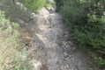
(4) Turn right towards the Vallon de la Figuière. The path gradually narrows, with large rock slabs to cross without difficulty. Keep to the right at a junction, then further on, turn left at a Y-junction. Reach a multi-path crossroads.
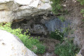
(5) Turn left, heading north, and pass to the right of an old, burnt-out fire lookout post. Reach the Grotte des Fées via a steep climb, keeping to the left at all times. Explore the area and set off again from the top of the cave, following the blue markings. After a stony descent, you’ll reach a fire lookout post and a Fork in the road.
(6) Turn right onto the narrow path through the woodland which descends gently towards the village of Saint-Savournin.
You’ll reach a T-junction.
(7) Turn right and discover the ruins of the feudal castle of Castellas, then, a little further on, an old wayside cross.
Turn left at the wayside cross and, after about 130 m, turn right to walk along the upper edge of the village of Saint-Savournin. You’ll come to a T-junction.
(8) Head down to the right along the path, passing a developed spring. About 50 m further on, turn left and follow a DFCI track, keeping as close as possible to the cliffs. You’ll spot fire cistern no. 637.
(9) Turn left onto the path heading south-west in line with the tank. The climb is steep. Ignore the paths branching off to the left and right. Join a DFCI track.
(10) Turn left onto the track and follow it to the underground fire tank no. 175 at a fork in the path.
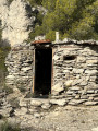
(11) Turn right at the cistern and, further down, you’ll come to a small hut and some metal benches, then the DFCI track and two fire cisterns (no. 642).
(12) Pass between the two tanks and head due south down the wide stony path. Pass under a high-voltage power line, then turn right at a watering trough for animals. After a short, steeper descent, you’ll reach a junction.
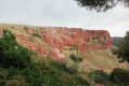
(13) Turn right. The track narrows to a path through denser vegetation. At the bottom of the valley, after a left-hand hairpin bend, and after about 200 metres, you’ll reach the Bau de l’Aigle, a huge cliff face and climbing spot. Carry on to reach the crossroads by the barrier you passed on the way out.
(4) Turn left, following the route back in the opposite direction to fire cisterns no. 555.
(3) Turn right onto the Vallon de la Vache DFCI track. Pass a small hut, then, further on to the right, a property with horses, then, on the left, a small cave closed off by a gate and, finally, an old well. Walk past the houses to reach the original crossroads.
(1) Retrace your steps along the same route as on the way there to return to the Vallon de la Vache car park (S/E).

 Visorando Member

 Difficult