Country:

 City:


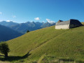
From Saint-Lary-Soulan, take the D116 up to Sailhan, then on to Ens. Walk through the small village of Ens and take the Honterette track leading to Le Plagnet. Park in the small car park next to the orientation board.
(S/E) From the car park, take the track heading south-east.
(1) Just after the first bend, leave the track and take a path on the right through the mountain pastures heading south-west. To find your way among the many possible paths, the one you’re taking never enters the forest. The path runs along the edge of the woodland before coming out at a small lake.
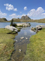
(2) Walk to the west of Lac de la Coume. This small lake can dry up quickly depending on the season. Continue south-east, passing beneath the Pic d’Urbin and the Montagne de Bastère towards the Crête de Cupeyroude.
(3) Reach the start of the Crête de Cupeyroude and turn left towards the Pic de Hountas (alt. 1,751 m).
(4) From the peak, turn back and return to the previous junction.
(3) Continue straight on, heading south-west towards the Pic de Pichebrou.
(5) At the fork (elevation 1,946), turn left towards the south, heading for an unnamed pass beneath Cap de Laubère (elevation 2,179).
(6) Cross this pass and descend the other side towards the south. The path then continues south-east at the foot of the Hitte Monte ridge to the first Lac de Consaterre (elevation 2344).
(7) Pass between the Consaterre Lakes and continue south-east along the foot of the Consaterre Ridge.
(8) Pass by two small lakes, at an altitude of 2,450 m, where the Bisourte stream begins. Head for the gap in the ridge at the very bottom of the valley, at an altitude of 2,620 m. The terrain becomes increasingly rocky.
(9) At the gap, turn right towards the south-south-west to reach the summit of the Pic de Thou (2,743 m) via rounded boulders and small, easy ledges. The path is more or less visible, but there are quite a few cairns.
(10) From the summit, turn back and return to the car park (S/E) via the same route you took on the way up.

 Visorando Member
 Difficult

 Easy
 Moderate