From Rouchas Frach to the Agnel refuge via the new Aigue Agnelle path

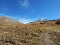
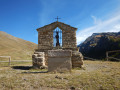
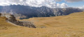
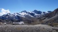
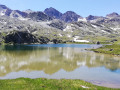
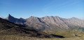
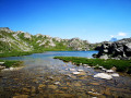
A family-friendly route to explore the Oratory of Notre-Dame du Berceau, a short stretch of the Rouchas Frach Canal and then the Aigue Agnelle, a charming, winding little stream. Beautiful views of the Pain de Sucre and the Pic d’Asti. Marmots, edelweiss…

Details

27926403
Creation:
Last update:
Last review:
  • Walking
    Activity: Walking
  • ↔
    Distance: 7.56 mi
  • ◔
    Average duration: 4h 40 
  • ▲
    Difficulty: Moderate

  • ⚐
    Back to start: Yes
  • ↗
    Ascent: + 1,391 ft
  • ↘
    Descent: - 1,375 ft

  • ▲
    Highest point: 8,451 ft
  • ▼
    Lowest point: 7,103 ft

Photos

Description of the walk

There are a few parking spaces at the start of the track leading up to the Oratoire Notre-Dame du Berceau. Please take care not to block the access route, which the shepherd also uses to reach his hut!

(S/E) Take the track which, after two hairpin bends, leads to the Oratory of Notre-Dame du Berceau and then to the heritage site (a circular area retracing the life and trades of days gone by) on the banks of the Rouchas Frach Canal.

(1) When you reach the canal, at the signpost ‘Oratoire N-D du Berceau, alt 2235 m’, turn right, heading east towards the Col Agnel. The path follows an old canal, which has been partially filled in. Walk for about 1 km until you reach the oratory in memory of General Pellegrin, situated to the right of the path.

(2) Please note: there is a wetland area around the canal. To preserve this natural environment, the path bypasses the area via the higher ground. Look out for and follow the wooden posts with yellow tops. Shortly after the three statues, the path joins the Col Agnel road.

(3) Cross the road, heading slightly uphill, then look out for the path that descends towards the Aigue Agnelle. This path is regularly signposted with yellow-topped stakes or yellow markings.

(4) After about 200 m, the path appears to fork. Stay on the better-marked path which climbs to the right, south-east, moving slightly away from the Aigue Agnelle. Follow it to the Refuge d’Agnel.

(5) Go round it to the east, cross the bend and head north-west to the ruins of the old refuge.

(6) The return journey follows the same route as the outward journey to reach your vehicle at (S/E).
At the end of the season, once the herds have left, it is possible to descend off-trail by staying on the south-facing slope, slightly above the D205T road, passing by Lac de Fiourent and joining the canal at road level. No signposting. Numerous paths.

Waypoints

  1. S/E : mi 0 - alt. 7,103 ft - D205T/track
  2. 1 : mi 0.4 - alt. 7,336 ft - Notre-Dame du Berceau signpost
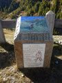
  3. 2 : mi 1.24 - alt. 7,395 ft - Memorial to General Pellegrin
  4. 3 : mi 1.41 - alt. 7,421 ft - Signpost: Le Canal de Rouchas Frach. Descent towards the - Aigue Agelle (rivière) - Affluent du Guil
  5. 4 : mi 1.57 - alt. 7,438 ft - Trail junction – Aigue Agnelle (river) –
  6. 5 : mi 3.63 - alt. 8,438 ft - Waymark - Refuge Agnel
  7. 6 : mi 3.78 - alt. 8,451 ft - Ruins of the old Napoléon Refuge at Col Agnel
  8. S/E : mi 7.56 - alt. 7,103 ft - D205T/track

Notes

The refuge is open from mid-June to mid-September. Lunch is available there. Booking recommended.
When the refuge is closed, the site of the former Napoléon refuge (6) is the perfect spot for a picnic!
There are no water sources along the route.
Dry toilets are available in the Col Vieux car park, a five-minute walk from the refuge.
It is also possible to park two or three cars near the (3) to shorten the route when travelling with children. (In this case, distance 8 km, elevation gain 330 m)

Reviews and comments

4.7 / 5
Based on 2 reviews

Reliability of the description
5 / 5
Ease of following the route
5 / 5
Route interest
4 / 5
User 3960107

Overall rating : 4.7 / 5

Date of your route : Aug 31, 2025
Reliability of the description : ★★★★★ Very good
Ease of following the route : ★★★★★ Very good
Route interest : ★★★★☆ Good
Very busy route : No

This is an excellent choice for a warm-up hike. It allows us to discover the magnificent Agnel Valley (my favourite valley in Queyras). At the start of the route, we follow the road for a short while, but then we move into a pretty valley surrounded by herds of free-roaming cows. We had the opportunity to see a fox and the Pain de Sucre in the distance... It's no bother to retrace our steps because the view on the way down is just as magnificent.

Machine-translated

mapigap
mapigap

Hello
Your comment has left me speechless. How could you not find the starting point? The Oratory is visible from the Agnel Pass road for much of the climb. The track you need to take is wide enough for a car to drive along, isn’t it?

Machine-translated

Louis Cara
Louis Cara
• Edited:

We never managed to find the starting point, so we eventually decided to get back in the car and do the return walk along the GR58 between the Agnel Refuge (we parked in the car park) and Lake Egorgéeou.
It was a lovely walk – perfectly signposted – and allowed us to explore a spectacular setting, on a fairly easy route despite the elevation gain (11.5 km return, 600 m elevation gain).

Machine-translated

mapigap
mapigap

Hello
It’s true that the noise from motorbikes in summer is something else! My aim in posting the route was also to suggest, at the start of the season – when the Col de Chamoussière isn’t yet open – an alternative route to reach the Col Agnel without following the road, as the route isn’t yet marked on maps. But I completely agree with you!

Machine-translated

jp11
jp11

Overall rating : 4.7 / 5

Date of your route : Aug 06, 2023
Reliability of the description : ★★★★★ Very good
Ease of following the route : ★★★★★ Very good
Route interest : ★★★★☆ Good
Very busy route : No

This easy route is not recommended at weekends in August, as the deafening noise from the hordes of motorcyclists undertaking the day-long journey via the Col de l’Agnel, Col d’Izoard and Montgenèvre is unbearable. The second part of the route, which is not marked on IGN maps, is very easy to follow. On the day we did this route, there was a strong wind, which is yet another consequence of climate change; we’ll just have to get used to it.

Machine-translated

Other walks in the area

For more walks, use our search engine .

The GPS track and description are the property of this route's author. Please do not copy them without permission.