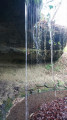
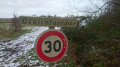
The circular Glassmakers’ Loop in Hennezel

This signposted circular trail was created and is maintained by the Club Vosgien, and the trail is marked with a Red Circle. The suggested starting point is at the Hutte Arboretum, but it is also possible to start at the Musée de la Résidence.

Details

4533729
Creation:
Last update:
Last review:
  • Walking
    Activity: Walking
  • ↔
    Distance: 6.90 mi
  • ◔
    Average duration: 3h 40 
  • ▲
    Difficulty: Moderate

  • ⚐
    Back to start: Yes
  • ↗
    Ascent: + 558 ft
  • ↘
    Descent: - 551 ft

  • ▲
    Highest point: 1,480 ft
  • ▼
    Lowest point: 1,056 ft
  • ⚐ Country: France
  • ⚐ City: Hennezel (88260)
  • ⚑
    Start/End: N 48.044181° / E 6.082429°
  • ❏
    IGN map(s): Ref. 3318SB, 3319SB
  • Hour-by-hour weather

Photos

Description of the walk

Start from the car park at the Hutte Arboretum. Follow the ‘Cercle Rouge’ markings throughout the route

(S/E) Start by visiting the Hutte Verbamont Arboretum, particularly its magnificent giant sequoias, which are amongst the tallest in France.

(1) Walk past the La Clairière du Verbamont campsite (with a fountain at the front) and carry on straight ahead to the hamlet of Henricel.

(2) Take the small path on the left, walk past the metal shed and the donkeys, and head uphill towards the woods; on your right is an old quarry. Cross a small stream and continue along the stony path.

(3) Turn right onto the forest track (dirt track) until you reach the tarmac road from La Planchotte to La Sybille. Cross it and continue straight on until you reach the Tranchée de la Fontaine aux Cerfs.

(4) Turn left onto this forest track (gravel path) until you reach Tranchée de la Haute Saône.

(5) Turn left and continue to the hamlet of Planchotte.
(6) Turn right, pass through the hamlet of Planchotte and carry on straight ahead for 1.5 km.

(7) Turn left at the wooden gate and walk alongside the Douglas fir forest. As you emerge from the forest, take in the view of La Frison, a quiet little hamlet. Turn right, continue along the road, pass the Arbre de la Vierge and carry on towards Clairey.

(8) At the first houses in Clairey, turn left, go up the small path between the houses and arrive at the Clairey Museum, which showcases iron, glass and wood.
(9) Walk past the museum and turn left, still following the ‘Cercle Rouge’ signposts; take the stony path to La Tranchée Sainte-Marie

(10) Turn left, pass between the ponds and reach the hamlet of La Frison.

(11) Turn right at the information board explaining the history of this little hamlet, pass between the buildings of La Frison farm (there is a slight change to the route here, avoiding the tarmac) and follow the narrow path between the fields to reach the forest. Turn right and head down the stony path from La Hutte to La Frison.
Reach the car park (S/E) a good kilometre further down.

Waypoints

  1. S/E : mi 0 - alt. 1,063 ft - Car park at the - Arboretum de la Hutte Verbamont
  2. 1 : mi 0.27 - alt. 1,125 ft - Verbamont Campsite
  3. 2 : mi 1.05 - alt. 1,161 ft - The hamlet of Henricel
  4. 3 : mi 1.51 - alt. 1,289 ft - Forest track junction
  5. 4 : mi 2.29 - alt. 1,332 ft - Junction at the Tranchée de la Fontaine aux Cerfs
  6. 5 : mi 2.84 - alt. 1,470 ft - Junction towards Planchotte
  7. 6 : mi 3.08 - alt. 1,440 ft - The hamlet of Planchotte
  8. 7 : mi 3.75 - alt. 1,476 ft - Wooden gate
  9. 8 : mi 4.86 - alt. 1,266 ft - The first houses in Clairey. Cross the - Ourche (rivière)
  10. 9 : mi 4.97 - alt. 1,309 ft - Museum of Iron, Glass and Wood
  11. 10 : mi 5.51 - alt. 1,237 ft - Junction towards the ponds
  12. 11 : mi 5.9 - alt. 1,240 ft - La Frison information board
  13. S/E : mi 6.9 - alt. 1,063 ft - Car park at the - Arboretum de la Hutte Verbamont

Notes

The Iron, Glass and Wood Museum: a geocaching trail with six caches along the route.

Worth a visit

Reviews and comments

3.5 / 5
Based on 2 reviews

Reliability of the description
3.5 / 5
Ease of following the route
3 / 5
Route interest
4 / 5
la bidouille
la bidouille

Overall rating : 3.3 / 5

Date of your route : Jun 12, 2023
Reliability of the description : ★★★☆☆ Average
Ease of following the route : ★★★☆☆ Average
Route interest : ★★★★☆ Good
Very busy route : No

The marker at point no. 3 and the start of the path are not very visible, and there is a change in the route near the farm, just after point no. 11

Machine-translated

ghfrubwk29
ghfrubwk29

Overall rating : 3.7 / 5

Date of your route : Jan 27, 2021
Reliability of the description : ★★★★☆ Good
Ease of following the route : ★★★☆☆ Average
Route interest : ★★★★☆ Good
Very busy route : Yes

For me, this circular route has too much tarmac, but overall I’m happy with it – especially today with the snow

Machine-translated

Other walks in the area

For more walks, use our search engine .

The GPS track and description are the property of this route's author. Please do not copy them without permission.