A short circular loop starting from Urval

Urval is a small, unassuming village on the outskirts of the Bergerac–Sarlat road; there are several walking trails, marked in yellow, which are very interesting. This short walk features a fairly steep climb at the start, but it’s shaded and leads to a magnificent little hamlet at the end, followed by a superb descent with a beautiful view and, finally, a gentle, slightly undulating stretch on the way back to Urval.

Details

22713720
Creation:
Last update:
Last review:
  • Walking
    Activity: Walking
  • ↔
    Distance: 2.56 mi
  • ◔
    Average duration: 1h 30 
  • ▲
    Difficulty: Easy

  • ⚐
    Back to start: Yes
  • ↗
    Ascent: + 348 ft
  • ↘
    Descent: - 354 ft

  • ▲
    Highest point: 571 ft
  • ▼
    Lowest point: 190 ft
  • ⚐ Country: France
  • ⚐
    Area: Périgord
  • ⚐ City: Urval (24480)
  • ⚑
    Start/End: N 44.812479° / E 0.948814°
  • ❏
    IGN map(s): Ref. 1936ET, 1937E
  • Hour-by-hour weather

Description of the walk

Park in the town hall square or in the car park (a field) situated just at the entrance to the village when coming from the D25.

(S/E) Follow the D62 towards the D25 for about fifty metres and turn right onto a small path marked in yellow which climbs up the hillside. Quite soon, continue along a path through the woodland; after passing a large house below, you’ll reach the Route de la Faurie. Follow this until the end of the hamlet.

(1) Stay on the yellow-marked path, which passes behind a large house and winds through the woodland. You will reach the hamlet of Les Barres.

(2) Turn left and begin a very pleasant descent along the edge of the woodland, with some lovely views over the valley. At the end of the descent, you’ll reach a picnic area.

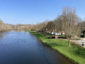
(3) Turn left onto the D52, taking care to watch out for traffic, particularly in summer. However, the verge is quite wide, so you can walk on the grass. You will then reach the Urval car park (S/E).

Waypoints

  1. S/E : mi 0 - alt. 269 ft - Town hall car park
  2. 1 : mi 0.62 - alt. 499 ft - La Faurie
  3. 2 : mi 0.92 - alt. 564 ft - Les Barres
  4. 3 : mi 1.69 - alt. 190 ft - Picnic area
  5. S/E : mi 2.56 - alt. 269 ft - Town hall car park

Notes

I didn’t see any water points along the route.
In Urval, there is a restaurant but no food shop.

Worth a visit

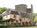
The village of Urval is well worth a visit.
Communal oven in the village.
Church of Our Lady of the Nativity.

Reviews and comments

4 / 5
Based on 3 reviews

Reliability of the description
4.3 / 5
Ease of following the route
4.7 / 5
Route interest
3 / 5
gilles777bd
gilles777bd

Overall rating : 2.7 / 5

Date of your route : Jul 29, 2024
Reliability of the description : ★★★☆☆ Average
Ease of following the route : ★★★★☆ Good
Route interest : ★☆☆☆☆ Very disappointing
Very busy route : No

A boring route. Nothing but tarmac. Nothing but roads, hardly any footpaths....

Machine-translated

gilles777bd
gilles777bd

Overall rating : 5 / 5

Date of your route : Jul 29, 2024
Reliability of the description : ★★★★★ Very good
Ease of following the route : ★★★★★ Very good
Route interest : ★★★★★ Very good
Very busy route : No

A lovely, easy, short route through a charming, secluded village. Splendid

Machine-translated

clingelfou
clingelfou

Overall rating : 4.3 / 5

Date of your route : Jul 06, 2023
Reliability of the description : ★★★★★ Very good
Ease of following the route : ★★★★★ Very good
Route interest : ★★★☆☆ Average
Very busy route : No

A pleasant route, mostly in the shade; it’s a shame that the final third follows the road, which, whilst not very busy, is rather uninteresting and exposed to the sun if you’re cycling it in the morning.

Machine-translated

Other walks in the area

For more walks, use our search engine .

The GPS track and description are the property of this route's author. Please do not copy them without permission.