Combes Circular Loop

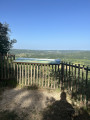
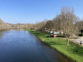
A pleasant, easy circular walk through the woodland, with no difficulties. A lovely little walk that’s a joy to take, offering a chance to explore the village of Audrix.

Details

n°37215417
Creation:
Last update:
Last review:
  • Walking
    Activity: Walking
  • ↔
    Distance: 2.73 mi
  • ◔
    Average duration: 1h 40 
  • ▲
    Difficulty: Easy

  • ⚐
    Back to start: Yes
  • ↗
    Ascent: + 427 ft
  • ↘
    Descent: - 446 ft

  • ▲
    Highest point: 745 ft
  • ▼
    Lowest point: 344 ft

Description of the walk

From Le Bugue, take the Route du Buisson, then turn left towards Audrix and the Gouffre de Proumeyssac.
Park in the car park at the Audrix swimming pool

(S/E) From the signpost, with your back to the car park and the swimming pool car park behind you, walk through the village, continuing straight ahead along the Route de Saint-Chamassy. Walk past the church until you reach a junction with the Route de Proumeyssac.

(1) Turn right onto the departmental road to reach a junction of footpaths called Chemin du Pré chez Maranne.

(2) Take the path down to the road (Route de Gravard).

(3) Turn right onto this road and follow it for about 50 metres, then take the path on the left which winds between pretty stone walls in the shade of the woodland. Continue to the bottom of the valley.

(4) Take the path on the right signposted ‘Circular Walk’. Stay on the path until you reach the star-shaped junction.

(5) At the junction of the paths, take care to turn right. You may come across donkeys here. If the path is ‘closed off’ by a wire, you can safely pass underneath it; it’s just there to stop the donkeys from wandering off. As you head uphill, you’ll pass close to some houses before reaching Route de Gravard.

(6) Take the road on the left. Immediately ignore a path on the left and carry on to the end of the road.

(7) Cross Route de Proumeyssac and carry on straight ahead. Take the first right onto Rue Cote de la Baronnie, which then becomes Rue du Coteau and leads back to the village centre (S/E).


Waypoints

  1. S/E : mi 0 - alt. 741 ft - Audrix swimming pool car park - Église Saint-Pierre (Audrix)
  2. 1 : mi 0.06 - alt. 725 ft - Route de Proumeyssac
  3. 2 : mi 0.14 - alt. 712 ft - Chemin du Pré chez Maranne
  4. 3 : mi 0.44 - alt. 558 ft - Route de Gravard
  5. 4 : mi 0.88 - alt. 348 ft - Combes Circular Loop
  6. 5 : mi 1.55 - alt. 466 ft - Country Lane
  7. 6 : mi 1.81 - alt. 604 ft - Route de Gravard
  8. 7 : mi 2.34 - alt. 719 ft - Route de Proumeyssac
  9. S/E : mi 2.73 - alt. 741 ft - Audrix swimming pool car park

Worth a visit

(S/E) Saint-Pierre Church
(3) 50 metres on, a wash house and picnic area make for a very pleasant stop.

Reviews and comments

4.2 / 5
Based on 2 reviews

Reliability of the description
4.5 / 5
Ease of following the route
4 / 5
Route interest
4 / 5
ADDX
ADDX

Overall rating : 4.7 / 5

Date of your route : Aug 19, 2025
Reliability of the description : ★★★★★ Very good
Ease of following the route : ★★★★☆ Good
Route interest : ★★★★★ Very good
Very busy route : No

A very pleasant route with some beautiful views; fairly shaded and well maintained; Audrix is truly a beautiful place.

Machine-translated

OT LDVV
OT LDVV
• Edited:

Thank you for letting us know; the issue with the fallen tree was sorted out this morning

Machine-translated

patlap49
patlap49

Overall rating : 3.7 / 5

Date of your route : Sep 17, 2024
Reliability of the description : ★★★★☆ Good
Ease of following the route : ★★★★☆ Good
Route interest : ★★★☆☆ Average
Very busy route : No

Please be careful: there is a fallen tree on the stony path at marker 3

Machine-translated

Other walks in the area

For more walks, use our search engine .

The GPS track and description are the property of this route's author. Please do not copy them without permission.