Urval South Circular Route

A route starting from Urval, a typical Périgord village, on the left bank of the Dordogne in the Périgord Noir, between Belvès and Le Buisson de Cadouin. A route, mainly through woodland, with little elevation gain and few tarmac sections. Ideal for families. 

Details

75435158
Creation:
Last update:
Last review:
  • Walking
    Activity: Walking
  • ↔
    Distance: 6.16 mi
  • ◔
    Average duration: 3h 25 
  • ▲
    Difficulty: Easy

  • ⚐
    Back to start: Yes
  • ↗
    Ascent: + 679 ft
  • ↘
    Descent: - 659 ft

  • ▲
    Highest point: 692 ft
  • ▼
    Lowest point: 256 ft
  • ⚐ Country: France
  • ⚐
    Area: Périgord
  • ⚐ City: Urval (24480)
  • ⚑
    Start/End: N 44.812336° / E 0.948633°
  • ❏
    IGN map(s): Ref. 1936ET, 1937E
  • Hour-by-hour weather

Photos

Description of the walk

A car park is available in Urval to the left of the town hall. Another is situated a few dozen metres away on the small road to the right of the town hall. The signpost is located at the side of the road opposite the town hall.

(S/E) Take the D52 towards Belvès for 300 m and take the path to the left of the road, which runs parallel to it. You will come to a fork in the road. 

(1) Head down the path on the right. Cross a meadow for a few dozen metres, then head up to the left to rejoin the D52. Follow the D52 to the left, keeping to the side of the yellow marker, for over a kilometre until you reach a junction of roads and paths.

(2) To the left, the Route du Soleillal heads towards Siorac. The D52, meanwhile, is signposted in green and joins another circular loop known as the ‘Boucle de la Pierre’. Leave the D52 and take the path on the right. After 250 m through the forest, you’ll reach another crossroads.

(3) Ignore the forest track opposite and take the first track on the right, heading due west. The other track slopes down slightly and is not in very good condition. After more than 1 km, you’ll reach a forest track at a place called Le Mas. Le Mas is a large building with an outbuilding, situated nearby on the right.

(4) A yellow signpost directs you to continue along the path directly opposite the one you are leaving. This path turns immediately to the left and heads south before taking a hairpin bend to the right and heading north-west towards the hamlet of La Salvagie, a very pretty hamlet with typical Périgord houses, which you do not pass through.

(5) After passing two houses on the left, followed by a few low walls and the remains of a ruined house, take the path on the left, which is clearly signposted. A few metres further on, follow the path that descends to the right, not the one on the left: small yellow arrows indicate this. After about 500 m, turn right. A long circular route to the left leads to another junction where you should also turn right to join a tarmac road heading towards Urval.

(6) Follow this road, turning right, then, after a wide bend to the right, leave it to follow a path on the left which runs alongside the road and the Ruisseau du Peyrat on your left. 

(7) Ford the stream using a few stones to keep your feet dry. The path continues directly opposite. This is the most challenging part of the route, as the path climbs for a few hundred metres over heavy ground, which is even muddy in places. Once at the top, the path turns right, and about 250 metres further on, another signpost directs you to turn right onto Impasse de la Forge at a place called Pessel. You’ll reach a spot where a very short road branches off to the right, running alongside a wooden building. 

(8) Ignore this and carry on along the path opposite , which is hidden amongst the tall grass in spring before mowing, despite a signpost on its right. Continue straight on to the hamlet of La Pelinque. 

(9) Turn right, then immediately left, and head towards the cemetery. Then turn left to come out onto the Route de la Forêt Royale. Follow this road to the right towards the village centre. The first road on the right leads straight back to the car park (S/E).

Waypoints

  1. S/E : mi 0 - alt. 256 ft - Urval Town Hall car park
  2. 1 : mi 0.81 - alt. 404 ft - Turn right at the fork
  3. 2 : mi 1.55 - alt. 597 ft - Road/track junctions
  4. 3 : mi 1.71 - alt. 643 ft - Junction, path on the right
  5. 4 : mi 2.44 - alt. 630 ft - Cross the forest road and take the path
  6. 5 : mi 3.33 - alt. 587 ft - La Salvagie
  7. 6 : mi 4.15 - alt. 463 ft - Road junction
  8. 7 : mi 4.47 - alt. 404 ft - Fording point on the Ruisseau du Peyrat
  9. 8 : mi 4.95 - alt. 646 ft - Pessel
  10. 9 : mi 5.77 - alt. 400 ft - La Pelinque
  11. S/E : mi 6.16 - alt. 269 ft - Urval Town Hall car park

Notes

Wear good, waterproof walking boots.

Like all circular walks in the Dordogne department, this one is signposted with wooden posts banded in yellow, or with wooden signposts bearing arrows and written in yellow. The routes connecting two loops are signposted with posts banded in green or signposts bearing arrows and written in green.

(2)Alternative: continue along the D52 for 350 m to see the Bonarme Dolmen, then take the forest track to the right of the D52 to rejoin the route described. 

Worth a visit

The Bonarme dolmen (off the route) isalso known as the ‘cow’s foot’ because a cow is said to have stood still on the top of the megalith and left two hoofprints. In the Dordogne, more than a hundred megaliths have survived the centuries. Place names suggest there must once have been many more: localities with names such as ‘Peyre’ or ‘pierre’ in Occitan often bear witness to a megalithic settlement.

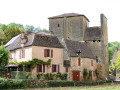
The Romanesque church of Urval, Notre-Dame de la Nativité, listed as a Historic Monument of France since 9 June 1926
Dordogne Departmental Tourism Committee (Dordogne/Périgord Tourisme):

"This charming Romanesque church comprises an 11th-century chancel , a 12th-century nave and a bell tower built at a later date. Notable features: above the chancel and the nave are defence chambers that were once used by the villagers in the event of an attack. To reinforce the church’s defensive capabilities, a high wall was erected along the apse."

Reviews and comments

4.7 / 5
Based on 2 reviews

Reliability of the description
5 / 5
Ease of following the route
5 / 5
Route interest
4 / 5
Pierrette.L
Pierrette.L

Overall rating : 4.7 / 5

Date of your route : Jun 30, 2026
Reliability of the description : ★★★★★ Very good
Ease of following the route : ★★★★★ Very good
Route interest : ★★★★☆ Good
Very busy route : No

A lovely walk! Lots of shade, very pleasant!

Machine-translated

User 2609540

Overall rating : 4.7 / 5

Date of your route : Jan 05, 2026
Reliability of the description : ★★★★★ Very good
Ease of following the route : ★★★★★ Very good
Route interest : ★★★★☆ Good
Very busy route : No

Very good, calm and pleasant, moderate elevation gain

Machine-translated

Other walks in the area

For more walks, use our search engine .

The GPS track and description are the property of this route's author. Please do not copy them without permission.