Circular countryside and woodland loop between Le Bugarel, La Cavalerie and L’Esquirpe

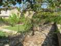
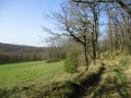
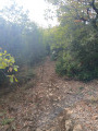
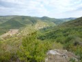
A lovely, very easy walk, with paths, little elevation gain and a few tarmac sections, with almost no traffic. A third of the walk is on open ground, then the paths pass through varied landscapes, follow tree-lined avenues, run alongside a stream and wind through woodland.

⚠️ 21/10/2026: the starting point of the walk has been changed.

Details

n°2796642
Creation:
Last update:
Last review:
  • Walking
    Activity: Walking
  • ↔
    Distance: 4.39 mi
  • ◔
    Average duration: 2h 10 
  • ▲
    Difficulty: Easy

  • ⚐
    Back to start: Yes
  • ↗
    Ascent: + 203 ft
  • ↘
    Descent: - 210 ft

  • ▲
    Highest point: 509 ft
  • ▼
    Lowest point: 354 ft
  • ⚐ Country: France
  • ⚐ City: Bruniquel (82800)
  • ⚑
    Start/End: N 44.069066° / E 1.623202°
  • ❏
    IGN map(s): Ref. 2141E
  • Hour-by-hour weather

Description of the walk

Start along the Route du Bugarel, on the widened verge, provided you do not obstruct traffic.

(1) Walk north-east along the road for 50 metres. Turn left onto a path through the woods. After about a hundred metres, turn 90° to the left, then continue along a wide bend to the right to exit the woods. Cross the field straight ahead, following a grassy path, then a track to the hamlet of La Cavalerie.

(2) Just past the first shed, take the grassy (communal) path that runs to the left, between two buildings (often blocked by vehicles). Join a footpath coming from Montricoux.

(3) Turn right and follow it straight on until you reach the road. Follow the road downhill for about a hundred metres until you reach the left-hand bend.

(4) At the bend, leave the road and take the path on the right. When you reach the next road, head up it to the right, ignore a path on the left, and carry on for a few dozen metres along the edge of the trees until you find a grassy track on the right.

(5) Follow it straight on, passing through the hamlet of L’Esquirpe, then across the Route de Moissacs, until you reach the entrance to La Cavalerie. Turn left and walk past the hamlet of La Cavalerie. Continue along the road, leaving the Impasse de la Cavalerie on your right, and walk a few dozen metres until you reach the start of a grassy path.

(6) Turn right onto this path. At the first junction, keep left until you reach the D964 road. Cross it to take the path on the other side. After about 150 metres, you’ll reach the Ruisseau de Nègue-Saume and the small pond on your left.

(7) Just after the pond, about 50 m before reaching the Vert farm, veer left round the trees to avoid the farm (although the path is a local public path, it passes through the farmyard). Join the road and follow it to the left for about 150 m, until you reach the start of a dirt track, near a solitary tree.

(8) Turn right and follow this track between the fields until you reach the T-junction with the Midi-Quercy GRP®.

(9) Turn right and head straight on, either along the edge of the woodland or through the forest, until you reach the Ruisseau de la Vaysse, then cross it.

(10) Immediately afterwards, leave the GRP® and take the lovely path that branches off to the right and runs alongside the stream. A little further on, the Ruisseau de Nègue-Saumur joins it. You’ll reach the Route de Bugarel.

(11) Walk up the road for a few metres to rejoin the path opposite. Return to the road, cross the bridge over the Ruisseau de Vaysse, and follow the road until you reach the end of its right-hand bend.

(1) Continue along the road for 50 metres to reach the point marked (S/E).

Waypoints

  1. S/E : mi 0 - alt. 407 ft - Wide verge
  2. 1 : mi 0.03 - alt. 394 ft - Junction with a path
  3. 2 : mi 0.57 - alt. 486 ft - The hamlet of La Cavalerie
  4. 3 : mi 0.68 - alt. 417 ft - Junction – Path
  5. 4 : mi 1.11 - alt. 436 ft - Road bend – Path
  6. 5 : mi 1.59 - alt. 499 ft - Crossroads – Grass track
  7. 6 : mi 2.42 - alt. 489 ft - Crossroads – Grassy path
  8. 7 : mi 2.98 - alt. 453 ft - Stream – Pond – ‘Le Vert’ Farm
  9. 8 : mi 3.12 - alt. 486 ft - Junction – Dirt track
  10. 9 : mi 3.41 - alt. 486 ft - T-junction – GRP
  11. 10 : mi 3.92 - alt. 394 ft - Vaysse (ruisseau) - Affluent de l'Aveyron
  12. 11 : mi 4.22 - alt. 407 ft - Route de Bugarel
  13. S/E : mi 4.39 - alt. 407 ft - Wide verge

Worth a visit

The first third of the walk is mainly along open paths. The rest of the route is mostly along shaded paths.

Reviews and comments

4.5 / 5
Based on 2 reviews

Reliability of the description
4 / 5
Ease of following the route
5 / 5
Route interest
4.5 / 5
User 31579949

Overall rating : 4.3 / 5

Date of your route : Oct 26, 2026
Reliability of the description : ★★★☆☆ Average
Ease of following the route : ★★★★★ Very good
Route interest : ★★★★★ Very good
Very busy route : Yes

Hello,

the starting point for this walk needs to be changed as local residents do not want people to park alongside a very narrow track.
We have been advised of a car park on the D964 (44.06827612590369, 1.6240936574874782).
The circular route rejoins the route at 800–900 metres.
Kind regards.

Machine-translated

VALERIEALBIAS
VALERIEALBIAS

Overall rating : 4.7 / 5

Date of your route : Jun 29, 2026
Reliability of the description : ★★★★★ Very good
Ease of following the route : ★★★★★ Very good
Route interest : ★★★★☆ Good
Very busy route : No

A lovely, varied walk: paths, woods and very few roads. Clear, unobstructed views.
Don’t go through the farm – the Alary path passes through there, but there’s a ‘Private Property’ sign; go to the right into the field instead.
We walked alongside the Vaysse stream, which was dry. We’ll do this route again in autumn or winter as it must be lovely then too.
Thank you for this route

Machine-translated

Other walks in the area

For more walks, use our search engine .

The GPS track and description are the property of this route's author. Please do not copy them without permission.