The Dolmen Trail and the Englishman's Tomb

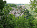
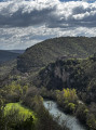
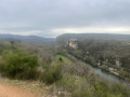
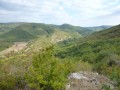
This route takes us above the countryside towards Saint-Maffre, south of Bruniquel. On a clear day, it is possible to see the Pyrenees mountain range. Towards the end of the route, you will discover Bruniquel from above.

Details

2111568
Creation:
Last update:
Last review:
  • Walking
    Activity: Walking
  • ↔
    Distance: 2.27 mi
  • ◔
    Average duration: 1h 30 
  • ▲
    Difficulty: Moderate

  • ⚐
    Back to start: Yes
  • ↗
    Ascent: + 551 ft
  • ↘
    Descent: - 551 ft

  • ▲
    Highest point: 994 ft
  • ▼
    Lowest point: 430 ft
  • ⚐ Country: France
  • ⚐ City: Bruniquel (82800)
  • ⚑
    Start/End: N 44.053613° / E 1.663584°
  • ❏
    IGN map(s): Ref. 2141E
  • Hour-by-hour weather

Photos

Description of the walk

Departure: park near the weighbridge at the bottom of Bruniquel, along the D964.

(S/E) Head west on Route Georges Gandil (D964) towards Montauban, passing a restaurant. After about 150 m, turn left onto Chemin des Dolmens and continue along the path, generally heading west and uphill. Ignore a turn-off on the right and you will soon come to a crossroads.

(1) Turn left onto the path that climbs slightly. Cross a track and pass the remains of a dolmen (information board).

(2) Follow the track, generally towards the summit, until you reach some antennas.

(3) Continue along the path that descends and follows the summit.

(4) To the right of the path, you will see the Englishman's tomb.
For those who are curious, the tomb known as "the Englishman's tomb" dates fromthe second quarter of the 19th century. It bears the date "1832". In accordance with his last wishes, Alfred de La Palme (1839-1876), a notary, was buried on the hillside overlooking the city by his English friend W. Minturn. The latter had the following epitaph engraved on the beautiful stone slab: "This man truly was my friend". And strangely enough, the grave, in this splendid location, took the name of the Englishman's Tomb.
Continue downhill overlooking the village of Bruniquel. At the bottom of the path, carefully cross Route Georges Gandil to reach Place du Truquet. Then turn left to return to the starting point (S/E).

Waypoints

  1. S/E : mi 0 - alt. 443 ft - Bruniquel weighbridge
  2. 1 : mi 0.61 - alt. 669 ft - Turn left
  3. 2 : mi 0.95 - alt. 820 ft - Track
  4. 3 : mi 1.62 - alt. 958 ft - Antennas
  5. 4 : mi 1.93 - alt. 689 ft - Tombe de l'anglais
  6. S/E : mi 2.27 - alt. 443 ft - Bruniquel weighbridge

Reviews and comments

4.5 / 5
Based on 13 reviews

Reliability of the description
4.6 / 5
Ease of following the route
4.5 / 5
Route interest
4.3 / 5
Axelle 91
Axelle 91

Overall rating : 4 / 5

Date of your route : Dec 06, 2024
Reliability of the description : ★★★★★ Very good
Ease of following the route : ★★★★☆ Good
Route interest : ★★★☆☆ Average
Very busy route : No

Tip: do it in reverse, starting with the steep slope (because it is really dangerous going downhill, even more so when wet), so you can enjoy both views of Bruniquel.
Interest: limited, no real dolmen to see, but there are information boards and the tomb is there. However, there is a beautiful view of the whole of the west, you can see far into the distance.
Clarity of the route: I recommend using the app or an offline map such as Maps.me, as there are lots of small tracks around.
Heat: the very steep part (at the end of the hike, but I recommend doing it at the beginning) is a little shaded, but 75% of the route is in full sun (be careful in summer) or windy (be careful in winter).

Machine-translated

pjp2camer
pjp2camer
• Edited:

Approximate signposting. Remember to download the GPX track and follow it. As for the dolmen, nature has reclaimed its rights, or man has forgotten to clear the access path.

Machine-translated

garbaye.alain@wanadoo.fr

Overall rating : 3.7 / 5

Date of your route : May 14, 2024
Reliability of the description : ★★★★☆ Good
Ease of following the route : ★★★★☆ Good
Route interest : ★★★☆☆ Average
Very busy route : No

I did this route as a "reconnaissance" trip, which was very useful as it will make things easier for me because the descent in rainy weather is very slippery and even dangerous. Only suitable for experienced hikers.

Machine-translated

janine.moulie@wanadoo.fr

Overall rating : 5 / 5

Date of your route : Apr 15, 2024
Reliability of the description : ★★★★★ Very good
Ease of following the route : ★★★★★ Very good
Route interest : ★★★★★ Very good
Very busy route : No

Great course, no problem, thank you.

Machine-translated

TheGreen
TheGreen

Overall rating : 4.7 / 5

Date of your route : Aug 08, 2023
Reliability of the description : ★★★★★ Very good
Ease of following the route : ★★★★★ Very good
Route interest : ★★★★☆ Good
Very busy route : No

This is my first time using Visiorando: The mapping and accuracy on the maps is perfect, impossible to go wrong.
Very useful...

Machine-translated

Angelo42
Angelo42

Overall rating : 4.7 / 5

Date of your route : Nov 13, 2022
Reliability of the description : ★★★★★ Very good
Ease of following the route : ★★★★☆ Good
Route interest : ★★★★★ Very good
Very busy route : No

16.5 km 4 parts of PR

Machine-translated

bretagne82
bretagne82

Overall rating : 4.3 / 5

Date of your route : Apr 05, 2021
Reliability of the description : ★★★★★ Very good
Ease of following the route : ★★★★☆ Good
Route interest : ★★★★☆ Good
Very busy route : No

View of Bruniquel
At marker 219, we took the white path on the map and the black dotted line (below the ridge), which offered a beautiful view of the village. We rejoined the route at the antennas.

Machine-translated

pascale.sartre
pascale.sartre

Actually, there were two dogs guarding a house located in a place called Saint Roch on the right as you go down. We had written to the Bruniquel tourist office at the time... without success.
Thank you for your reply. Have a nice day.

Machine-translated

Garrigues
Garrigues

Personally, I have never seen a dog on this hike. But since it is not a national park, it is not forbidden to walk with your dog and therefore to encounter one, as sometimes happens on this type of trail. In any case, dog owners must be in control of their dogs and are responsible for them.
Best regards

Machine-translated

pascale.sartre
pascale.sartre

Overall rating : 5 / 5

Date of your route : Oct 01, 2008
Reliability of the description : ★★★★★ Very good
Ease of following the route : ★★★★★ Very good
Route interest : ★★★★★ Very good
Very busy route : No

Hello,
I did this hike about ten years ago and we were harassed by two dogs near Saint Roch (on the way back).
Since then, we've been so scared that we've never gone back there.
Could you tell us if these dogs are still there?
Otherwise, it's a splendid hike with many views of Bruniquel and the surrounding limestone plateaus.

Machine-translated

ANICB
ANICB

Overall rating : 5 / 5

Date of your route : Sep 07, 2020
Reliability of the description : ★★★★★ Very good
Ease of following the route : ★★★★★ Very good
Route interest : ★★★★★ Very good
Very busy route : Yes

The descent to Bruniquel is quite steep, but if you avoid it after a day of rain, it's fine.

Machine-translated

Garrigues
Garrigues
• Edited:

In order to avoid private property in the hamlet of Brian de Causse and the truffle field, I have modified the route. It is now shorter but retains all its appeal.

Machine-translated

Wattebled82
Wattebled82
• Edited:

Overall rating : 4.3 / 5

Date of your route : Jun 07, 2020
Reliability of the description : ★★★★☆ Good
Ease of following the route : ★★★★★ Very good
Route interest : ★★★★☆ Good
Very busy route : Yes

A lovely short hike with no markings along the route, but the map and description are sufficient.

Machine-translated

Garrigues
Garrigues
• Edited:

To avoid the hamlet, shorten the route by turning left when you reach the truffle field to rejoin the route back to the Englishman's grave.

Machine-translated

annebornes
annebornes
• Edited:

Overall rating : 5 / 5

Date of your route : May 21, 2020
Reliability of the description : ★★★★★ Very good
Ease of following the route : ★★★★★ Very good
Route interest : ★★★★★ Very good
Very busy route : Yes

I confirm that access to the hamlet of Brian du Causse is no longer possible; the owner has had to close off the passage through his property once again. Despite the "private property" sign, he has had to deal with numerous incidents of incivility.
How can we find a route from number 2 that bypasses this private property and provides access to the relay antenna? This would allow us to continue to "the Englishman's grave" and finish the hike.

Machine-translated

Other walks in the area

For more walks, use our search engine .

The GPS track and description are the property of this route's author. Please do not copy them without permission.