Pas de la Demi-Lune and three caves around Marseilleveyre

A varied and challenging route that requires good balance, taking you through a small cave, the Pas de la Demi-Lune and the Grotte Saint-Michel, and offering magnificent views from the summit of Marseilleveyre.

You are in the Calanques National Park, which is subject to specific regulations. Failure to comply with these regulations may result in a fine of up to €1,500.

Details

1899173
Creation:
Last update:
Last review:
  • Walking
    Activity: Walking
  • ↔
    Distance: 5.82 mi
  • ◔
    Average duration: 4h 55 
  • ▲
    Difficulty: Difficult

  • ⚐
    Back to start: Yes
  • ↗
    Ascent: + 2,566 ft
  • ↘
    Descent: - 2,536 ft

  • ▲
    Highest point: 1,417 ft
  • ▼
    Lowest point: 128 ft

Photos

Description of the walk

The route starts at the top of Boulevard de la Grotte Rolland. It is recommended that you park before the Marseille Canal viaduct, as the parking spaces there are wider and more numerous.

(S/E) Pass under the canal bridge and continue to the end of the street, where a barrier blocks vehicle access and signs remind you that you are entering the Calanques National Park.

Turn left, heading north, onto the green-marked path towards Pastré. Follow it to the junction of two paths, situated near another sign for the Calanques National Park.

(1) Leave the green-marked path and turn right onto a wide path marked with yellow dotted lines. Follow these markings until you rejoin the solid yellow markings near the first cave.

(2) Pass through it. From there, follow the yellow markings towards Callelongue. Take the path on the right. Don’t hesitate to use your hands to climb the path, which ascends along a very steep rock face but has plenty of handholds. You’ll reach a flat area at the junction with the red-marked path.

(3) Follow the yellow or red markings to the right until you reach a junction where five paths meet.

(4) Head left, following the yellow markings for Callelongue and the green markings. Continue to the Col de la Selle.

(5) Continue downhill along the yellow-marked trail. You’ll reach a junction of the yellow and green trails near the Col de la Galinette.

(6) Leave the yellow-marked path on the right and take a path marked with a dotted green line, which leads directly to the Pas de la Demi-Lune.

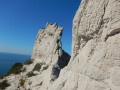
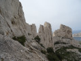
(7) Take care here: cross the ridge whilst remaining very vigilant, as the terrain behind is narrow and sheer, but there is plenty of room to place your feet. Continue following the dotted yellow markings. You will reach the crossroads by the cave.

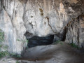
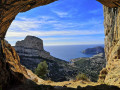
(8) Take a short detour to the Grotte Saint-Michel d’Eau Douce. Now follow the green markings towards Pastré. Another small cave can be visited less than a 5-minute walk away by continuing along the path.

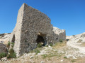
(9) Leave the green markings and follow the red markings to the summit of Marseilleveyre. To reach the summit, go round the ruin to the right (east). The summit is marked by a large Red Cross.

(10) Now follow the yellow markings to complete the circular route. Take care on the descent as the steps are quite high and slippery. Go round the cliff at Grotte Rolland before returning to the car park (S/E).

Waypoints

  1. S/E : mi 0 - alt. 128 ft - Set off towards the canal bridge - Canal de Marseille
  2. 1 : mi 0.27 - alt. 174 ft - Markings: Green – dotted yellow
  3. 2 : mi 1.08 - alt. 456 ft - Markings: dotted yellow – solid yellow line
  4. 3 : mi 1.39 - alt. 791 ft - Yellow–Red markings
  5. 4 : mi 1.67 - alt. 787 ft - Junction of 5 trails
  6. 5 : mi 1.75 - alt. 902 ft - Col de la Selle (275m)
  7. 6 : mi 2.87 - alt. 476 ft - Yellow–Green markings – After the > - Col de la Galinette (149m)
  8. 7 : mi 3.24 - alt. 761 ft - Pas de la Demie Lune
  9. 8 : mi 3.49 - alt. 712 ft - Grotte St Michel d'Eau Douce
  10. 9 : mi 3.72 - alt. 692 ft - Green–Red markings
  11. 10 : mi 4.44 - alt. 1,414 ft - Marseilleveyre
  12. S/E : mi 5.82 - alt. 128 ft - Finish

Notes

Important note: by parking on Boulevard de la Grotte Rolland, you’ll avoid the evening traffic jams between Callelongue and La Madrague.

Precaution: Make sure you have the IGN map at a scale of 1:15,000, which colour-codes the trails. This is from the ‘Outdoor Leisure Maps’ series: ‘Les Calanques from Marseille to Cassis’, which is easier to use than the standard TOP 25 map.

The paths are very well signposted; keep an eye out for the colour you need to follow. Follow the markings carefully, as they take you along the easiest routes.

Several sections require you to use your hands; only take walking poles if you can attach them to your rucksack during these tricky sections.
This hike should only be undertaken in dry weather and on dry ground, as the limestone slabs can be particularly slippery.

This hike is therefore suitable for experienced walkers who are well-shod, agile and unafraid of exposed sections or short climbing moves on rock faces.

Worth a visit

(8) The Saint-Michel-d’Eau-Douce Cave is well worth a look. A rope has been re-installed to make access easier.

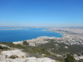
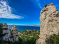
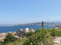
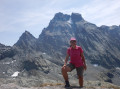
(10) The summit of Marseilleveyre offers a magnificent panoramic view of Marseille and all the calanques as far as Cassis, as well as towards the Sainte-Victoire Massif and the Côte Bleue.

Reviews and comments

4.1 / 5
Based on 3 reviews

Reliability of the description
3.3 / 5
Ease of following the route
4 / 5
Route interest
5 / 5
mapigap
mapigap

Hello
I’m glad to hear you enjoyed it. The discrepancies in the tracks may be due to passing under rocks, which make GPS positioning difficult.

Machine-translated

jeromedu13
jeromedu13

Overall rating : 4.7 / 5

Date of your route : Jun 16, 2026
Reliability of the description : ★★★★☆ Good
Ease of following the route : ★★★★★ Very good
Route interest : ★★★★★ Very good
Very busy route : No

A lovely walk with some beautiful views.
No technical difficulties, but some steep climbs.
The route description is very reliable, but occasionally the route deviates from the path (perhaps due to a long interval between GPS readings?). So, stay alert and keep an eye on both the route and the path!
The first part is in the shade, which is lovely in summer!

Machine-translated

Kerfred
Kerfred

Overall rating : 4 / 5

Date of your route : Mar 27, 2022
Reliability of the description : ★★★★☆ Good
Ease of following the route : ★★★☆☆ Average
Route interest : ★★★★★ Very good
Very busy route : No

A brilliant hike! It’s actually the best one I’ve done in the area so far.
Breathtaking scenery, several climbing sections (both on the way up and down), and large caves. Magnificent views of the Calanques, the islands and Marseille.

Please note, however, that there are a few errors in the route:

  • the crossing of the first cave is further on than point 2
  • the GPS route strays from the marked paths twice (probably due to missing GPS waypoints). You must stay on the marked paths at all times and not follow the route to the letter.

Machine-translated

• Edited:

The user account associated with this content has been deleted.

• Edited:

The user account associated with this content has been deleted.

mapigap
mapigap

As you know the area well, it might be nice to suggest a route focusing on the caves? For my part, I was more interested in the viewpoints (particularly from the Col de la Selle, the Pas de la Demi-Lune and the summit of Marseilleveyre).

Machine-translated

• Edited:

The user account associated with this content has been deleted.

mapigap
mapigap

Good evening
I’m delighted you enjoyed this route, but I do wonder if we’re talking about the same one?
1/ Introduction: “A varied and challenging route that requires good balance, taking you through a small cave, the Pas de la Demi-Lune, the Saint-Michel cave and offering a magnificent view from the summit of Marseilleveyre.” To me, a comma means “then”. You go through a small cave, then the Pas de la Demi-Lune, then…
2/ The first cave you pass through (in point 2) is definitely not the Grotte Rolland. The route doesn’t go through it. The Grotte Rolland is much higher up the cliff. For your information, access to the Grotte Rolland is prohibited for safety reasons.
3/ I didn’t mention it in the description, but you could actually head to the Déserteur Cave between points 6 and 7. This is a possible alternative route but isn’t marked on the map.
4/ At no point do I mention the ‘cave’ of the Half-Moon. In (7), I talk about straddling the mountain, not entering a cave.
5/ There are indeed three successive caves (the Hermit’s Cave, St Michel’s Cave and the Bear’s Cave) on the ground. However, on the IGN maps – which serve as a reference for walkers – only the “Hermit’s Cave” is marked with the name “St Michel”! You can check this by zooming in on the map.
6/ It would indeed be possible to visit five caves on the route, but that wasn’t my choice. I simply suggest walking through the first one and visiting one of them.
7/ If you did this route in 2016, I suppose my 2019 guide has simply helped you to recall a lovely memory.

Machine-translated

The user account associated with this content has been deleted.

Other walks in the area

For more walks, use our search engine .

The GPS track and description are the property of this route's author. Please do not copy them without permission.