From Pastré Park to the Titou-Ninou Viewpoint

A lovely, challenging circular loop.
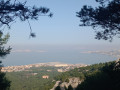
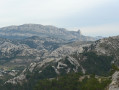
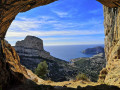
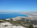
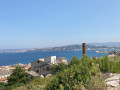
Stunning panoramic views of Marseille and wild valleys.
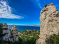
The Titou-Ninou viewpoint is a little corner of paradise.

You are in the Calanques National Park, which is subject to specific regulations. Failure to comply with these regulations may result in a fine of up to €1,500.

Details

5928726
Creation:
Last update:
Last review:
  • Walking
    Activity: Walking
  • ↔
    Distance: 6.21 mi
  • ◔
    Average duration: 4h 55 
  • ▲
    Difficulty: Difficult

  • ⚐
    Back to start: Yes
  • ↗
    Ascent: + 2,326 ft
  • ↘
    Descent: - 2,316 ft

  • ▲
    Highest point: 1,234 ft
  • ▼
    Lowest point: 49 ft

Photos

Description of the walk

(S/E) Park entrance. Walk up to the castle along the main avenue and pass in front of the castle. At the fork, turn left, following the yellow markings.

(1) Follow the yellow markings; stay on this route until you reach the blue markings. Along the way, you’ll find a signpost rock (yellow): head towards Callelongue on your left. Piste des Goélands.

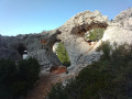
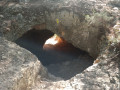
(2) On the right, there’s a short, easy climb (you’ll need to use your hands). The path, still clearly marked in yellow, continues and will take you to a cave which you’ll need to walk through; carry on along the path (yellow).

(3) Keep going in the same direction; from here, the Club Alpin trail will be marked in yellow and red.

(4) Turn left towards the Col de la Selle; the path to follow is now marked in yellow and green.

(5) Continue to the left; the path is now marked in blue. Pass the western summit of the Homme Mort.

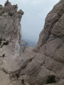
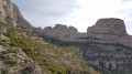
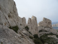
(6) Turn sharply right, taking great care. You’ll come back to the yellow markings. This path takes you down via Les Trois Arches. It’s very steep, and at times you’ll need to use your hands to help you, before joining a good path at a junction.

(7) Turn left, following the green markings, to head up the Vallon de Malvallon Sud.

(8) Leave this green-marked path and take a track on your right leading to the Titou-Ninou viewpoint,

(9) Return to the green-marked path to join and cross the blue-marked path of the Plateau de l’Homme Mort, then head down towards La Fontaine de Voire.

(10) At the crossroads, a few steps from La Fontaine de Voire, take the red-marked path on your left which leads back up to the crossroads you passed on the way there.

(3) Turn right onto the yellow-marked path and walk back under the cave to the castle.

(1) For a short alternative route, turn left at the castle, cross the canal, turn right, and follow it to rejoin the main avenue, then walk down it to the park entrance (S/E).

Waypoints

  1. S/E : mi 0 - alt. 49 ft - Entrance to Pastré Aventure Park
  2. 1 : mi 0.6 - alt. 180 ft - Junction of the circular loop at - Château Pastré
  3. 2 : mi 1.23 - alt. 571 ft - No climbing required
  4. 3 : mi 1.41 - alt. 807 ft - Junction of the main circular loop
  5. 4 : mi 1.68 - alt. 784 ft - Junction
  6. 5 : mi 1.74 - alt. 906 ft - Col de la Selle
  7. 6 : mi 2.04 - alt. 1,217 ft - Junction
  8. 7 : mi 2.53 - alt. 410 ft - Junction
  9. 8 : mi 3.19 - alt. 1,079 ft - Steep path on the right
  10. 9 : mi 3.24 - alt. 1,119 ft - Titou-Ninou Viewpoint
  11. 10 : mi 4.08 - alt. 528 ft - On the left, red markings - Fontaine de Voire
  12. S/E : mi 6.21 - alt. 52 ft - Entrance to Pastré Aventure Park

Worth a visit

Very close to (10), head down to the right to reach the Fontaine de Voire.

Reviews and comments

4.3 / 5
Based on 3 reviews

Reliability of the description
4 / 5
Ease of following the route
4.3 / 5
Route interest
4.7 / 5
Doremi 13
Doremi 13

Overall rating : 4.3 / 5

Date of your route : Oct 20, 2024
Reliability of the description : ★★★★☆ Good
Ease of following the route : ★★★★★ Very good
Route interest : ★★★★☆ Good
Very busy route : Yes

A fairly challenging hike offering breathtaking views of the Calanques and Marseille. The climb up to the Titou Ninou viewpoint is quite technical (it’s not far off rock climbing). I’d recommend this hike.

Machine-translated

DiGi
DiGi

Overall rating : 4.3 / 5

Date of your route : Oct 21, 2024
Reliability of the description : ★★★★☆ Good
Ease of following the route : ★★★★☆ Good
Route interest : ★★★★★ Very good
Very busy route : Yes

A really interesting walk, a bit technical in places but nothing too difficult. We didn’t go all the way down to point 7 as we thought it looked a bit dangerous. We took a shortcut and went to points 8 and 9, then came back to point 10.
We enjoyed the walk; it was brilliant 👍🏻

Machine-translated

njnrando
njnrando

Thank you for your comments

Machine-translated

Randonneur du dimanche

Overall rating : 4.3 / 5

Date of your route : Feb 03, 2024
Reliability of the description : ★★★★☆ Good
Ease of following the route : ★★★★☆ Good
Route interest : ★★★★★ Very good
Very busy route : No

It was a real pleasure to do this circular loop in the winter sunshine, without the heat
It’s a bit technical, but not too much.
It’s best to have ‘grippy’ soles, as on the (slightly) tricky sections, the rock is sometimes very smooth.
Halfway through, I realised I was doing the circular route in the opposite direction
It doesn’t make any difference, and the scenery is just as beautiful
After the Col de la Selle – point 6 – (if you’re doing the route the right way round),
I’d recommend following the yellow trail (freshly repainted) rather than turning right (brown trail, marked as ‘dangerous’) to make a safe descent to the Trois Arches.
A lovely walk – thanks to the author.

Machine-translated

Other walks in the area

For more walks, use our search engine .

The GPS track and description are the property of this route's author. Please do not copy them without permission.