The Marseilleveyre circuit via the Pas de Demi-Lune and Béouveyre

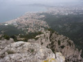
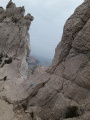
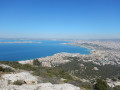
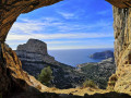
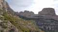
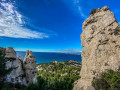
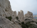
A very beautiful, challenging hike with exposed sections, superb views and numerous caves to explore. This hike requires you to use your hands on several ‘steps’, but the rewards are well worth it! Don’t forget your head torch and something to secure your walking poles to your rucksack at times.
Obviously, avoid this route in wet weather as the rocks are slippery in places.

You are in the Calanques National Park, which is subject to specific regulations. Failure to comply with these regulations may result in a fine of up to €1,500.

Details

2900914
Creation:
Last update:
Last review:
  • Walking
    Activity: Walking
  • ↔
    Distance: 4.38 mi
  • ◔
    Average duration: 3h 50 
  • ▲
    Difficulty: Difficult

  • ⚐
    Back to start: Yes
  • ↗
    Ascent: + 2,077 ft
  • ↘
    Descent: - 2,067 ft

  • ▲
    Highest point: 1,201 ft
  • ▼
    Lowest point: 135 ft

Photos

Description of the walk

Park on Boulevard de la Grotte Rolland near the canal bridge.

(S/E) Head south and, at the end of the cul-de-sac, opposite the Calanques sign, turn left onto a wide track.

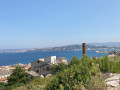
(1) After this stretch of track, turn right onto the very pleasant Path 2c, marked with a dotted yellow line, which climbs via steps in places and offers lovely views of Marseille. Continue south-east, ignoring the track you left behind on your right.

(2) At the junction with the permanent yellow 2 trail, carry on to the left along a slightly steep section where it may be helpful to use your hands. Continue along the yellow trail until you reach the Col de la Selle, a lovely crossroads of trails.

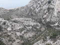
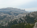
(3) Descend gently, staying on the Yellow trail. You’ll be treated to some stunning views over the various valleys of Malvallon. Continue along the pleasant, undulating path—which is easy to follow—until you reach the Col de la Galinette: a beautiful view of the Plan des Cailles and the Calanque de Marseilleveyre.

(4) Continue for about a hundred metres along the Yellow 2 trail before turning right and taking the dotted Green 2a trail, which leads, via a few steep sections, to the Pas de Demi-Lune. Stunning!

(5) Cross this pass via the dotted Yellow 2a path, which is narrow and steep but offers plenty of room to place your feet. Continue to the Saint-Michel d’Eau Douce cave, which is well worth a visit.

(6) After this cave, and another small one a little further on, continue along the Green 1 trail to the junction with the Red 1 trail.

(7) Continue the climb, still following the Green 1 trail, through the Vallon de l’Aigle, where you’ll need to use your hands in places to reach the Col des Chèvres.

(8) Turn left (Green and Blue markings) onto a short, steep slope leading to the summit of Béouveyre: a superb 360° panorama. Then veer right to descend via the Brown 1 trail (steep in places) and reach the finish at the canal bridge (S/E).

Waypoints

  1. S/E : mi 0 - alt. 135 ft - Canal bridge, Boulevard de la Grotte Rolland
  2. 1 : mi 0.22 - alt. 174 ft - Path on the right 2c, dotted yellow markings
  3. 2 : mi 0.94 - alt. 456 ft - Junction with Yellow Trail 2 (permanent markings)
  4. 3 : mi 1.55 - alt. 906 ft - Col de la Selle (275m)
  5. 4 : mi 2.48 - alt. 476 ft - Col de la Galinette (149m)
  6. 5 : mi 2.88 - alt. 748 ft - No Demi-Lune
  7. 6 : mi 3.1 - alt. 722 ft - Saint-Michel d’Eau Douce Cave
  8. 7 : mi 3.26 - alt. 676 ft - Green 1 and Red 1 junction
  9. 8 : mi 3.54 - alt. 1,056 ft - Col des Chèvres (280m)
  10. S/E : mi 4.38 - alt. 135 ft - Canal Bridge, Boulevard de la Grotte Rolland

Reviews and comments

4 / 5
Based on 3 reviews

Reliability of the description
4 / 5
Ease of following the route
3.3 / 5
Route interest
4.7 / 5
magali flecheux
magali flecheux

Overall rating : 4 / 5

Date of your route : Nov 17, 2023
Reliability of the description : ★★★★☆ Good
Ease of following the route : ★★★☆☆ Average
Route interest : ★★★★★ Very good
Very busy route : No

It’s a challenging but stunning walk. You really must follow the signposts, as the route alternates between yellow, green, dotted yellow, brown and blue markers, and it’s easy to lose your way if you don’t follow them. It can sometimes be difficult to turn back. Allow 4½ to 5 hours without breaks.

Machine-translated

ogyo
ogyo

Overall rating : 4 / 5

Date of your route : Jul 24, 2023
Reliability of the description : ★★★★☆ Good
Ease of following the route : ★★★☆☆ Average
Route interest : ★★★★★ Very good
Very busy route : Yes

There are a few shortcuts across the scree slopes, which I wouldn’t recommend. You’re better off following the signposts, which are very well marked along the route. A lovely walk that I’d recommend if you don’t suffer from vertigo.

Machine-translated

alaix
alaix

Overall rating : 4 / 5

Date of your route : Feb 10, 2020
Reliability of the description : ★★★★☆ Good
Ease of following the route : ★★★★☆ Good
Route interest : ★★★★☆ Good

A very pleasant walk with sections at higher altitudes offering magnificent views of the sea and Marseille (for experienced walkers).

Machine-translated

Other walks in the area

For more walks, use our search engine .

The GPS track and description are the property of this route's author. Please do not copy them without permission.