Country:

 City:


Park at the leisure centre car park
(S/E) Cross the stream via the footbridge, turn left onto the path alongside the Ruisseau de la Mère and continue until you reach Avenue du Parc. Turn left onto this road until you reach the roundabout, go through the large green gate opposite and follow the path to the right along the fence until you reach the thermal baths building.
(1) Take the path on your left, which joins the Chemin du Sous-Bois after you’ve gone through a small gate.
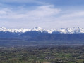
(2) Take the second small road on the left and immediately turn off onto the path that climbs to the right. At a hairpin bend further on, turn right and head for the Chanet viewpoint.
(3) Take the first path on the left and continue until you reach the “Le Suelet” junction, passing a path straight ahead.
(4) Turn right, pass the “Le Grand Chanet” junction and carry on straight ahead.
(5) Take the path on the left and, further on, after a descent over rocky ground, you’ll reach the Brulin junction.
(6) Turn right onto the Chemin du Brulin to reach the area featuring sculptures.
(7) Then follow the ‘Pedestrians’ signs, cross the footbridges and continue to the left.
(8) Head all the way to the left and, after passing a barrier, take a small road on the left.
(9) First turn right then left, head down into Parc Trivier and cross through it. Continue along a path lined with plane trees, pass to the left of a fountain, carry on straight ahead and, after going through a small gate, walk past the thermal baths.
(1) Carry on straight ahead and, following the route back in the opposite direction to the outward journey, head for the leisure centre car park (S/E).
 Visorando Member
 Moderate