La Fejaz de la Ravoire, Barby and the Château de la Bâtie

A short, easy and pleasant circular route to the east of the Chambéry gorge, combining urban and natural scenery; Starting from La Fejaz (La Ravoire), it allows you to explore the centre of the pretty village of Barby before gently making your way up into the foothills of the Bauges massif via Les Chavonnes and the Château de la Bâtie, until you reach the heights overlooking the ‘end of the world’ (Saint-Alban-Leysse) and the River Leysse.

Details

16768999
Creation:
Last update:
Last review:
  • Walking
    Activity: Walking
  • ↔
    Distance: 4.09 mi
  • ◔
    Average duration: 2h 35 
  • ▲
    Difficulty: Easy

  • ⚐
    Back to start: Yes
  • ↗
    Ascent: + 787 ft
  • ↘
    Descent: - 758 ft

  • ▲
    Highest point: 1,706 ft
  • ▼
    Lowest point: 988 ft
  • ⚐ Country: France
  • ⚐
    Areas: Alps, Bauges
  • ⚐ City: La Ravoire (73490)
  • ⚑
    Start/End: N 45.572311° / E 5.965934°
  • ❏
    IGN map(s): Ref. 3332OT, 3333OT, 3333OTR, 3432OT, 3432OTR
  • Hour-by-hour weather

Photos

Description of the walk

Park in the main square of the Fejaz neighbourhood in La Ravoire (also known as Place et Parc des Fées).

(S/E) Cross the square and pass the shops to reach the Route de Barby. Then turn left towards Barby and, at the next junction, turn right onto Rue du Mont-Saint-Michel – named after the large hill on your left. Continue straight on until you reach the pétanque courts. Cross the Fejaz sports grounds until you reach the sports hall.

(1) Follow the road as it veers left along the footpath, carry on straight ahead, cross Rue de la Chavanne and head straight on between the blocks of flats until you reach the Stade des Épinettes. Go round it via the footpath towards the secondary school, then head for the main cobbled square.

(2) Continue to the left towards the tennis courts, walk alongside them, then carry on along the path until you reach the brand-new neighbourhood in the centre of Barby. Walk through it to reach the Place de la Mairie and cross it to reach the Parc du Clos Besson.

(3) Head north towards the car parks adjoining the park, then take the footpath through the houses (turn left as you come out of the first path). At the new junction, head straight ahead and slightly to the right, up Avenue des Salins, then take the long footpath which runs along the right-hand side of the neighbourhood up the hillside to the new blocks of flats with pointed roofs. A short climb with an elevation gain of 60 to 80 metres.

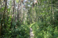
When you reach this new neighbourhood, take the road on the right heading up the hill, then turn left onto the very narrow road that leads into the woods. The main ascent of the route begins here (around 170 m elevation gain from this point). Historically, this was the Roman road.

After a while, well before you reach any houses, take the path signposted in yellow which climbs to the left into the woods. Carry on straight ahead until you reach the next junction.

(4) Turn left towards La Bâtie. After a few minutes, you’ll come to a residential area and then the road leading towards Curienne. Walk to the road, follow it to the right, then cross it to take the path on the left that runs alongside farmland. At the entrance to the greenhouse complex, continue to the right along the road for just over 200 m.

(5) Take the path leading off to the right into the woods (this is another starting point for a walk). Turn left immediately and take the well-used path that passes behind the Château de la Bâtie through the woods. You will go all the way round it and then find yourself higher up than the terrain to your right. Below lie the Leysse Gorges; this area is also known as the ‘Bout du Monde’ (in the municipalities of Saint-Alban-Leysse and Saint-Jean-d’Arvey).

Continue for a good while along the main path, which eventually descends towards the Chambéry valley, overlooking the Leysse. At one point, you’ll be above the mineral quarries of the hamlet of La Leysse. About ten minutes past the quarries, you’ll reach a small suburb of Saint-Alban-Leysse.

(6) At Villaret de la Leisse (or Leysse, a hamlet of Saint-Alban-Leysse situated at this point where the river flows), cross the main square and then turn left onto Rue des Sablons. Walk up this street, which is lined with old buildings and traditional shops.

(7) Turn left onto the pedestrian path (Chemin du Moulin), which takes you through the Sablons neighbourhood. At the junction with Rue du Nivolet, cross the road and continue straight on along the footpath, then make your way through the Guillère or Meule neighbourhoods. Cross the central park in the village of Fejaz and arrive back at the starting point (S/E).

Waypoints

  1. S/E : mi 0 - alt. 997 ft - Place aux Fées
  2. 1 : mi 0.34 - alt. 988 ft - Fejaz sports grounds
  3. 2 : mi 0.61 - alt. 997 ft - Place des Épinettes
  4. 3 : mi 0.92 - alt. 1,001 ft - Clos Besson Park
  5. 4 : mi 1.89 - alt. 1,667 ft - Les Chavonnes
  6. 5 : mi 2.52 - alt. 1,447 ft - Path on the right
  7. 6 : mi 3.44 - alt. 1,060 ft - Villaret de la Leisse - Leysse (rivière)
  8. 7 : mi 3.77 - alt. 1,017 ft - Chemin du Moulin
  9. S/E : mi 4.09 - alt. 997 ft - Place aux Fées

Notes

A fairly easy walk; nothing in particular to note. Take care to follow the correct paths in the hills above Barby, particularly towards the Roman road and the northern side of Mont Saint-Michel.

There is another possible starting point to shorten the route: from Parc Malatray or the car park at Barby church. In this case, right at the start of the walk, head up the Château Road to join the Roman road and reach the point (4). For the return journey, at Villaret de la Leisse (6), turn left towards the centre of Barby via the Barby Road, then, after the town centre park, take Rue des Charmilles and finally head towards Saint-Jean Church.

Worth a visit

Nearby: the Bout du Monde waterfall trail and the routes to the Chapelle Saint-Michel, for other walks in this area.

Reviews and comments

3.6 / 5
Based on 4 reviews

Reliability of the description
3.5 / 5
Ease of following the route
3.5 / 5
Route interest
3.8 / 5
User 25629284

Overall rating : 3 / 5

Date of your route : Feb 03, 2026
Reliability of the description : ★★★☆☆ Average
Ease of following the route : ★★★☆☆ Average
Route interest : ★★★☆☆ Average
Very busy route : No

Between points 3 and 4, there is a very steep slope, which can be dangerous if the ground is slippery. This is worth mentioning.
Depending on your preferences, you may or may not appreciate the long stretches through the city (even in pedestrian areas).

Machine-translated

daboloz
daboloz

Overall rating : 5 / 5

Date of your route : Aug 31, 2025
Reliability of the description : ★★★★★ Very good
Ease of following the route : ★★★★★ Very good
Route interest : ★★★★★ Very good
Very busy route : No

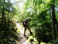
Be warned, between 3 and 4, the climb is difficult: first a long staircase, then a parish specific to Brittany climb through the woods that is very steep....
But the wooded section of this circuit is pleasant when it's hot like today.
The urban section allows you to visit Barby and Leysse, which is rather nice.

Machine-translated

Labugne
Labugne

Overall rating : 3.3 / 5

Date of your route : Mar 02, 2025
Reliability of the description : ★★★☆☆ Average
Ease of following the route : ★★★☆☆ Average
Route interest : ★★★★☆ Good
Very busy route : No

For me, it’s a hike of moderate difficulty because the climb is very steep and can be slippery if the undergrowth is damp. Apart from that section, it’s a very pleasant walk. Completed on 2 March 2025 by
Lovely spring sunshine; signposting is missing at key points 🧑‍🦯🧑‍🦯

Machine-translated

JACQUELET Claude
JACQUELET Claude

Overall rating : 3 / 5

Date of your route : Feb 23, 2022
Reliability of the description : ★★★☆☆ Average
Ease of following the route : ★★★☆☆ Average
Route interest : ★★★☆☆ Average
Very busy route : No

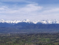
As is often the case, setting off from an urban area presents navigation challenges due to the lack of signposting. The sections through built-up areas are of little interest. There are many tarmac sections. The only highlight is the view from the high points over the Belledonnes and the Combe de Savoie. To make things easier, I recommend recording the route on a GPS device.

Machine-translated

Other walks in the area

For more walks, use our search engine .

The GPS track and description are the property of this route's author. Please do not copy them without permission.