Country:

 City:
City:


Park at the Colombier car park near the Casino.
(S/E) Turn right onto the gravel path lined with plane trees and head towards Parc Triviers.
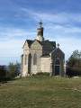
(1) Walk round the small pond on the left to come out opposite the château. Climb the steps and join the small road on the left above the château, then follow this road to the right for about ten metres.
(2) Turn left, then right, and go through the gate across the path: an information sign indicates whether the path is open, due to the risk of forest fires. Continue to the right at the crossroads.
(3) Take the path on the left and follow it straight on until you reach the sign for “Mont Saint-Michel sportif”.
(4) Carry on straight ahead.
(5) Turn right onto the Chemin de Bellevarde.
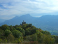
(6) Head up to the right to reach the viewpoint.
(7) Carry on until you reach some mountain pastures with a spring and a pond.
(8) Head off to the far left, northwards, and then, at the junction, take a sharp right to reach the ruins of the Resistance fighters’ farm and the commemorative stele.
(9) Turn back to the junction, then rejoin the route to the right. Walk for about 650 m to reach a crossroads.
(10) Head downhill, turning left twice, and continue along the main path, which winds its way through the Bois de Barby in wide hairpin bends, alternating between fairly steep descents and flat sections. Further down, you’ll come to a good gravel path (an old Roman road).
(11) Follow it to the left for 500 metres, ignoring the two paths on the right.
(12) Climb the steep slope to the left in the middle of the mountain pasture, passing to the right of a ruin. The path then turns right into the forest.
(13) Ignore the path on the right and continue straight ahead to rejoin the route you took on the way there.
(6) Carry on straight ahead, in the opposite direction to the outward journey.
(5) Carry on straight ahead and rejoin the path you took on the way there. Follow this path to the right, in the opposite direction to the outward journey, to return to the car park where you started (S/E).
 Visorando Member
 Easy
Easy