Country:

 City:
City:


Park in the small park situated on the border between the La Peysse and La Déserte neighbourhoods.
(S/E) Head up Rue de la République, which runs alongside the residential neighbourhood, until you reach the start of the La Peysse Industrial Estate. At the large old timber-processing building, turn right onto Rue Lamenais, then follow the VRU (Route des Belledonnes) to the roundabout at the north-western entrance to La Ravoire.
(1) Cross to the opposite side via the footpaths. Head uphill towards the new blocks of flats on Rue du Clos Saint-Antoine. Follow the footpath running alongside them, then, at the end, turn right and take the path and steps leading up the hill.
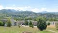
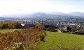
You will then arrive at a small residential square with the first houses of the Échaud neighbourhood. Here, look behind you to enjoy a magnificent view of the Chambéry gorge, with Barberaz and Saint-Baldolph below. Take the street leading to these houses, Rue Antoine de Saint-Exupéry, then, after the fourth house, take the footpath on the left.
Continue for a few metres past this point to reach the meadows of the Échaud hill, the Clos Saint-François. In days gone by, this site was home to a hamlet comprising farms, Catholic cloisters or monasteries, and wine cellars (clos are enclosed vineyards). Today, it is a large, upmarket residential neighbourhood.
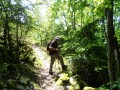
(2) Take Rue Napoléon 1er towards Les Bauges. This road has been partially closed to motor traffic (blocked at Haut-Mollard to prevent its use). At the barrier, turn left between the meadows and continue straight on along the fields. Carry on until you reach the woods. At the large farm at the entrance to the woods, take the footpath that leads down towards the Madeleine neighbourhood.
Take the woodland path that leads down to La Madeleine, an area that was once made up of farmland, some of which belonged to Guillemin Castle. On emerging from the woodland, you’ll reach a crossroads just before Rue de la Parpillette.
(3) Keep to the left, cross the street and head towards the children’s playground. Walk through the playground and then continue straight on along the street called Chemin du Sous-Bois. Take the first right, Rue des Églantiers, to begin the circular route. You’ll reach the new blocks of flats; walk past them to return to Rue de la Parpillette.
(4) Turn right onto the well-maintained footpath that runs alongside this street to return to the previous junction.
(3) Take the path on the left, then turn left a few metres further on as you re-enter the woods. You will then reach the large meadows of Le Galibier. Turn left, following the path towards La Trousse. Walk alongside the woods on your left and carry on straight ahead until you reach a junction leading to Le Haut-Mollard.
(5) Continue along the Chemin de la Trousse aux Mollard until you reach Rue du Galibier, then carry on to the junction.
(6) Turn left onto Rue Victor Lyonne until you reach the T-junction.
(7) Turn right onto Rue Leon Costa de Beauregard. Just round the corner from the car park of the small shop ‘La Ravoire Paysanne’, head to the right and then continue along the pedestrianised Rue Hector Berlioz. At the entrance to the Sainte-Lucie private school, go straight on towards Parc de l’Échaud, following the pedestrianised street.
(8) Turn left to enter Parc de l’Échaud: it was in this area, in centuries past, that outlaws were displayed – crucified, hanged or burnt (on gallows) – to warn and deter those with ill intent as they arrived in the city of the Dukes of Chambéry. This is why the hill has retained the name ‘l’Échaud’, the colloquial short form of ‘échafaud’ (scaffold).
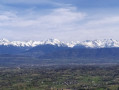
Walk through the park and head south towards Rue de Saint-Exupéry. For those who are interested, there is a lovely viewing point at the top of the park offering a beautiful panorama. Before reaching the avenue, turn right up towards the neighbourhood houses; then, after the small park on the bend, cross the road to take the narrow path opposite between the houses, which leads to Rue Saint-François de Sales.
Follow this street, then turn right onto Rue Philibert Curial (named after the Curial square in Chambéry). Continue along these residential streets until you reach Route des Belledonnes again, just before the Carrefour des Belledonnes junction.
Cross the road at the pedestrian crossing, then head towards the new blocks of flats opposite, which are slightly higher up. Cross the adjoining park at the back via the footpaths, then cross the road to reach the Clos de la Chapelle. Turn right onto Rue Duguesclin and follow it until you reach the starting car park (S/E).


 Visorando Member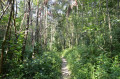

 Moderate