


 Country:
 City:
City:


In Condé-en-Brie, you can park on the Place de l’Église, before the Dhuys bridge.
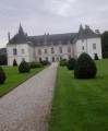
(S/E) From the Place de l’Église, turn right onto the Grande Rue, cross the Dhuys Bridge, then pass in front of the Château de Condé-en-Brie.
(1) At the junction, before the bakery, follow the arrow on the right towards Monthurel. Continue straight on along the Chemin du Bouvier, which becomes a farm track.
(2) After the sewage treatment works, do not cross the railway line, but turn right. After 450 metres, cross the first bridge over a tributary of the Surmelin, then a second bridge on the right over the Surmelin. Pass the mill and head back up towards the village.
(3) At the first house, turn left and head up Rue du Moulin to the junction, then turn left onto Rue de Celles-lès-Condé (D85) until you reach the town hall in the village centre.
(4) Follow the signpost on the right towards Celles-lès-Condé. Walk up Rue de Janvier for about 200 metres. At the top of the street, take Chemin des Besnardes on the right. For 800 metres, stay on the path through the vineyards until you reach the bend.
(5) First turn right then left, and pass the tree on the path below the vineyards. Continue for 700 metres below the vineyards, then turn right to reach Celles-lès-Condé.
(6) Head back down towards the village via Rue de Janvier. At the fork, carry straight on along Rue de Bicètre. At the junction with Rue de Monthurel (D85), follow the arrow opposite towards Condé-en-Brie. Go down the path to the right of the tower towards Surmelin.
(7) Cross the footbridge over the Surmelin, where you’ll find a picnic table. Head back up towards the village. Take a moment to read the story of Xavier Moissinac, a pilot during the First World War. Continue straight on towards Condé-en-Brie, follow Rue Saint-Rémy and emerge onto the Grande Rue at Les Halles. Turn right and head back down, following the arrow towards the centre of Condé-en-Brie to return to the church car park (S/E).
 Visorando Member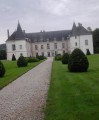
 Moderate
 Difficult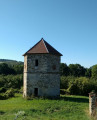
 Local authority
