


Refine your search for walks in Notre-Dame du Rot
Notre-Dame du Rot walks


 Notre-Dame du Rot and Pilon du Roi from Lou Limas
 Visorando Member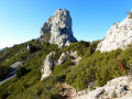
 6.32 mi
 +1,332 ft
 -1,332 ft
 4h 05
4h 05
 Average
 Departure from Allauch (Bouches-du-Rhône)
Starting from the Marseille metropolitan area, a combination of classic trails and lesser-known paths to reach and explore a section of the Chaîne de l'Étoile ridges.
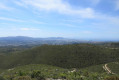
The Pilon du Roi via the Crêtes du Petit Cornillon and Mauvelle
 6.46 mi
+1,923 ft
-1,936 ft
4h 40
6.46 mi
+1,923 ft
-1,936 ft
4h 40
 Difficult
Departure from Allauch (Bouches-du-Rhône)
Difficult
Departure from Allauch (Bouches-du-Rhône)
A difficult hike offering access to the ruins of Notre-Dame du Rot and the Pilon du Roi via less well-trodden paths, as they do not appear on IGN maps. Along the way, you’ll encounter a spectacular landscape with strangely shaped rocks and magnificent views of Marseille, Gardanne and the Sainte-Victoire massif.Please note: there are a few difficult ascents and descents where you will need to use your hands (see practical information).The use of a GPS or the app with the route track is essential.
Walks near Notre-Dame du Rot
From Peypin to La Destrousse via the Col du Marseillais
6.20 mi
+1,365 ft
-1,680 ft
4h 00
Average
Departure from Peypin (Bouches-du-Rhône)
This lovely walk, winding from valley to valley, takes you from Peypin to the Col du Marseillais. Stunning views of Sainte-Victoire, as well as of Roquevaire and the Huveaune valley from the pass. Then the descent back down to the village of La Destrousse.
- The walk is accessible at the start and finish via the free bus network of the Pays d’Aubagne et de l’Etoile (line 17).
From La Treille to La Font de Mai
3.64 mi
+856 ft
-587 ft
2h 25
 Easy
Departure from Marseille (Bouches-du-Rhône)
Easy
Departure from Marseille (Bouches-du-Rhône)
The free Pays d'Aubagne et de l'Étoile bus network offers some unique routes. For example, line 10 (Aubagne Station – La Treille) will drop you off at La Treille, just a stone’s throw from Marcel Pagnol’s grave. You can then head into the hills where he filmed his movies. You will then pass through the magnificent Font de Mai estate. Afterwards, you can return to Aubagne on bus route 14 (Éoures – Aubagne Station). Please note that these buses do not run on Sundays.
From La Penne-sur-Huveaune to Le Charrel via La Candolle
5.32 mi
+1,099 ft
-1,040 ft
3h 25
Easy
Departure from La Penne-sur-Huveaune (Bouches-du-Rhône)
A lovely walk starting from La Penne-sur-Huveaune that takes you through pine forests to the summit of La Candolle. An easy path winds its way along the cliff face, offering magnificent views of Sainte-Baume, the Huveaune valley, Garlaban and the Bay of Marseille. The descent takes you back down to La Pérussonne and Le Charrel. The free bus on Line 6, which connects with the free tram, takes you back to the starting point, and the tram takes you back to the city centre.
You are in the Calanques National Park, which is subject to specific regulations. Failure to comply with these regulations may result in a fine of up to €1,500.
The historic centre of Aix-en-Provence
 4.31 mi
+72 ft
-98 ft
2h 05
Easy
Departure from Aix-en-Provence (Bouches-du-Rhône)
4.31 mi
+72 ft
-98 ft
2h 05
Easy
Departure from Aix-en-Provence (Bouches-du-Rhône)
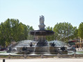
A family outing, a cultural outing, an architectural outing... and a culinary outing if you like! Fountains, cathedrals, churches, museums, theatres, hotels, squares and other attractions... The main things to discover when you come to Aix-en-Provence, a city of water, art, history and well-being!
The Corniche, from Notre-Dame de la Garde to the Old Port
 5.13 mi
+344 ft
-797 ft
2h 40
Easy
Departure from Marseille (Bouches-du-Rhône)
5.13 mi
+344 ft
-797 ft
2h 40
Easy
Departure from Marseille (Bouches-du-Rhône)
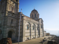
Starting from the Notre-Dame de la Garde Basilica, this route invites you to head down towards the Corniche, a magnificent winding balcony overlooking the Mediterranean. Here you’ll discover the charm of little hidden corners, such as the Malmousque Peninsula, the Endoume neighbourhood and the famous Vallon des Auffes.
From the Refuge Cézanne to the Deux Aiguilles car park via the Trou
 1.80 mi
+387 ft
-407 ft
1h 10
Easy
Departure from Saint-Antonin-sur-Bayon (Bouches-du-Rhône)
1.80 mi
+387 ft
-407 ft
1h 10
Easy
Departure from Saint-Antonin-sur-Bayon (Bouches-du-Rhône)
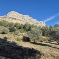
This trail is an alternative known to local hikers for reaching the Saint-Antonin car parks when they have just completed a circular in Sainte-Victoire: it avoids following the brown-marked route, passing through the Col de l'Oppidum (alt. 580 m), then descending a very steep and rugged path. There is a 40-metre less elevation gain, and when you are in a hurry to get to the car park or tired, taking this Trou trail is a good option, especially in bad weather.
La Sainte Victoire
 6.71 mi
+2,385 ft
-2,169 ft
5h 10
Difficult
Departure from Saint-Marc-Jaumegarde (Bouches-du-Rhône)
6.71 mi
+2,385 ft
-2,169 ft
5h 10
Difficult
Departure from Saint-Marc-Jaumegarde (Bouches-du-Rhône)
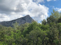
Une magnifique promenade sur l'un des plus hauts massifs de Provence qui convient pour une sortie du club de randonnée en autocar (le départ du parking du barrage de Bimont et l'arrivée à Vauvenargues). La montée au Prieuré et à la Croix de Provence se fait par le sentier Imoucha et la descente par le sentier des Venturiers. De sublimes paysages de Paul Cézanne en 3D au sommet : la basse Provence jusqu'à la mer et l'étang de Berre, le sommet du mont Ventoux, les contours des Alpes au Nord.Attention. Un randonneur signale le 17 septembre 2024 :- Fermeture du Sentier Imoucha pour travaux du 01/10/2024 au 31/12/2024 et du 01/10/2025 au 31/10/2025.- Fermeture du Prieuré pour travaux jusqu'au 31/12/2024.
Chemin de Roques Hautes from the Bimont dam
 4.01 mi
+709 ft
-850 ft
2h 30
Easy
Departure from Saint-Marc-Jaumegarde (Bouches-du-Rhône)
4.01 mi
+709 ft
-850 ft
2h 30
Easy
Departure from Saint-Marc-Jaumegarde (Bouches-du-Rhône)
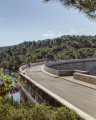
This short loop from the Bimont dam allows you to visit Roques Hautes. It is very accessible, even for families. You will see a marble quarry, numerous busy meadows and, of course, a beautiful view of the Sainte-Victoire mountain.
There are a few changes to the route in the reserve, see the notices
From Carnoux to Cassis via La Croix
5.34 mi
+361 ft
-1,056 ft
2h 45
Easy
Departure from Carnoux-en-Provence (Bouches-du-Rhône)
A very lovely walk linking Carnoux to Cassis through the hills. Panoramic views of Cassis and Sainte Baume. Botanical trail. The walk is fully accessible by bus.
In the heart of the Cirque des Pételins via the Vallon de la Fenêtre
 8.48 mi
+2,582 ft
-2,881 ft
6h 10
8.48 mi
+2,582 ft
-2,881 ft
6h 10
 Very difficult
Departure from Marseille (Bouches-du-Rhône)
Very difficult
Departure from Marseille (Bouches-du-Rhône)
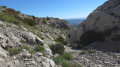
The Cirque des Pételins is a sight of unparalleled beauty. It is a very little-used trail in the Calanques National Park of Marseille. A superb but demanding hike requiring sure-footedness, good physical fitness and the ability to use a GPS effectively in certain places where the path is harder to find. This hike is not circular; it requires a shuttle service between the Logisson car park and the Col de la Gineste car park.
Please note: you are hiking in a national park; please respect the rules and avoid straying from the paths. Before setting off, please familiarise yourself with the regulations of the Calanques National Park: Calanques National Park Regulations