Country:
 City:
City:


Car park opposite the church.
(S/E) As you leave the car park, head up Rue de l’Église, then continue along the ‘Chemin de la Planche Ronde’, marked with red and white signs. At the last house, turn left and carry on to the recycling centre. Marked with yellow and blue signs.
(1) Then head right up the small tarmac road for a few metres and turn left onto the stony track. As soon as you enter the woods, at the first fork, head down to the left to the main road, which you cross at the pedestrian crossing, then head towards the centre of Thoraise.
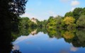
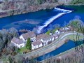
(2) Ride about twenty metres past Rue de la Surotte and turn right down the path at the corner of house number 1B. Please note: it is somewhat hidden by the vegetation. Then turn right onto Chemin du Portail. You will pass through an old gate in the castle grounds, riding alongside beautiful rock formations and the river.
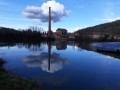
(3) You’ll rejoin the cycle route and the Percée de Thoraise, known as the ‘Monsieur Tunnel’, a 185-metre-long tunnel dating from 1810. A circular basin allows the barges to turn round.
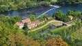
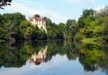
(4) A hundred metres further on, do pop down a small path to the riverbank for a lovely view of the castle overlooking the river. You can carry on for a hundred or two hundred metres along the riverbanks and the canal to rejoin the cycle route. Along the canal, the path is a little less accessible.
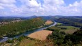
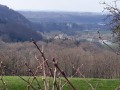
(5) After the lock, leave the cycle route and turn right onto the path – half stone, half grass – leading to the Notre-Dame du Mont viewpoint. Continue along this path to the viewpoint. The Notre-Dame du Mont viewpoint offers an exceptional view of the Doubs valley and its meanders, the Jura mountains and, in the foreground, the keep of the feudal castle of Montferrand.
(6) Set off again along the path that descends opposite the chapel. A little further down, at the signpost, join another stony path at right angles. Head up to the left and carry on straight ahead. Signposting is sparse. You’ll be walking alongside the fitness trail. Shortly after a red ‘No Hunting’ sign, the path turns right.
(7) Walk back up the main road for about a hundred metres, then turn right onto the small, straight and somewhat monotonous tarmac road.
(8) At the Champ Mougin junction, turn right. Soon after, ignore the signpost suggesting you turn right into the woods and carry on straight ahead along this well-graveled track.
(9) As you catch sight of Abbans-Desssus, head down to the right. The small road soon ends, splitting into three forest tracks. Take the one on the far left and follow it, continuing downhill. Unfortunately, the signposting is in the opposite direction to the walk.
(10) You’ll hear the sound of the stream and come to a fork. Turn right to follow it. Soon, there’s another fork. Continue left along the path that runs alongside the stream and crosses it via a footbridge. A little further on, before a fir forest with tall trees, wade across the stream over large stones.
(11) After a short climb, at the fork, head down to the left. You’ll reach the pastures overlooking Boussieres. At the first fork, carry on straight ahead towards the village, passing vineyards on your way. Turn left onto the Chemin du Bas des Vignes, passing the plaque commemorating the deaths of two Resistance fighters.
(12) Head up the D105 to the right towards the village centre. On the right, there is an old house with numerous protruding stones. This was how our old stonemasons used to celebrate the owner of the future building when he treated them to a drink. He seems to have been a generous man! Soon after, turn into Rue de l’Église to reach the car park (S/E).
 The paths are rocky and slippery in places. Sturdy footwear is essential and the use of walking poles is recommended.
 Visorando Member

 Difficult
 Easy
Easy