Circular walk from Boussières to the Signal d’Abbans-Dessus and back via La Chandole

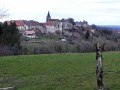
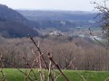
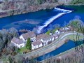
A lovely, easy family walk offering magnificent views over the Doubs valley as far as the Serre massif, as well as over the Loue valley, from the lower plateaus to Mont Poupet. Part of the return journey follows a small stream and the Boussières plain.

Details

983780
Creation:
Last update:
Last review:
  • Walking
    Activity: Walking
  • ↔
    Distance: 8.01 mi
  • ◔
    Average duration: 4h 25 
  • ▲
    Difficulty: Moderate

  • ⚐
    Back to start: Yes
  • ↗
    Ascent: + 850 ft
  • ↘
    Descent: - 863 ft

  • ▲
    Highest point: 1,545 ft
  • ▼
    Lowest point: 781 ft
  • ⚐ Country: France
  • ⚐ City: Boussières (25320)
  • ⚑
    Start/End: N 47.157904° / E 5.901002°
  • ❏
    IGN map(s): Ref. 3324ET
  • Hour-by-hour weather

Photos

Description of the walk

Start from the car park at the Boussières village hall.

(S/E) Take Rue des Richets on your right and walk down through the village along Rue du Centre until you reach a right-angle bend to the right.

GR®59signposting

(1) Turn left onto Rue des Résistants, then right onto Chemin du Bas des Vignes.

No signposting

(2) Cross the industrial estate and continue straight on. The stony path then becomes steeper as it winds past vineyards and orchards. Further up, along the meadow, keep to the right.

(3) You’ll come to an old, ruined milking parlour which was used to milk a herd of cows in the summer, 40 years ago.

Before beginning the descent 200 metres further on, turn left and head into the woods. Follow this well-marked path, which suddenly branches off to the right at the edge of the meadows. After making your way through some holly bushes, turn left and head uphill as the track begins to descend. Climb steeply and follow this ridge until you reach a junction with a wide track.

(4) This newly created track links the Chemin de la Grande Fin and the neighbouring farms with the Roman road and the meadows of Chouzelot. Continue straight on, enjoying the view over the valley and the Osselle sand pits. You will soon come within sight of the Signal d’Abbans Dessus, a pylon laden with communication antennas.

Before passing this pylon, look out for one or two small paths on the left and follow them for about ten metres to reach the pastures. The landscape then opens up before you, revealing the Loue valley and the Chouzelot Viaduct. In the distance, you can see the Reugney and Bolandoz hills. Finally, to the right, you can see Quingey and Mont Poupet.

(5) Return to the Signal. You can walk a little further ahead for a final view of Quingey. Turn right onto the tarmac road, which descends very steeply to the village of Abbans-Dessus.

(6) In front of the cemetery, turn right onto the Chemin de la Grande Fin and follow it past the farms. At the last building, you’ll see the track you crossed earlier along the ridge. Continue along the road for about one kilometre until you reach a junction leading to the lorry turning area

(7) Head down from this turning area and take the path on the left, which descends quite steeply to reach the confluence of two streams at La Chandole.

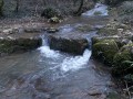
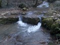
(8) Turn right, following the bank of the stream. A little further on, a bridge takes you across it. Follow the stream until you reach a junction with a path coming from the right. You’ll arrive at the Pré de Vé ford. Lovely little waterfalls dot the lower reaches of the stream, but there’s no marked path to follow its course.

(9) Cross the stream and head up the track directly in front of you, ignoring all the adjacent paths.

GR®59signposting

Follow theGR®59signposting all the way to the village. Cross the Bois de Blâme and head down into the Boussières plain. At the two junctions, turn left and then right.

(10) Head back up towards the village, following a very recently planted vineyard, and admire the orchards with their neatly pruned and well-tended trees.

(2) At the junction with the Chemin du Bas des Vignes, turn left to join the departmental road.

(1) Walk back up towards the village and take the opportunity to admire the Romanesque church and its porch, both listed as historic monuments. Continue as far as the chemist’s and turn left to reach the car park (S/E).


Waypoints

  1. S/E : mi 0 - alt. 925 ft - Car park at the village hall
  2. 1 : mi 0.19 - alt. 879 ft - Rue des Résistants
  3. 2 : mi 0.31 - alt. 860 ft - Crossroads of the circular loop
  4. 3 : mi 1.19 - alt. 1,191 ft - Former lodge
  5. 4 : mi 2.43 - alt. 1,480 ft - Crossing the ridge via a track
  6. 5 : mi 3.28 - alt. 1,539 ft - Abbans transmitter
  7. 6 : mi 3.76 - alt. 1,342 ft - Turn right at the cemetery
  8. 7 : mi 5.33 - alt. 1,240 ft - Turning area
  9. 8 : mi 5.82 - alt. 1,024 ft - Chandole
  10. 9 : mi 6.1 - alt. 958 ft - Gué Pré de Vé
  11. 10 : mi 7.02 - alt. 784 ft - On the right, a vineyard
  12. S/E : mi 8.01 - alt. 925 ft - Car park at the village hall

Notes

There is a bakery and a grocery shop in the village.
The bar, next to the grocery shop, also offers quick meals and snacks.
There’s a restaurant next door.
The ‘Lodges of the Wood’ can also accommodate walkers wishing to stay for a few days.

Worth a visit

A stroll through the village of Abbans-Dessus and the narrow streets around the castle.
A restored wash house on the outskirts of the village on the Chemin de la Grande Fin.

Always be cautious and plan ahead when you're outdoors. Visorando and the author of this route cannot be held responsible for any accidents occurring on this route.

The GR® and PR® markings are the intellectual property of the Fédération Française de Randonnée Pédestre.

Reviews and comments

4.2 / 5
Based on 3 reviews

Reliability of the description
4.3 / 5
Ease of following the route
4.3 / 5
Route interest
4 / 5
pnuninger
pnuninger

Thank you for your kind comment. Have a nice day and enjoy your hikes

Machine-translated

Paps
Paps

Overall rating : 4.7 / 5

Date of your route : Sep 07, 2025
Reliability of the description : ★★★★★ Very good
Ease of following the route : ★★★★★ Very good
Route interest : ★★★★☆ Good
Very busy route : No

A pleasant route that presents no difficulty. There are beautiful views to enjoy at point 5, both towards the Loue Valley and the Doubs.

Machine-translated

pnuninger
pnuninger

Thank you for your kind comment.
Have a lovely day

Machine-translated

Larose54
Larose54

Overall rating : 4 / 5

Date of your route : Feb 22, 2021
Reliability of the description : ★★★★☆ Good
Ease of following the route : ★★★★☆ Good
Route interest : ★★★★☆ Good
Very busy route : No

A pleasant walk, partly in the shade and partly in the open, through meadows with lovely views. I found the little, very quiet road we took on leaving Abbans-dessus, leading to the Chandole stream, a bit long. Even so, it passes through some lovely meadows.
Thank you for this lovely walk.

Machine-translated

richardd
richardd

Overall rating : 4 / 5

Date of your route : Nov 10, 2019
Reliability of the description : ★★★★☆ Good
Ease of following the route : ★★★★☆ Good
Route interest : ★★★★☆ Good

A family walk with views over the Doubs Valley.

Machine-translated

Other walks in the area

For more walks, use our search engine .

The GPS track and description are the property of this route's author. Please do not copy them without permission.