Country:
 City:


Park in the car park at the Boussières village hall.
(S/E) Join the D104 road and follow it for about twenty metres on your left. You have two options:
- for those who prefer tarmac, follow the D104 towards Torpes until you come to a small white track on your right,
- for everyone else, trail enthusiasts, take the Chemin du Seterot on your left. It soon enters the forest. Follow it along the cliff edge. Enjoy the view over the Thoraise plain and the military camp. Return to the D104, cross carefully to take the small white track opposite and rejoin the road at the crossroads at a place called La Rivière.
(1) Carry on straight ahead, cross the River Doubs and continue until you reach a bend in front of the railway line.
(2) Turn left and follow the cycle route for about 3 km. Ride past the lock and continue along the canal until you reach the junction with the road to the village of Osselle.
(3) Turn right onto this road for 200 metres and, at the sharp three-way junction, turn right onto Rue de la Fourotelle. You’ll soon leave the last houses behind as you enter the forest and reach a hunting lodge.
(4) Turn sharply left at the right-angled junction. Follow this path, which veers right a little further on and very quickly becomes much steeper. You’ll pass a beautiful sinkhole, which is unfortunately signposted in the opposite direction. You’ll then reach the highest point of the climb after crossing a marked path coming in from the left.
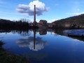
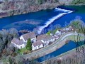
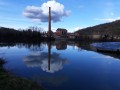
(5) Continue along this track, keeping close to the ridge. As soon as the descent becomes steeper, you’ll be able to make the most of a few clearings in the forest to catch a glimpse of the paper mills below, along the River Doubs.
Caution: the viewing points are not secured and the cliffs are quite high.
You will then reach the water tower.
(6) Take the gravel path. You’ll come to a junction with a new path at a left-hand bend.
(7) Take the small path on the right, which runs alongside the housing estates before opening out onto a clearing dominated by the statue of the Virgin of Torpes.
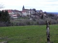
Make the most of the lawn and the benches around the statue to relax for a few moments and admire the view of Boussières and its castle.
(8) Carry on straight through the village along Rue de la Grande Plaine, ignoring the roads joining from the left. You will soon reach the D12.
(9) Turn right onto it towards Boussières. After crossing the level crossing, you’ll rejoin your original route at the junction with the D104.
(2) Cross the River Doubs to reach the first junction.
(1) Take the small path straight ahead. For the return journey, you have the same options as on the way out: either take the departmental road (the route shown on the map) or the path on the right. This path is known as the ‘Chemin des Ouvriers’ (Workers’ Path) as it was used daily by paper mill workers on their way to work.
At the chemist’s, turn right to reach the car park (S/E).

 Visorando Member

 Easy
 Difficult