Country:
 City:
City:


Park in the car park at the Boussières village hall.
(S/E) Walk to the church and follow the path alongside it. Head up Rue de l’Église, then along Chemin de Planche Ronde to the edge of the woods. Then take the gravel path that climbs into the forest. Follow this fitness trail path to the junction at elevation 351 (see map).
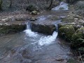
(1) Carry on and take a well-marked path on the left which descends gradually. As you walk past some beautiful rocks, you’ll see a few hollows that are no doubt home to foxes and badgers. You may also catch a glimpse of some chamois scampering over the rocks. You’ll soon reach the lowest point of this walk when you come to the Ruisseau du Moulin à Caillet.
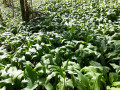
(2) Leave the wooden bridge crossing this ford behind you. Head uphill to the right along the stream, which winds to your left, whilst a strong smell of wild garlic tickles your nostrils. Vast fields of wild garlic green the undergrowth on both sides of the path until you emerge onto the pastures. When you reach the Moulin Caillet, take the county road ahead of you for a few dozen metres.
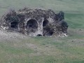
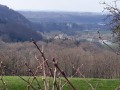
(3) At the hairpin bend, take the dirt track branching off to the right. Ahead of you, you’ll see a ruined building with beautiful arches. This is the entrance to the old gypsum mines. Follow this path for 1.7 km until you come to a main track. Behind you, a beautiful panoramic view of the Doubs valley is well worth a few seconds’ attention.
(4) You are 100 metres from the Vorges monument, erected in memory of the soldiers killed in 1870. Continue to your right along this wide Roman road. Further on, on your left, you will find the Montgardot monument, which has the same origins as the previous one.
(5) Here, leave the lovely road and take a wide stone track on the right which runs alongside the meadow and climbs steeply into the forest to the summit, where you can enjoy the view of Abbans-Dessus and its castle.
(6) Begin the descent, which quickly leads to the corner of a farm shed at the junction with the Chemin de la Grand-Fin, which you take to the right. Follow this track until you reach a T-junction, which is the turning point for vehicles.
(7) Take the path on your far left, which descends steeply to join the Ruisseau de la Chandole.
(8) Follow the stream as you enter the valley, cross the footbridge and follow the stream to a slightly more open area where you’ll find a fine ford to cross the stream without getting your feet wet. Take this lovely uphill path, cross through the beautiful fir forest and you’ll soon emerge into the fields. At the first junction, turn left then right and head back up to the village via the Chemin du Vigney. Do take a moment to admire the hillside and, along the path, all the beautifully maintained vineyards and orchards. You’ll come out at the junction with the Chemin du Bas des Vignes.
(9) Turn left here, then left again onto Rue des Résistants, and finally right onto Route de Quingey to cross the village. Then turn left and head for the village hall car park (S/E).



 Visorando Member

 Easy
Easy 
 Difficult