The Goulot Farm circular walk

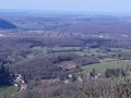
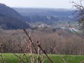
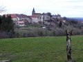
This long hike will take you to the Goulot farm, offering superb panoramic views over the lower Doubs valley and the Chaux and Serre forests. There are also views of the first and second Doubs plateaus. The varied trail surfaces, short climbs and long descents will ensure a wide variety of experiences throughout the route.

Details

1033200
Creation:
Last update:
Last review:
  • Walking
    Activity: Walking
  • ↔
    Distance: 14.03 mi
  • ◔
    Average duration: 7h 30 
  • ▲
    Difficulty: Difficult

  • ⚐
    Back to start: Yes
  • ↗
    Ascent: + 1,240 ft
  • ↘
    Descent: - 1,240 ft

  • ▲
    Highest point: 1,709 ft
  • ▼
    Lowest point: 722 ft
  • ⚐ Country: France
  • ⚐ City: Boussières (25320)
  • ⚑
    Start/End: N 47.157748° / E 5.901027°
  • Accessible from the train station Gare de Byans.
  • ❏
    IGN map(s): Ref. 3323ET, 3323O, 3324ET
  • Hour-by-hour weather

Photos

Description of the walk

Park in the car park by the village hall.

(S/E) Walk down Rue des Richets and, opposite the bakery, head straight across onto the D104, which you follow for 1 km towards Vorges.

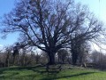
(1) Leave the D104 at the property and turn right onto the tarmac track. As you emerge from the forest, the track becomes stony. Follow it to a large crossroads at Noyer de Champmougin.

(2) Turn right and continue for about 300 metres. Pass a small meadow on your right.

(3) Take the path on the left which leads back into the forest where the track you’re following begins to descend. Follow this path, which climbs gently to follow the ridge. Further on, you’ll come out onto a wide track that joins the slope from both sides. Cross it and take the path directly opposite. Continue along a path that widens as you approach the mobile phone mast. About a hundred metres before you reach it, one or two clearings in the bramble bushes give you access to pastures and panoramic views of the Loue Valley, the Chouzelot viaduct and Mont Poupet.

(4) At Le Signal, follow the path down to the right to reach the Abbans-Dessus cemetery.

(5) Turn left and take Rue du Chatelot on the left. Continue past the houses to reach the Quingey road.

(6) Cross the D13 to reach Rue des Favorges. At the first junction, turn right onto Rue des Combes and follow it to the end. You’ll arrive beneath the power line.

(7) Take the path, which becomes rockier and earthier, to climb up into the woods. Stay on this route, walking along the edge of the meadows and, further on, following small cliffs. You’ll reach a well-signposted and highly visible viewpoint, which will offer you a breathtaking view of the lower Doubs valley.

(8) Continue along the track, staying on the main path and ignoring the various side trails.

(9) Enter the meadow via a clearly marked path provided for this purpose at a bend in the trail. Cross straight across to join a lovely path opposite, which you’ll follow to the right. Continue until you reach a junction with the path to Goulot Farm, which is now in a very dilapidated state.

(10) Turn left twice and head off, in a hairpin bend, to your right for a long descent which continues onto a tarmac road.
You can take a short detour by following the path through the woods on the left to the aviators’ memorial, which pays tribute to servicemen shot down in flight.
Carry on until you reach a hairpin bend.

(11) At this point, enter the woodland via a lovely forest lane which takes you down a long, steep descent to Byans-sur-Doubs. Then follow the Chemin de Chavanne. Cross the Grande Rue and carry on to the stop sign.

(12) Then head along Rue la Gare to reach the D13. Turn left onto Rue de la Grotte, cross the Doubs at the Reculot bridge and continue carefully along this busy road to reach Osselle beach.

(13) In front of the beach car park, cross the road and follow the grassy path alongside the Rhône–Rhine Canal. Cross to the other bank at the lock bridge and follow the Eurovélo route for about 4 km.

(14) Leave the cycle route and take the D104 to cross the River Doubs and then pass through the workers’ housing estates. At the junction of the two departmental roads, take the small gravel path at the corner by the electricity substation and rejoin the road a little further up. Follow it for a few metres.

(15) You will then join the workers’ path (formerly used by paper mill workers to get to work from Boussières). Follow it uphill until, after a few dozen metres on level ground, you reach a lovely junction of forest tracks. Turn right, then immediately left onto the path leading to the reservoir, which takes you back to the car park where you started (S/E).


Waypoints

  1. S/E : mi 0 - alt. 925 ft - Car park at the village hall
  2. 1 : mi 0.74 - alt. 1,037 ft - Tarmac road on the right
  3. 2 : mi 1.62 - alt. 1,201 ft - The walnut tree at Champmougin
  4. 3 : mi 1.93 - alt. 1,214 ft - Entrance on the ridge path
  5. 4 : mi 3.85 - alt. 1,539 ft - Le Signal
  6. 5 : mi 4.23 - alt. 1,345 ft - Abbans-Dessus cemetery
  7. 6 : mi 4.66 - alt. 1,257 ft - Crossing the D13
  8. 7 : mi 5.05 - alt. 1,388 ft - Power line
  9. 8 : mi 5.96 - alt. 1,624 ft - Viewpoint
  10. 9 : mi 6.49 - alt. 1,627 ft - Entrance to the meadow
  11. 10 : mi 6.9 - alt. 1,624 ft - Ferme du Goulot
  12. 11 : mi 7.32 - alt. 1,371 ft - Entrance to the woodland
  13. 12 : mi 8.2 - alt. 951 ft - Junction with Rue de la Gare
  14. 13 : mi 10.06 - alt. 735 ft - Osselle beach - Canal du Rhône au Rhin
  15. 14 : mi 12.88 - alt. 745 ft - Cycle route exit. Cross the
  16. 15 : mi 13.32 - alt. 810 ft - Entrance via the workers’ path
  17. S/E : mi 14.03 - alt. 925 ft - Car park at the village hall

Notes

Bakery and restaurant in Byans.
Bar and seasonal catering at the beachside café on Osselle beach.
Bakery and grocery shop in Boussières.
Bar serving light meals and sandwiches in Boussières.

Worth a visit

Viewpoint looking towards Le Signal in Abbans-Dessus.
Remarkable tree near La Vierge, Rue du Chatelot in Abbans-Dessus.
Viewpoint near the Goulot farm.
(Between 9 and 10) Aviators’ memorial, set slightly apart from the path.
Osselle beach.
View of the paper mills.
The church and porch at Boussières, listed as historic monuments.

Reviews and comments

4.2 / 5
Based on 3 reviews

Reliability of the description
4.3 / 5
Ease of following the route
4.3 / 5
Route interest
4 / 5
pnuninger
pnuninger

Thank you very much for your positive review.
Have a nice day.

Machine-translated

Patrick_C25
Patrick_C25

Overall rating : 4.7 / 5

Date of your route : Nov 05, 2025
Reliability of the description : ★★★★★ Very good
Ease of following the route : ★★★★★ Very good
Route interest : ★★★★☆ Good
Very busy route : No

A lovely walk, without any difficulties. The stretch along the road before Osselle isn't very pleasant, but there's no other option.

Machine-translated

pnuninger
pnuninger

Hello.
Apologies for this ‘tarmacked’ section, but there’s no alternative, as there’s no path running alongside the river.
As for the cycle route section, it looks as though the path on the other side of the canal has been cleared of undergrowth and seems passable (to be checked).
Before, it was nothing but brambles, nettles and undergrowth.
Have a lovely day

Machine-translated

mruelle
mruelle

Overall rating : 3.7 / 5

Date of your route : Feb 03, 2025
Reliability of the description : ★★★★☆ Good
Ease of following the route : ★★★★☆ Good
Route interest : ★★★☆☆ Average
Very busy route : Yes

I’m heading to Ponsot => the section along the departmental road is really unpleasant and, above all, dangerous.
It’s a shame, because the rest of the walk is really lovely. We should consider an alternative route to bypass this 90 road.

Machine-translated

ponsot
ponsot

Overall rating : 4.3 / 5

Date of your route : Sep 11, 2019
Reliability of the description : ★★★★☆ Good
Ease of following the route : ★★★★☆ Good
Route interest : ★★★★★ Very good

An interesting route, but best tackled in mild weather as there are plenty of open stretches. The cycle route between 13 and 14 is a bit monotonous.A major downside is the stretch along the D13 between 12 and 13, which is very busy; you need to be very careful as you can’t always walk on the hard shoulder, which isn’t mown all the way along, forcing you to walk right next to the road – and, to top it all, you have to put up with the noise and the smell of exhaust fumes.

Machine-translated

Other walks in the area

For more walks, use our search engine .

The GPS track and description are the property of this route's author. Please do not copy them without permission.