Country:

 City:
City:


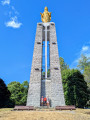
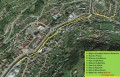
(S/E) From the small car park near Notre-Dame de la Paix and the Monument to the Moroccan Riflemen, retrace the route you took by car. Take the road to the left, then the next one to the right, just before a house.
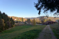
(1) Ignore the path leading straight ahead and turn right, towards the house and the barn. Walk between the two buildings. The road becomes a track which you follow, more or less straight ahead, until you reach the Chemin des Colonies.
(2) Carry on straight ahead along the road (very little traffic) until you reach the Col du Brabant.
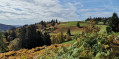
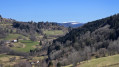
(3) Turn left and head up the path which runs alongside, then passes under, the ski lift. There’s a beautiful panoramic view of La Bresse and the Chajoux valley from the cliff-top path. Reach the Roche de Minuit by leaving the path to the right.
(4) Retrace your steps, then turn right to continue along the path you took from the Col du Brabant. Ignore a path branching off to the right and another to the left; reach and pass a isolated house where the path ends and turns into a small road. Carry on, passing the Bergerie des Hiez; ignore the path branching off to the right at the height of the fence post, and reach the start of the path branching off to the right, just before the road bends to the left.
(5) Take this path which descends through the woodland. Turn right at the first junction, then, further down, turn left to reach the Petites Alpes viewpoint. There’s a lovely view of the Moselotte valley, the Cherménil power station (in the background, next to the Aldi) and the “alpages”, near the Pierre des 4 Communes (opposite on the Haut de Parfongoutte).
(6) Continue down the path, then along a small road, and take the track that climbs up to the left, past the house, to reach Notre-Dame de la Paix. Viewpoint over Cornimont.
(7) Ignore all the paths leading down towards Cornimont, and head back up the path that branches off to the left, behind the statue. The car park is very close by (S/E).

 Visorando Member
 Very difficult
 Moderate