Country:

 City:
City:


Park in the car park at Place de la Pronzière.
(S/E) From the car park, head to the right then turn left towards the town hall. Walk to the right of the town hall and take the path at the end of Place Joseph Petitgeret, near the school.
Red Cross signposting
At the end of the path, keep to the right onto the Route du Page. Follow the hairpin bend. At the next bend, turn right into the cul-de-sac, then take the small path on the right until you reach a junction.
Yellow Ring markings
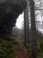
(1) Head straight ahead and pass La Roche Brulée via a path with cables.
Red Cross signpost
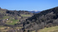
Then keep straight ahead again at the next junction to reach a viewpoint.
(2) Keep going straight ahead, cross a section with a cable and turn onto the path on the left.
No markings
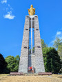
At the next fork in the road, head up to the right towards Notre-Dame de la Paix and its viewpoint.
Green Rectangle with a white cross
(3) Continue along the path straight ahead on the other side of the monument. The path descends and offers some panoramic views. Pass a junction to reach a road.
(4) Follow this road to the right and ignore the next track leading uphill. Cross a stream and you’ll reach a junction with two paths. Take the one starting straight ahead on the right. This path climbs more or less steeply through the forest to the Belvédère des Petites Alpes.
(5) Continue the climb, then, at the junction for the spring, turn sharply right. At the next hairpin bend, keep left, then, at the edge of the woods, turn left again to reach the Chemin de Notre-Dame de la Paix.
Green Rectangle signposting
(6) Follow this path to the left and continue to the end. Carry on along the track and, at the Fork in the road, keep to the right. At the next junction, continue to the left to reach a Y-junction.
(7) Stay on the track on the right. Enter the woods and stay on the path on the right at the junction. You will reach the junction for the summit of the Roche de Minuit.
Unmarked
Turn left to reach the summit and enjoy a view over the Moselotte valley.
(8) Return to the previous junction.
Green Rectangle Signposting
Keep left onto the wide, descending track, which then turns into a path leading straight ahead. At the end, reach the Col du Brabant and its chapel.
Green Triangle signpost
(9) Turn right, then immediately left onto the Chemin du Haut des Bouchaux. Then continue downhill to the left along the Chemin des Gélinottes. At the bend in the track, carry on downhill straight ahead, towards La Bresse. Pass one junction and then reach a second one.
(10) Keep going straight ahead. At the Fork in the road, keep left and then keep left again before going through a gate. You’ll then reach a wide track which you should follow to the right. Leave it quickly to take a shortcut on the left, which leads to the Route des Bouchaux.
(11) Head down the road to the left. Pass a junction on the right, then take two bends. Just after the second bend, take the steps on the left. Ignore a small path that starts on the right and continue downhill until you reach a lane. Turn right onto Rue du Chevreuil. Blanc.
(12) Take the second left towards a lane and stay on the path on the right. Continue along the Traversée des Proyes, then keep right onto the street of the same name. Continue until you cross the Moselotte.
No signposting
(13) Go round the Place du Champtel on the right and follow Rue de l’Église to the right until you reach the church.
(14) Turn back and turn right onto Rue du Souvenir. Walk past the cinema, then, at the junction, head straight across.
Green Disc signposting
Turn immediately right onto the path which climbs very steeply, then keep to the left straight away. When you reach the road, follow the hairpin bend and climb up to the junction with the D34.
(15) Turn left onto Route de Planois before taking the footpath on the right at the pedestrian crossing. It starts with a flight of steps. Ignore a path on the left. At the end, turn left and continue to Chemin du Breuil.
(16) Follow the Chemin du Breuil on the right up to the bend. Take the path leading uphill opposite before then taking the footpath on the left. Cut across the Impasse du Ruisseau and the next path, passing close to a house. At the end of the footpath, continue straight on until you reach the bend. Follow the footpath to the right of the bend as far as La Louvière.
Blue Ring signposting
(17) Cross the road to take the path opposite. At the end of the path, keep to the right towards Pré Mougel. Then stay on the path that climbs to the right before rejoining the road. Follow it to the right until you reach the Fork in the road.
Blue Diamond signpost
(18) Keep left. Pass a junction and take the next track on the right. Soon after, turn right. Ignore the first path on the left and take the second one. You will then reach the junction for the Chalet de la Truche.
Blue Triangle signpost
(19) Continue straight ahead. At the next Fork in the road, keep left before veering right to reach a crossroads.
Yellow Saltire signpost
Keep left towards La Basse des Feignes. At the Fork in the road, keep left before staying on the left at the next junction. Pass close to a pond and then head straight on towards the viewpoint situated by a rock.
(20) Return to the previous junction and turn left to join a track; follow this track uphill to the right to reach the Col de la Basse des Feignes, passing a junction on the way.
Blue Saltire signposting
(21) Take the track branching off to the left, which climbs gently. At the Y-junction, keep left, then ignore a faint, grass-covered path on the left. Next, ignore a track on the right, then a faint path on the left.
(22) At the next junction, keep to the right and ignore the mountain bike route on the left. Do the same at the next fork in the road before ignoring a faint path coming in from the left. Then keep to the left, ignoring a path on the right, until you reach a junction.
(23) Keep right, then left, and join the path to the Jemnaufaing peat bog.
Blue Ring markings
(24) Turn onto the track on the right, which leads to the bog. Pass a track on the left to reach the embankment.
(25) Turn left as you cross over the dyke. Once on the other side, follow the path on the left, then ignore a less obvious path on the left. At the large junction, turn left and then right. Ignore two junctions on the left and a third on the right to reach the edge of the forest. Then keep right towards the Pierre des Quatre Communes and Rondfaing.
(26) Continue along the path, which enters the woodland again and passes close to a peat bog. At the junction, keep left, then turn left again before keeping right (some of the signposting on the IGN maps is out of date). You’ll come to a wide track.
(27) Turn left towards Cornimont. At the crossroads, take the dirt track on the right, cross a track and pass through a turnstile to enter a woodland. Pass the Moinats’ house and reach the road.
Red Diamond markings
Head down to the right to reach the D34, opposite the monument dedicated to the Moroccan Goums.
Red Cross signpost
(28) Cross the road very carefully and take the path to the left of the monument. Just after the bend, stay on the track on the right, which climbs. At the junction, leave the track and take the path on the left to reach another Fork in the road.
(29) Keep straight ahead to reach a crossroads at the edge of the forest.
(30) Head down to the left before cutting across a track. Just before the road, head straight ahead to join it.
(31) Keep straight ahead onto the Chemin des Gouttes. Pass Pré Toussaint before taking the track that starts straight ahead on the right. You’ll reach a viewpoint with a table.
(32) Follow the track to the road.
(33) Walk down the road and, at the bend, take the track on the left by the letterbox. Walk to the house and take the path on its right. At the hairpin bend, keep to the right and you’ll reach a Fork in the road.
(34) Follow the path up to the left, then keep to the right until you reach the viewpoint.
(35) Head back to the second junction.
(34) Head down to the left and cross the road before taking the first path on the left. Continue downhill along the street until you reach Rue du Daval.
No signposting
(36) Cross the street and turn left. At the next junction, head downhill to the right, still on Rue du Daval, then go up Passage Perrin on the left. At the confluence of the rivers, cross the footbridge and go through the playground, then along Rue de la 3e DIA to return to the car park (S/E).
 Visorando Member
 Easy
Easy 
 Difficult
 Moderate