Les Champis and Rouge Feigne, from La Bresse

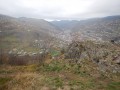
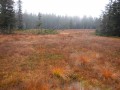
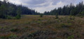
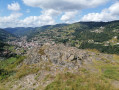
This hike in the hills of La Bresse will take you to the stunning high-altitude Chaume des Champis and introduce you to the Rouge Feigne peat bog (with its rare flora). At Roches Beuty, you’ll enjoy an unrivalled panoramic view over the valleys of La Bresse.

Details

171780
Creation:
Last update:
Last review:
  • Walking
    Activity: Walking
  • ↔
    Distance: 12.06 mi
  • ◔
    Average duration: 7h 45 
  • ▲
    Difficulty: Moderate

  • ⚐
    Back to start: Yes
  • ↗
    Ascent: + 2,569 ft
  • ↘
    Descent: - 2,552 ft

  • ▲
    Highest point: 3,940 ft
  • ▼
    Lowest point: 2,057 ft
  • ⚐ Country: France
  • ⚐
  • ⚐ City: La Bresse (88250)
  • ⚑
    Start/End: N 48.002084° / E 6.872892°
  • Accessible from the train station Gare de La Bresse.
  • ❏
    IGN map(s): Ref. 3618OT, 3618OTR, 3619OT, 3619OTR
  • Hour-by-hour weather

Photos

Description of the walk

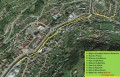
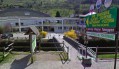
Start at La Bresse at the Swimming Pool and Ice Rink Complex (see the attached map and photo).

(S/E) Follow the Chemin des Ecoliers for 150 metres.

(1) Cross Rue des Proyes before the bridge, then follow the footpath opposite that runs alongside the Moselotte. Pass the Maison de la Bresse and the Ibis Hotel, then cross Rue Joseph Remy. Continue along the footpath overlooking the Moselotte, pass beneath the retirement home and arrive at Rue de la Clairie.

(2) Continue to the left, cross the bridge, and arrive at Rue du Hohneck. Walk up this street to the right for 200 metres, then turn left onto Rue de Moyenmont for 100 metres to reach the start of the path towards Moyenmont and Pré Jacquot.

(3) Turn right (Blue Triangle orGR®533Green Rectangle), then turn right onto Rue de Bellevue. Continue up a fairly steep slope, pass a path on the left and take the fork to the right towards the Vologne Valley (Red Triangle).

(4) At the Fork in the road, turn right and take the path towards Les Baraques.

(5) Leave this path at the junction and head uphill to the left, continuing to follow the Red Triangles of the Chemin Grandemange.

(6) At the crossroads, head east along this path for 1.2 km, following the Yellow Cross markings.

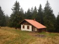
(7) At the crossroads, take the path on the left. After a 45-minute climb, having passed several turnings on both the left and right, you’ll reach the small pass of the Etang and its chalet.

(8) After the chalet, continue to the right towards Les Champis along the ridge path (signposted and marked with Yellow Triangles). After three-quarters of an hour, you’ll arrive at Les Champis.

(9) Carry on straight ahead along an unmarked path, continuing to follow the ridge and the edge of the forest, until you rejoin the track.

(10) It descends to the right then turns left towards Rouge Feigne. A rather damp and marshy path on the left then leads you to a junction.

(11) Turn left onto the path, heading towards Les Champis (signposted and marked with Yellow Saltires), and continue to the Chalet des Champis.

(12) Continue along a wide track (called Chemin des Champis), ignoring the other tracks, and after 1.5 km, you’ll reach a crossroads.

(13) Head straight on towards the Collet de l’Étang via the Chemin de la Piquancoire. After 1.3 km, you’ll reach the Collet de l’Étang, which you’ve already passed on the way out.

(8) Set off again straight ahead for the return journey on theGR®533(marked with Green Rectangles) towards Pré Jacquot and Moyenmont. Ignore several paths on the right.

(14) At the junction, leave theGR®533and continue straight on.

(15) 120 metres further on, at a bend, turn left towards La Roche Beuty (path marked with Red Triangles), pass a farm and then a telecoms pylon, and arrive at La Roche Beuty.

(16) Then head down the path on the left (marked with a yellow circle) to rejoin the GR®533.

(17) Turn right and return to the La Bresse Swimming Pool and Ice Rink (S/E) via the reverse route of the outward journey.

Waypoints

  1. S/E : mi 0 - alt. 2,057 ft - Car park at the Swimming Pool and Ice Rink Complex
  2. 1 : mi 0.1 - alt. 2,073 ft - Chemin des Ecoliers. Pont de la - Moselotte (rivière)
  3. 2 : mi 0.58 - alt. 2,119 ft - Towards the bridge. Confluence of the Moselotte and - Chajoux (rivière)
  4. 3 : mi 0.79 - alt. 2,172 ft - Path towards Pré Jacquot and Moyenmont
  5. 4 : mi 1.21 - alt. 2,651 ft - Turn right towards the Vologne Valley
  6. 5 : mi 1.6 - alt. 2,507 ft - junction towards the Chemin Grandemange
  7. 6 : mi 1.93 - alt. 2,995 ft - Arrival at Chemin Grandemange
  8. 7 : mi 2.72 - alt. 2,913 ft - Path to the small pass of the Étang
  9. 8 : mi 3.79 - alt. 3,612 ft - Collet de l’Étang chalet
  10. 9 : mi 5.08 - alt. 3,845 ft - Arrival at Les Champis
  11. 10 : mi 5.57 - alt. 3,927 ft - Towards Rouge Feigne
  12. 11 : mi 6.21 - alt. 3,707 ft - Return to Les Champis
  13. 12 : mi 6.72 - alt. 3,832 ft - Champis Chalet
  14. 13 : mi 7.76 - alt. 3,481 ft - Junction of Chemin des Champis and Chemin de Piquancoire
  15. 14 : mi 10.02 - alt. 3,146 ft - GR 533/Chemin des Roches Beuty junction
  16. 15 : mi 10.09 - alt. 3,140 ft - Chemin des Roches Beuty
  17. 16 : mi 10.76 - alt. 2,700 ft - Roches Beuty
  18. 17 : mi 10.94 - alt. 2,543 ft - Gr 533, and back towards La Bresse
  19. S/E : mi 12.06 - alt. 2,057 ft - Car park at the Swimming Pool and Ice Rink Complex

Notes

Two well-equipped chalets: at the small pass of Collet de l’Étang and at Champis. Water points at the Champis chalet and a fountain on the Chemin de la Piquancoire. No food or drink available along the route.
Standard kit for a day in the mid-mountains; bear in mind that we are constantly in the forest and quite far from any settlements.

Worth a visit

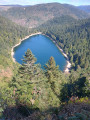
Étang de la Cure (near the small pass of the Étang).
Viewpoint overlooking the Bresse ski area at Les Champis.

Always be cautious and plan ahead when you're outdoors. Visorando and the author of this route cannot be held responsible for any accidents occurring on this route.

The GR® and PR® markings are the intellectual property of the Fédération Française de Randonnée Pédestre.

Reviews and comments

4.7 / 5
Based on 2 reviews

Reliability of the description
4.5 / 5
Ease of following the route
4.5 / 5
Route interest
5 / 5
Nicolas K
Nicolas K

Overall rating : 4.3 / 5

Date of your route : May 09, 2024
Reliability of the description : ★★★★☆ Good
Ease of following the route : ★★★★☆ Good
Route interest : ★★★★★ Very good
Very busy route : No

We have this beautiful walk in the direction of Col des Haute Feigne towards La Bresse. After a very tough start (there is another longer but less steep route), the arrival on the plateau allows you to appreciate the heights of La Bresse, mostly in the woods except for the Champis hill in the middle, and at the end with meadows that lead to a very steep descent to La Bresse (there is another route here too, which is longer but much less steep). There is a beautiful view of La Bresse from the Beutry rock.

Machine-translated

mauricejeannine
mauricejeannine

Overall rating : 5 / 5

Date of your route : Jun 06, 2022
Reliability of the description : ★★★★★ Very good
Ease of following the route : ★★★★★ Very good
Route interest : ★★★★★ Very good
Very busy route : No

We really enjoyed the balcony trail from Roche Peuty to Moyenmont. However, from Pré Jacquot to Chaume des Champis, it is a very long forest trail that seemed endless to us. Chaume des Champis is a large meadow full of flowers with a beautiful view. We didn't go as far as the Rouge Feignes peat bog because it started to rain, so we decided to turn back towards La Bresse where we were staying.

Machine-translated

Other walks in the area

For more walks, use our search engine .

The GPS track and description are the property of this route's author. Please do not copy them without permission.