


 Country:
 City:


We set off from the hiking car park behind the Däumling shoe factory in Bruchweiler-Bärenbach (Fabrikstraße).
(S/E) From the car park, we take the wide forest track and turn sharply right at the first opportunity.
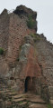
(1) The forest track soon narrows to a narrow path and leads us gently uphill into the hillside and up to the Retschelfelsen. Beyond the rock, the path now climbs more steeply into the mountainside. Amongst the pine trees, on the narrow path criss-crossed with gnarled tree roots, you’ll need to navigate natural rock steps. Sure-footedness is essential. In this section too, isolated red sandstone outcrops appear time and again to the right and left of the path.
(2) When the route finally levels out and leads almost flat through the forest with gentle ups and downs, you reach the Eisenbahnfelsen. For quite a while, the Napoleon-Steig runs alongside this gigantic rock formation, which does indeed resemble a railway train. The Napoleon-Steig circles round the rock.
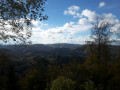
(3) Continuing along the footpath, we reach the Rauhberg Rock. From its natural platform, the view stretches out over the densely wooded Wasgau valley. We leave the Rauhberg Rock and follow the winding forest path as it descends extremely steeply in tight hairpin bends. Even on the way down into the valley, we are accompanied by the bizarre, reddish-brown rocks, which are often covered in yellow lichen.
(4) At the bottom of the valley, the Napoleon-Steig trail enters the Wöllmersbach Valley. We turn right at the stream. Birch and willow copses rise up from the marshy, wet meadows. At the next junction, we turn left and continue to follow the stream. About 500 metres further on, we can take a detour to the left to the Reinigshof spring. Fresh spring water emerges here from a pipe and trickles into a crystal-clear pond. We return to the footpath, turn left and continue along it to the next T-junction. The path climbs gently out of the Wöllmersbach Valley and back into the forest. We turn right, then left twice, then take the third option on the right.
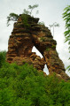
(5) We follow the path for about 700 metres and turn sharply right, reaching the Napoleonfelsen. Completely freestanding, wildly rugged and, in places, overhanging menacingly, this imposing red sandstone rock towers into the sky. From here, there are magnificent views across the Wasgau. At the next junction, keep left and turn left again at the next T-junction.
(6) The route takes us past the Dretschberg Rock.
(7) From there, we continue straight on towards the Pfälzerwaldhütte at Schmalstein, which is open at weekends. It is idyllically situated in the Wöllmersbach Valley. From the terrace, there are lovely views across the marshy stream valley. We reach a car park, turn right and then immediately sharp right again. At the fork, we keep to the left and then turn left. We follow the path to the right and turn left at the next junction. We continue straight ahead along the path.
(8) At the fourth junction, we turn left. The walk draws to a close across the expansive and completely treeless Fleckstein plateau, with magnificent panoramic views of the Dahner Felsenland. Just under 400 m after the junction, we turn left once more.
(9) We reach the K42 and turn right. We leave the road to the left and rejoin Fabrikstraße, which we follow to the left, thus returning to our starting point. (S/E)

 Visorando Member



 Difficult

 Easy

