


Refine your search for walks in Mont Aragnoué (811m)
Mont Aragnoué (811m) walks


 Circular Mont Aragnoué from Castelbiague
 Visorando Member
 8.85 mi
 +1,604 ft
 -1,621 ft
 5h 30
5h 30
 Moderate
 Departure from Castelbiague (Haute-Garonne)
This long, fairly challenging circular route takes you up to Mont Aragnoué and its paragliding launch site via a well-shaded forest track, allowing for a relatively quick ascent, before a gentler descent via the Col d’Arbas and the western face of the Tucas, before returning to your starting point, the small village of Castelbiague.
Walks near Mont Aragnoué (811m)
From Razecueillé to Tachoires via the Pic de Paloumère (or Pic de l'Aube)
8.30 mi
+3,471 ft
-3,547 ft
6h 50
 Difficult
Departure from Razecueillé (Haute-Garonne)
Difficult
Departure from Razecueillé (Haute-Garonne)
A beautiful line hike, which requires you to leave a vehicle at the finish beforehand. From the village of Razecueillé, the route takes you directly to the Pic de Paloumère, offering magnificent views of the Piedmont to the north and the highest peaks to the south, east and west. The route to the finish is very varied: forestry paths, ridges, old paths that are a little forgotten and therefore poorly marked, beech forests frequented mainly by wild boar and roe deer.
From Sentein to the Refuge d’Eylie via the Vallée de l’Isard and the Col des Cos
 8.68 mi
+3,747 ft
-2,864 ft
7h 15
Difficult
Departure from Sentein (Ariège)
8.68 mi
+3,747 ft
-2,864 ft
7h 15
Difficult
Departure from Sentein (Ariège)
First day of this trip to the Refuge d’Eylie. A day not to be underestimated.Set off from Sentein along an old track, then take the small road up to Bencarrech, joining the GRP® Tour du Biros. The GRP® in the Isard Valley crosses to the other bank via the Illa Maria footbridge. It then passes the Passerelle du Pichès on the right and begins a steep climb. From there, a PR® trail leads to the Col des Cos (mountain hut, fountain). This is followed by a tricky descent due to fallen trees blocking the path (PR®). After at least 6 hours’ walking, including breaks, with 1,200 m of ascent and 900 m of descent, the Eylie restaurant and bar is a welcome sight.
The Étang d'Araing Refuge as seen from the Anglade car park
 6.20 mi
+4,065 ft
-305 ft
6h 25
Difficult
Departure from Sentein (Ariège)
6.20 mi
+4,065 ft
-305 ft
6h 25
Difficult
Departure from Sentein (Ariège)
First stage of the Petit Tour du Biros.From the Anglade car park, a steady climb along theGRP®® Tour du Biros to the Passerelle des Pichès, then a detour via the Chapel and the Cabane Forestière de l'Isard.Then, after returning to theGRP®®, you arrive at the Cabane d'Illau.This is followed by a steep climb up to just below the Étang d’Araing dam and finally the arrival at the Refuge Jacques Husson de l’Étang d’Araing.This stage is only feasible when there is no snow, from late May until the huts close or the first snowfall begins.
The Anglade car park from the Eylie stopover lodge via the Col des Cos
 7.41 mi
+2,267 ft
-2,858 ft
5h 25
Moderate
Departure from Sentein (Ariège)
7.41 mi
+2,267 ft
-2,858 ft
5h 25
Moderate
Departure from Sentein (Ariège)
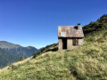
Third and final stage of the short Tour du Biros.The return route follows a very interesting and well-marked path, passing through Col des Cos.A lovely hut with a new roof, open to the public, is available at this pass as a new hut has been refurbished for the shepherd(s). There is also a water source at this spot.A very beautiful descent until you reach the GRP® Tour du Biros.Pass by the lovely Passerelle des Pichès footbridge.You pass through the hamlets of La Peyre and Frechendech before arriving at the car park.This stage is only possible when there is no snow, from late May until the mountain huts close or the first snowfall begins.
From the Refuge d’Eylie to Sentein via the Bois de Laspé and the Col des Cassaings
 10.40 mi
+2,825 ft
-3,684 ft
7h 15
Difficult
Departure from Sentein (Ariège)
10.40 mi
+2,825 ft
-3,684 ft
7h 15
Difficult
Departure from Sentein (Ariège)
Second day of this trip to the Refuge d’Eylie. A day not to be underestimated.Classified as difficult due to an average gradient (slope) of 24% from (1) to (3). Afterwards, the GR®10 access trail – GRP® Tour du Biros – is very narrow, poorly maintained and at times dangerous due to low-lying, slippery rhododendrons: it is a north-facing slope. There are moments of respite in the woods, where the path is fairly wide and very well signposted. From the Col des Cassaings onwards, conditions improve. The highlights of this balcony trail are the numerous viewpoints from (3) to (4) and from (4) to (6).After at least 6 hours’ walking, including breaks, with 900 m ascent and 1,150 m descent, the arrival at the Ostal du Biros in Bonac is a welcome relief. From there, it’s a 25-minute drive along a very quiet road back to Sentein (E).
The Eylie stopover lodge from the Étang d'Araing refuge
 6.16 mi
+1,824 ft
-5,000 ft
4h 25
Moderate
Departure from Sentein (Ariège)
6.16 mi
+1,824 ft
-5,000 ft
4h 25
Moderate
Departure from Sentein (Ariège)
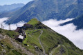
Second day of the Petit Tour de Biros.From the refuge, head due east along theGR®®10to the junction at the foot of the dam (passed the previous day).Continue uphill along theGR®®10. Reach a fork at the Col de la Serre d’Araing.Head left for a round trip to the Pic de l'Har. A stunning 360° view.Then descend via theGR®®10to the Mines de Bentaillou.Head north and follow theGRP®® to the Col de la Catauère (Plateau de Rouge).Then head down theGR®®10to Eylie.This stage is only feasible when there is no snow, from late May until the mountain huts close or the first snowfall begins.