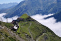
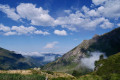
The Eylie stopover lodge from the Étang d'Araing refuge

Second day of the Petit Tour de Biros.
From the refuge, head due east along theGR®®10to the junction at the foot of the dam (passed the previous day).
Continue uphill along theGR®®10. Reach a fork at the Col de la Serre d’Araing.
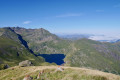
Head left for a round trip to the Pic de l'Har. A stunning 360° view.
Then descend via theGR®®10to the Mines de Bentaillou.
Head north and follow theGRP®® to the Col de la Catauère (Plateau de Rouge).
Then head down theGR®®10to Eylie.
This stage is only feasible when there is no snow, from late May until the mountain huts close or the first snowfall begins.

This walk is part of a multi-day hike: The short Tour du Biros

Details

38633793
Creation:
Last update:
Last review:
  • Walking
    Activity: Walking
  • ↔
    Distance: 6.16 mi
  • ◔
    Average duration: 4h 25 
  • ▲
    Difficulty: Moderate

  • ⚐
    Back to start: No
  • ↗
    Ascent: + 1,824 ft
  • ↘
    Descent: - 5,000 ft

  • ▲
    Highest point: 7,923 ft
  • ▼
    Lowest point: 3,235 ft
  • ⚐ Country: France
  • ⚐
    Area: Pyrenees
  • ⚐ City: Sentein (09800)
  • ⚑
    Start: N 42.834569° / E 0.873349°
  • ⚑
    End: N 42.834315° / E 0.934597°
  • ❏
    IGN map(s): Ref. 1947OT
  • Hour-by-hour weather

Photos

Description of the walk

Please note: The yellow and red markings ofthe GRP®® Tour du Biros give way to the white and red markings ofthe GR®®10.

White and redGR®®10markings (which replace theGRP®® Tour du Biros)

(S) From the refuge, head due east along theGR®®10and reach the fork at the foot of the dam (passed the previous day).
Beautiful scenery (viewpoints) to the left ofthe GR®®10.

(1) Head south and pass the Cabane de l'Étang d'Araing (alt. 1915 m). Climb south-east along the very good path and, after a steep climb, reach a junction at the Col de la Serre d’Araing.

Yellow markings

(2) Head left up a good path heading north-east.
Please note: at an altitude of around 2,285 m, the path continues with a first turn right then left. The path is visible and very well marked on the ground. Reach the Col de la Serre d’Araing.
Stunning 360° panoramic view.

(3) Turn back and return to the fork at the Col de la Serre d’Araing. Please note: the map is inaccurate at this point. Continue straight ahead, south-west, and reach another fork 100 m further on.

Red and white markings take precedence over theGRP®®

(4) Turn left and descend via theGR®®10, which is clearly marked on the ground. Pass the commemorative steles and then reach a junction at the former Narbionne Station. Directional posts.

(5) Leave the GRT51 on your right, which is also marked in white and red. Head straight ahead on theGR®®10and reach the buildings of the old Bentaillou mines, at a junction with a sign indicating: water point on the right.

No markings

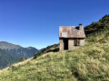
(6) Turn right, between two buildings and the water point, and head for a prefabricated building (a dormitory now used by cavers). Two simple wooden benches are available in the shade.

(7) Turn back and return to theGR®®10. * See practical information in case of problems.

White and red markings ofthe GR®®10

(6) Turn right then head due north to a fork at elevation 1869, after the Ruisseau de la Cigalère.

(8) Continue left on theGRP®®/GR®®10.

(9) Ignore the climb to Tuc des Ours (old saltire). Continue on theGR®®10and head for the Col de la Catauère.

(10) Continue east, then north-east across the Plateau de Rouge. Then begin a steep descent through the forest. At the bottom, reach the Ruisseau de Rouge. Numerous signposts. Turn right and arrive at the Stopover Lodge d’Eylie (E).
Second stage. Water available. See practical information.

Waypoints

  1. S : mi 0 - alt. 6,414 ft - Refuge de l'étang d'Araing
  2. 1 : mi 0.36 - alt. 6,165 ft - Junction. GR10 - Barrage de l'Etang d'Araing
  3. 2 : mi 1.3 - alt. 7,283 ft - Col de la Serre d’Araing. Fork in the path. Return to L’Har
  4. 3 : mi 1.92 - alt. 7,920 ft - Pic de l'Har. Elevation 2422 m
  5. 4 : mi 2.63 - alt. 7,346 ft - Junction. GR10
  6. 5 : mi 3.49 - alt. 6,398 ft - Junction. Narbonne station
  7. 6 : mi 3.72 - alt. 6,158 ft - Junction. Water source
  8. 7 : mi 3.76 - alt. 6,132 ft - Cave explorers’ hut and dormitory
  9. 8 : mi 3.95 - alt. 6,138 ft - Cigalère stream
  10. 9 : mi 4.34 - alt. 6,132 ft - Tuc de l'Ours junction
  11. 10 : mi 4.55 - alt. 5,827 ft - Rouge Plateau
  12. E : mi 6.16 - alt. 3,235 ft - Gîte d’étape sur le GR10

Notes

  • Unique feature at the Eylie stopover lodge:

1) hang up your rucksack.
2) Return to the signposts, cross the stream and head up towards the houses, following the ‘gardiens’ signs to the restaurant.
3) Introduce yourself and find out where your bed is in the dormitory. Drinks, snacks, water, toilets, etc.

Drinking water, meals, supplies and drinks at the Eylie stopover lodge (E).
(6) Water point at the Bentaillou mines. Please note: the water from the streams is very iron-rich...

  • In case of bad weather, fatigue, etc., it is possible to descend to Eylie (approx. 10 km) via the miners’ track from point (6).

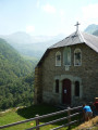
(1) Étang d’Araing hut. Shelter and hut at the Bentaillou mines.

This is a mountainous area: bring rainwear, water, snacks, GPX track, route description, map, GPS or Visorando app, camera, good walking boots and walking poles.

Worth a visit

Always be cautious and plan ahead when you're outdoors. Visorando and the author of this route cannot be held responsible for any accidents occurring on this route.

The GR® and PR® markings are the intellectual property of the Fédération Française de Randonnée Pédestre.

Reviews and comments

4 / 5
Based on 1 review

Reliability of the description
Not used
Ease of following the route
Non utilisé
Route interest
4 / 5
Malou31
Malou31
• Edited:

Overall rating : 4 / 5

Date of your route : May 09, 2026
Reliability of the description : Not used / Not applicable
Ease of following the route : Not used / Not applicable
Route interest : ★★★★☆ Good
Very busy route : No

The hike was made difficult by patches of snow. There were numerous sections on a slope. The descent was very, very long and tedious, even technical. The scenery was beautiful. The Eylie mountain hut was clean and functional.

Machine-translated

Other walks in the area

For more walks, use our search engine .

The GPS track and description are the property of this route's author. Please do not copy them without permission.