Country:

 City:
City:


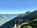
Red and white GR®10markings
(S) With your back to the stopover lodge, head right, eastwards along the GR®10, which turns south. After a challenging descent, cross a footbridge and join a track. Follow it to the right for 40 m.
(1) Climb left towards the north-east along a path, passing a few very steep hairpin bends. The GR®10 then turns due east across open ground. Reach the entrance to the Bois de Laspé at the 1239-metre mark.
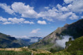
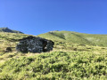
(2) Begin a very difficult climb via hairpin bends through this beautiful beech forest. The path then climbs less steeply and emerges from the woods. But then another very steep and longer climb via hairpin bends begins, out in the open. Very beautiful scenery. You suddenly emerge onto a flat area near the stone shelter, which has unfortunately collapsed (alt. 1660 m). Dilapidated wooden signposts.
White and red markings for the GR®10 access route. All this is theoretical (based on the IGN map), but the markings are completely absent on the ground.
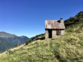
(3) Caution. The path is completely unmaintained and slippery due to fallen rhododendrons. The northern slope is very damp (observed in early July 2026). Continue left towards Bonac, on level ground along a mountain-side path. Exercise extra caution. After heading north, the path turns north-west, remaining at the same level. Conditions improve considerably upon entering the Bois de la Pale. Red and white markings are present. You finally reach the Col des Cassaings at an elevation of 1497. There is a dilapidated wooden signpost. A very beautiful spot. The hut is in good condition. Observed in early July 2026.
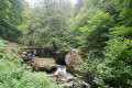
(4) Descend via a small path to the north, to the left of the hut and along a fence on your left. The start of the path has been carved into the rock. Very beautiful scenery. You arrive in a very wet area by the Ruisseau de Trémoulet (alt. 1,490 m).
(5) After heading north-west, then west, cross a long wooden boardwalk and a marshy area.Cotton grass is present. Further on, at an elevation of 1,408 metres,you’ll reach the start of a more frequently used track, which is therefore overgrown with grass and easy to walk on.
(6) Follow it north-west on a gentle, gradual descent.
(7) * See practical information. Pass a track on your left. Continue north, north-east along the same track through the Andraud Forest. At an altitude of around 1175 m, the track turns right (south-east) then heads north again for 200 m to reach a small, fairly flat area (alt. 1130 m).
(8) * See practical information. Take care. The White Cross and Red Cross indicate the wrong direction. Look out for the white and red right-turn marker on a tree on the right. Leave the track and head steeply uphill to the right for about a hundred metres until you reach a very overgrown and confusing flat area. Observed in early July 2026.
(9) Leave a track on your right heading south-east. Continue slightly to the left through the grass and find a very good path marked in white and red in the forest. Continue along this beautiful, wide path, generally heading north-east, until you reach a fork (alt. 950 m).
(10) Turn sharply left (north-west) onto the continuation of the very good path. Emerge onto a resurfaced, level track.
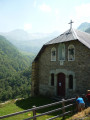
(11) Follow it straight ahead, with the motorhome site on your right. Cross the road bridge over the Lez. Immediately on the right, you’ll find a lovely shelter with a fountain and a horse-shoeing stand. Cross the D4 and continue to the church and the new stopover lodge, bar and restaurant at Bonac de l’Ostal du Biros (opening May 2026).
(12) This is now the least interesting part of the route. There is no other easy way to avoid the road.
Hitchhiking works well in Ariège. LiO Car Ariège bus route 455, 2026 timetable: 13:07, 18:22.
Return to the very quiet D4 and follow it to the right, keeping to its left-hand side. Pass the Irazein road on your right and, 100 metres further on, on your left, you’ll see the marquee – shows – bar – restaurant at the Relais Montagnard. Continue along the D4 and head back to the car park at Sentein (E).
 Visorando Member
 Moderate
  Very difficult