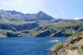
The Anglade car park from the Eylie stopover lodge via the Col des Cos

Third and final stage of the short Tour du Biros.
The return route follows a very interesting and well-marked path, passing through Col des Cos.
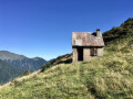
A lovely hut with a new roof, open to the public, is available at this pass as a new hut has been refurbished for the shepherd(s). There is also a water source at this spot.
A very beautiful descent until you reach the GRP® Tour du Biros.
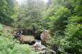
Pass by the lovely Passerelle des Pichès footbridge.
You pass through the hamlets of La Peyre and Frechendech before arriving at the car park.
This stage is only possible when there is no snow, from late May until the mountain huts close or the first snowfall begins.

This walk is part of a multi-day hike: The short Tour du Biros

Details

38613450
Creation:
Last update:
Last review:
  • Walking
    Activity: Walking
  • ↔
    Distance: 7.41 mi
  • ◔
    Average duration: 5h 25 
  • ▲
    Difficulty: Moderate

  • ⚐
    Back to start: No
  • ↗
    Ascent: + 2,267 ft
  • ↘
    Descent: - 2,858 ft

  • ▲
    Highest point: 5,007 ft
  • ▼
    Lowest point: 2,625 ft
  • ⚐ Country: France
  • ⚐
    Area: Pyrenees
  • ⚐ City: Sentein (09800)
  • ⚑
    Start: N 42.834377° / E 0.93458°
  • ⚑
    End: N 42.866976° / E 0.934282°
  • ❏
    IGN map(s): Ref. 1947OT
  • Hour-by-hour weather

Photos

Description of the walk

(S) From the Eylie stopover lodge, head towards the signposts and cross the Ruisseau de Rouge.

(1) Turn right and, further down, join the access road to the hamlet. Head up the road to the left and reach the final hairpin bend. Signpost.

Recentyellow PR®markings

(2) Continue straight ahead, due north, starting on almost flat ground in the forest. After a left-hand bend, begin a steep climb, heading north-west. Pass under the EDF water pipe and arrive at a fork.

(3) Continue left on the PR® in the same direction. Continue the steep climb to another fork (alt. 1120 m). Signpost for Col de Cos.

(4) Please note: there is some old yellow signposting which may be misleading. Follow the recent yellow signposting (August 2023) carefully.
First turn right then left and continue up a less steep slope. Curve to the left, heading south-west.
The path descends to the right, towards the stream (Ruisseau de Haurendech), which is flowing strongly (August 2023).
No footbridge. The crossing of the stream indicated by the yellow markings was impassable on this date.
Look for a crossing further up where the stream has not yet split.

(5) Cross it as best you can and continue on the other bank heading north. From this point, on several occasions, you will need to pass through trees across the path. Keep a close eye out for and follow the very clear yellow markings. Cross the Ruisseau de l’Alléo and emerge from the forest towards the 1286m mark.
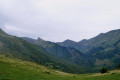
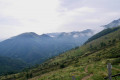
Beautiful views over the many small hamlets.

(6) Continue the climb westwards on a very good path that is clearly marked on the ground and well signposted.
You’ll reach a vast area of summer pastures and a junction with several paths.

(7) To the right, Cabanes de Cos. One, in very good condition (new roof), is freely accessible. Another hut, belonging to the shepherd(s), next to it is fully equipped and in perfect condition. Continue straight on towards the water source and follow the wooden fence. Reach the Col des Cos. Directional sign screwed onto the fence.

(8) Continue downhill along the PR®, which is well signposted, marked on the ground and heads west. After a pleasant descent, join the GRP® Tour du Biros.

(9) Descend a few hairpin bends, then turn right onto a wide path, which is very muddy in places and marshy. Much further down, you’ll reach the Passerelle des Pichès (alt. 1,130 m).

(10) Without crossing it, continue straight ahead on the GRP® and, further down, you’ll reach the Passerelle Illa Maria.

(11) Cross it and head right until you reach the junction at elevation 873.

(12) Leave the GRP® to your left. Head down to the right onto the GRP® access path and arrive at the end of the road.

(13) Continue left, still on the GRP® access path towards Anglade. Reach a fork. Directional signs. Turn right and arrive at the Anglade car park (E).
End of the three-day Petit Tour du Biros.
Waypoints

  1. S : mi 0 - alt. 3,232 ft - Gîte d’étape sur le GR10
  2. 1 : mi 0.03 - alt. 3,261 ft - Rouge stream
  3. 2 : mi 0.19 - alt. 3,248 ft - Sharp bend in the road
  4. 3 : mi 0.64 - alt. 3,389 ft - Junction. PR
  5. 4 : mi 0.77 - alt. 3,645 ft - Junction. Left-right
  6. 5 : mi 1.24 - alt. 3,753 ft - Haurendech stream
  7. 6 : mi 2 - alt. 4,226 ft - Junction. PR
  8. 7 : mi 2.66 - alt. 4,967 ft - Cos Hut
  9. 8 : mi 2.82 - alt. 5,003 ft - Col des Cos
  10. 9 : mi 3.78 - alt. 4,616 ft - Junction. GRP
  11. 10 : mi 5.14 - alt. 3,655 ft - Passerelle des Piches
  12. 11 : mi 6.17 - alt. 3,041 ft - Illa Maria footbridge
  13. 12 : mi 6.62 - alt. 2,887 ft - Junction
  14. 13 : mi 6.97 - alt. 2,707 ft - Junction. GRP access
  15. E : mi 7.41 - alt. 2,638 ft - Anglade car park

Notes

(S) Water point at the Eylie stopover lodge; drinking water, meals and drinks available at the Eylie restaurant a little further up.
(8) Water point at the Col des Cos.
Water in streams (torrents) to be filtered or disinfected.

(7) Free-access hut.

This is a mountainous area: bring rainwear, water, snacks, GPX track, route description, map, GPS or Visorando app, camera, good walking shoes and walking poles.

Worth a visit

Always be cautious and plan ahead when you're outdoors. Visorando and the author of this route cannot be held responsible for any accidents occurring on this route.

The GR® and PR® markings are the intellectual property of the Fédération Française de Randonnée Pédestre.

Reviews and comments

4 / 5
Based on 1 review

Reliability of the description
4 / 5
Ease of following the route
4 / 5
Route interest
4 / 5
Malou31
Malou31

Overall rating : 4 / 5

Date of your route : May 10, 2026
Reliability of the description : ★★★★☆ Good
Ease of following the route : ★★★★☆ Good
Route interest : ★★★★☆ Good
Very busy route : No

A challenging hike involving crossings of torrents, streams and muddy sections. Three-quarters of the route takes place in woodland. There are numerous sections on a slope, with a very narrow path and plenty of leaves. Superb views. The torrent is a constant feature throughout the hike.

Machine-translated

Other walks in the area

For more walks, use our search engine .

The GPS track and description are the property of this route's author. Please do not copy them without permission.