


Refine your search for walks in Molkenrain
Molkenrain walks


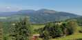
 Freundstein and Molkenrain
 Visorando Member
 3.86 mi
 +866 ft
 -850 ft
 2h 30
 Easy
 Departure from Willer-sur-Thur (Haut-Rhin)
Starting from the Route des Crêtes, near the Freundstein farmhouse inn, a magnificent, fairly easy and varied route with numerous viewpoints.
Ostein Farm and Rock, Camp Turenne and Molkenrain from Bitschwiller
10.05 mi
+2,559 ft
-2,549 ft
6h 50
 Difficult
Departure from Bitschwiller-lès-Thann (Haut-Rhin)
Starting from Bitschwiller-lès-Thann, climb to Camp Turenne via the Wickenbaechle path, the Ostein Farm Inn, the Triade shelter and Rocher d’Ostein, then climb to Molkenrain via the Friends of Nature refuge. Return via Camp Turenne, Baerenthal, Camp des Pyramides, Place des Canaris and Roche Albert. This loop walk passes numerous vantage points overlooking the Thur Valley and the surrounding peaks, such as Thanner Hubel and the Grand Ballon, as well as iconic historical sites on theFirst World War front.
The Molkenrain via Rehbrunnel and the Ostein rock
9.41 mi
+2,510 ft
-2,523 ft
6h 30
Difficult
Departure from Haut-Rhin
Ascent to the summit of Molkenrain, situated opposite the Grand Ballon and next to the Hartmannswillerkopf, starting from Steinbach and passing through the viewpoints at Rehbrunnel and Rocher d’Ostein, as well as the Pyramides and Turenne camps, then returning via the Molkenrain ridge and the Col d’Herrenfluh,
An accessible hike enjoying pleasant forest paths and high-altitude stubble fields that offer remarkable views and panoramas whilst passing through historic sites.
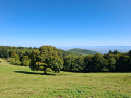
The Kohlschlag farmhouse inn and Molkenrain as seen from the Firstacker Pass
 Tourism professional
 8.69 mi
+1,847 ft
-1,850 ft
5h 35
 Moderate
Departure from Soultz-Haut-Rhin (Haut-Rhin)
This circular mountain route starting from the Col du Firstacker links three farm-inns (the Kohlschlag, the Freundstein and the Molkenrain) whilst offering you the chance to discover the Hartmannswillerkopf Memorial, the famous and deadly Franco-German mountain battlefield of the First World War. Alternating between forests, pastures and ruins, the route subtly blends heritage with farm life and the atmosphere of the forest, all enhanced by magnificent views.
Walks near Molkenrain
A day trip to Lac du Ballon
 Tourist office8.50 mi
+1,467 ft
-2,031 ft
5h 10
Moderate
Departure from Murbach (Haut-Rhin)
Enjoy a relaxing break at Lac du Ballon before setting off again along the Route des Crêtes.
The route for this second day, starting from the Grand Ballon, includes a short detour to Lac du Ballon, so you can take in the scenery and the tranquillity of this little paradise. The walk continues along the Route des Crêtes to Markstein, with views of the Grand Ballon and the Thur Valley, and, if you wish, you can enjoy the leisure and outdoor activities on offer at the Markstein resort.
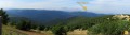
On the ridges: Grand Ballon – Markstein – Petit Ballon
 13.44 mi
+2,110 ft
-3,022 ft
8h 00
Difficult
Departure from Murbach (Haut-Rhin)
An easy route, gently undulating across the highest peaks of the Vosges, through stubble fields and forests. Magnificent views over the surrounding valleys.
Le Col du Grand Ballon depuis Soultz
8.15 mi
+3,596 ft
-89 ft
6h 55
Difficult
Departure from Soultz-Haut-Rhin (Haut-Rhin)
Randonnée presque quasiment en montée qui permet de relier Soultz, sympathique village culturel, au Col du Grand Ballon où vous pourrez passer la nuit avant d'aller le lendemain matin au sommet. Bien que cette étape soit courte en kilomètres, elle comporte un important dénivelé à ne pas négliger. Mais que de beautés en revanche entre les forêts et points de vues remarquables dans la dernière partie du parcours.
Guebwiller – Grand Ballon
8.25 mi
+3,622 ft
-174 ft
6h 55
Difficult
Departure from Guebwiller (Haut-Rhin)
Get straight to the heart of the matter with the ascent of the Grand Ballon, which will delight the fittest walkers!
Starting from Guebwiller, the first day of this multi-day hike will take you to the Grand Ballon, the highest peak in the Vosges mountains, which rises to an altitude of 1,424 metres. The climb to this pass is therefore quite challenging and requires a good level of fitness. Along the way, you’ll be able to enjoy the varied landscapes and the flora and fauna of the Vosges, and on arrival, the exceptional panoramic views across the whole of the Alsace plain, the Black Forest and even the Bernese Alps if the sky is clear.
3-day tour of the Grand Ballon: from Guebwiller to the Grand Ballon
8.23 mi
+3,622 ft
-174 ft
6h 55
Difficult
Departure from Guebwiller (Haut-Rhin)
First day of the 3-day Grand Ballon circuit. Starting from Guebwiller, the first day of this multi-day hike will take you to the Grand Ballon, the highest peak in the Vosges mountains, which rises to an altitude of 1,424 metres. The ascent is quite challenging and requires a good level of fitness. Along the way, you can enjoy the varied landscapes and the flora and fauna of the Vosges, and on arrival, the exceptional panoramic views across the whole of the Alsace plain, the Black Forest and, on a clear day, even the Bernese Alps.
Gsang towards the Hundsruck Pass
4.44 mi
+499 ft
-1,444 ft
2h 30
Easy
Departure from Moosch (Haut-Rhin)
Return to the Hundrunck Pass via the summit of the Vogelstein.
Ascent to the Grand Ballon from Sengern (Guebwiller) via the lake
 5.78 mi
+2,910 ft
-39 ft
5h 10
Difficult
Departure from Lautenbachzell (Haut-Rhin)
A challenging climb to the Grand Ballon from Sengern (past Guebwiller). The route passes by the beautiful Lac du Ballon and the Gustiberg farmhouse inn, both of which offer very pleasant places to stop for a break.
Linthal – Grand Ballon – Markstein
12.20 mi
+3,553 ft
-1,319 ft
8h 40
Difficult
Departure from Linthal (Haut-Rhin)
A very physically demanding first day with a wide variety of landscapes.
Starting from Linthal, the most mountainous village in the Guebwiller region, the first day of this multi-day hike will take you to the Auberge du Steinlebach, via the Grand Ballon – the highest peak in the Vosges mountains, rising to an altitude of 1,424 metres – and the Markstein resort. The ascent is quite challenging and requires a good level of fitness. Along the way, you’ll pass the Gustiberg farmhouse inn, Lake Ballon and the Haag farmhouse inn…
From the ridges towards the Petit Ballon
8.32 mi
+866 ft
-784 ft
4h 35
Moderate
Departure from Ranspach (Haut-Rhin)
The Munster Valley, Hohrodberg, Haut-Koenigsbourg Castle – just how far will the Col d’Oberlauchen take your view?
Setting off from Markstein, before crossing the resort’s ski slopes, you can stop off to visit the Notre-Dame-des-Neiges Chapel for a brief cultural break. Heading towards the Petit Ballon, this route crosses numerous passes and peaks, such as the Klintzkopf and the Hilsenfirst, not to mention the Col d’Oberlauchen, from which you’ll be able to spot many of the area’s distinctive features… Keep your eyes peeled!
Auberge du Belacker – Grand Ballon
10.07 mi
+3,353 ft
-2,126 ft
7h 35
Difficult
Departure from Moosch (Haut-Rhin)
For this lovely new stage, which will take you from Belacker to the Grand Ballon, the highest peak in the Vosges, follow the Club Vosgien route, marked with Yellow Rectangles. These markings indicate theGR®532, an iconic walking route across the Vosges linking Woerth in the Bas-Rhin to Belfort.
Although the distance is shorter, this stage is by no means easy. After a descent towards Saint Amarin, with a 560m drop in altitude, don’t forget to save your energy, as a 1,000m climb then awaits you to reach the “roof of the Vosges”.