


Please note that it is possible to do a circular walk starting from the Rawez Farms to explore the Breuvanne Marshes in greater depth… but not by following the Red Triangle-marked trail in its entirety, as certain sections have become completely impassable due to a lack of maintenance of the route by the relevant authorities! It is therefore better to follow part of the GRP®162 route. Watch this space – and perhaps there’ll soon be a fully-fledged walk dedicated to this nature reserve.
Circular walk starting from the Rawez Farm


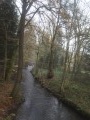
An easy circular walk starting from the Rawez Farms (large public car park on the east side) to explore the countryside and the magnificent forests on either side of the Athus–Meuse railway line. Of particular note is the beautiful stream with its stepped sections just before the Avioth Bridge.
Details
Creation:
Last update:
Last review:
–
–
-
 Activity: Walking
-
 Distance: 9.57 mi
-
 Average duration: 4h 40
-
 Difficulty: Moderate
-
-
 Back to start: Yes
-
 Ascent: + 348 ft
-
 Descent: - 348 ft
-
-
 Highest point: 1,227 ft
-
 Lowest point: 1,017 ft
-
 Country:
Belgium
-
 Area: Massif des Ardennes
-
 City:
Tintigny
-
 Start/End: N 49.668331° / E 5.453045°
-
 IGN map(s): Ref. 3210O
-


 Hour-by-hour weather
Photos
Waypoints
- S/E : mi 0 - alt. 1,135 ft - Rawez Farm
- 1 : mi 0.91 - alt. 1,171 ft - Roman Road from Reims to Trier
- 2 : mi 0.98 - alt. 1,181 ft - Bench
- 3 : mi 2.15 - alt. 1,181 ft - Bellefontaine – Croix Dansart
- 4 : mi 2.7 - alt. 1,165 ft - Picnic shelter and playground
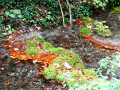
- 5 : mi 4.08 - alt. 1,109 ft - A splendid stream with terraced, moss-covered steps
- 6 : mi 4.66 - alt. 1,178 ft - Jubilee trees
- 7 : mi 6.08 - alt. 1,135 ft - Picnic shelter
- 8 : mi 7.74 - alt. 1,155 ft - Passing under the Athus–Meuse railway line
- 9 : mi 9.17 - alt. 1,132 ft - Near the Breuvanne Marshes
- S/E : mi 9.57 - alt. 1,135 ft - Rawez Farm
Worth a visit
Other walks in the area
The Meixoise via Gros Cron
 Visorando Member
 11.39 mi
+791 ft
-801 ft
5h 55
Moderate
 Departure from Tintigny (Province de Luxembourg)
Starting from Bellefontaine, a small village in the Gaume region, this is a lovely walk through the forests of Gaume to Meix-devant-Virton, following both sides of the Chevratte valley. Along the way, you’ll discover the Gros Cron (a remarkable geological formation in the Belgian Gaume) and its spring.
The Gros Cron in Lahage
 10.41 mi
+614 ft
-636 ft
5h 20
Moderate
Departure from Tintigny (Province de Luxembourg)
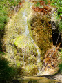
Inspired by, modified and extended from the local signposted walk “Le Cron et sa source”, this hike circles Lahage anti-clockwise. There isplenty of woodland, though there are some open landscapes too. The highlight is, of course, the Gros Cron and its spring… a spring that looks more like a resurgence than a spring, given the flow rate.
A Gaume getaway starting from Gérouville
 12.08 mi
+610 ft
-604 ft
6h 05
 Difficult
Departure from Meix-devant-Virton (Province de Luxembourg)
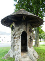
The village of Gérouville is known for its Place du Tilleul … there are many lime trees there, but that is not the original reason for its name. On this square stands the splendid remains of a tree trunk dating back several centuries, which some people mistook for a lime tree, whilst in reality it is an elm planted in the 13th century and which fell from old age in the 19th century. The full story is set out on the information panel next to it. So do step through the archway and make yourself comfortable there for a drink with friends or whilst waiting for the bus.Partly through the countryside but mainly through woodland, the walk takes you on a tour of the surrounding area. The only houses you’ll come across (apart from the centre of Gérouville) are in Limes, where the route passes by the old watermill.The short stretch in France is very rural at the start and then becomes wooded towards the end. The route passes close to another disused watermill that was once used to power a flat iron works (production of flat iron).
Meix-devant-Virton – Halanzy
 15.11 mi
+889 ft
-814 ft
7h 45
Difficult
Departure from Meix-devant-Virton (Province de Luxembourg)
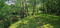
Leaving Meix-devant-Virton via roads with light to moderate traffic and arriving in Halanzy via similar roads does not mean the entire route is like this. No, there are quiet country lanes with beautiful views, farm tracks that turn into woodland paths, and a steep downhill stretch through a neighbourhood of holiday homes. And then there’s the River Ton, which sets the tone in its valley, along with more unexpected and unlikely paths and tracks. As I’m staying with a local, my stopping point is open to chance.
The Trou des Fées and the woods of Bonlieu and Lacquet
 4.70 mi
+220 ft
-246 ft
2h 20
 Easy
Departure from Etalle (Belgique) (Province de Luxembourg)
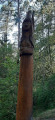
What a lovely, enchanting walk! Enter the great Gaume forest. Passing through another beautiful high forest, you’ll follow a magnificent path winding through a secluded valley, where you’ll discover the Trou des Fées right at its heart. This astonishing sand dune is made up of several galleries carved out by natural erosion.
The Montauban Spring and Fourneau Marchand
 9.70 mi
+709 ft
-725 ft
5h 05
Moderate
Departure from Etalle (Belgique) (Province de Luxembourg)
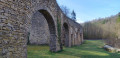
A pleasant walk passing through Montauban, the Fourneau Marchand fish market and crossing the old railway line. In summer, you can enjoy a drink on the terrace at the Fourneau Marchand!
The Prés d'Orval Nature Reserve
 6.45 mi
+341 ft
-341 ft
3h 15
Moderate
Departure from Florenville (Province de Luxembourg)
Walk between France and Belgium from Orval Abbey to the small village of Williers on the French side.
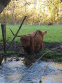
Hike along forest trails, guided by the murmur of a stream. Encounter a herd of Highland cows and, more unusually, observe traces of Gallo-Roman remains.
For more walks, use our search engine .
The GPS track and description are the property of this route's author. Please do not copy them without permission.

