Lac des Sirènes, starting from Prapic

A walk with almost no descent thanks to the Télémix and the car left beforehand at the Orcières Merlette resort.
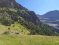
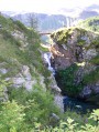
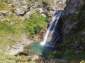
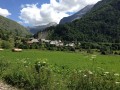
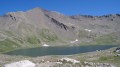
The Diolon Valley is beautiful and little-known. It takes you from Prapic to Lac des Sirènes. From there, it’s easy to reach Roche Rousse.
This hike should only be undertaken when the Merlette resort is open in summer (July and August) so you can return via the Roche Rousse Télémix. (The descent is much shorter as it includes the ride down on the Télémix!)

Details

23535549
Creation:
Last update:
Last review:
  • Walking
    Activity: Walking
  • ↔
    Distance: 6.38 mi
  • ◔
    Average duration: 5h 25 
  • ▲
    Difficulty: Difficult

  • ⚐
    Back to start: No
  • ↗
    Ascent: + 2,884 ft
  • ↘
    Descent: - 1,864 ft

  • ▲
    Highest point: 7,907 ft
  • ▼
    Lowest point: 5,023 ft

Photos

Description of the walk

Park in the car park at the entrance to Prapic.

(S) Walk up the road to reach the village square in Prapic and the Tourist Office.

(1) Turn left onto the cobbled road leading uphill. Then turn right and take the dirt track on the left. Follow this track alongside the Torrent du Blaisil to reach the Tombeau du Poète crossroads.

(2) Turn left and cross the torrent; the track becomes a path climbing up the hillside. It crosses the Torrent du Diolon and continues its ascent via a series of tight hairpin bends until it reaches a crossroads.

(3) Head towards Lac Jujal on the left. The path continues its series of hairpin bends; the valley opens out and the slope becomes less steep. Stay on the left bank of the Diolon; the path becomes somewhat overgrown with grass. The valley becomes very flat. The stream changes its name to the Lac du Col stream! Near a cubic rock, fords the stream to rejoin the path, which climbs steeply towards the hut at the base of the Gnourou chairlift.

(4) The path becomes a dirt track suitable for vehicles, rising gently through the pastures.

(5) Turn right onto the ascending track.

(6) Turn left onto the track leading down towards Roche Rousse and, after a short descent, follow a track to the top station of the Roche Rousse Télémix.

(7) Take the Télémix to finish the walk at the lower station at Orcières Merlette (E).

Waypoints

  1. S : mi 0 - alt. 5,023 ft - Prapic car park - Drac (rivière) - Drac Noir-Drac
  2. 1 : mi 0.24 - alt. 5,128 ft - Place de - Arrêt navette Prapic
  3. 2 : mi 0.93 - alt. 5,249 ft - Tombeau du Poète crossroads
  4. 3 : mi 1.76 - alt. 5,955 ft - Lac des Pisses crossroads
  5. 4 : mi 3.36 - alt. 7,661 ft - Gnourou chairlift station
  6. 5 : mi 3.85 - alt. 7,805 ft - Turn right - Lac des Sirènes
  7. 6 : mi 3.99 - alt. 7,907 ft - Turn left onto the downhill track - Lac des Sirènes
  8. 7 : mi 4.9 - alt. 7,493 ft - Gare arrivée Télémix Roche Rousse
  9. E : mi 6.38 - alt. 6,043 ft - Orcières Merlette

Notes

(S) Prapic: with toilets, a bin and drinking fountains.
(7) Roche Rousse: a restaurant and bar with a lovely terrace.
(E) Return to Prapic either by car, coach or hitchhiking.
Orcières Tourist Office

Reviews and comments

4.7 / 5
Based on 1 review

Reliability of the description
5 / 5
Ease of following the route
4 / 5
Route interest
5 / 5
charlolotte83
charlolotte83

Overall rating : 4.7 / 5

Date of your route : Aug 19, 2026
Reliability of the description : ★★★★★ Very good
Ease of following the route : ★★★★☆ Good
Route interest : ★★★★★ Very good
Very busy route : No

We did this walk in the opposite direction
We set off from Orcières 1850 and walked up to Lac des Sirènes, where we rejoined the trail to head down to Prapic and catch the free shuttle back to the resort (please note: it doesn’t run every day and is by booking only; dogs are allowed)

I’d recommend doing the walk in the direction we took, as the descent after Lac des Sirènes offers some breathtaking scenery

Between Orcières and Lac des Sirènes it gets quite busy, especially from Rocherousse onwards, as the chairlift takes people straight there, so the Rocherousse–Sirènes section isn’t all that pleasant, but you’re rewarded afterwards once you leave the ‘main route’!

A few kilometres of slightly monotonous descent through the woods (but I’m really glad I didn’t have to do that on the way up! I don’t have the calf muscles for it!), and we arrived in Prapic just in time to enjoy a delicious slice of blueberry tart and a small local beer. I highly recommend it!

Machine-translated

Other walks in the area

For more walks, use our search engine .

The GPS track and description are the property of this route's author. Please do not copy them without permission.