


Refine your search for walks in Bütgenbacher See (Lac de Bütgenbach)
Bütgenbacher See (Lac de Bütgenbach) walks


 Tour de Wallonie
 Visorando Member
 456.86 mi
 +25,620 ft
 -26,109 ft
 33 days
 Difficult
 Departure from Waterloo (Brabant Wallon)
This walking tour of Wallonia, which includes the German-speaking part of Belgium, is a circular route that generally follows the borders as closely as possible, whether linguistic or territorial. This sometimes involves forays into neighbouring territories – France, the Grand Duchy of Luxembourg and the Flemish Region. Occasionally, the route also deviates from this due to accommodation requirements or because suitable accommodation could not be found close to the borders, whilst still adhering to various constraints.
Losheimergraben – Nidrum
 10.42 mi
+456 ft
-814 ft
5h 10
10.42 mi
+456 ft
-814 ft
5h 10
 Moderate
Departure from Belgium
Moderate
Departure from Belgium
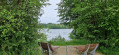
This24th stage takes us from the tranquillity of the forests of the Eastern Cantons to the livelier atmosphere of the shores of Lake Bütgenbach, before returning to the countryside in Nidrum. For your feet, it means switching from forest paths with ‘natural’ surfaces to the tarmac of small country roads, town streets and the Ravel. A complete change of scenery is guaranteed.
Walks near Bütgenbacher See (Lac de Bütgenbach)
Nidrum – Eupen
 18.26 mi
+869 ft
-1,732 ft
9h 10
Difficult
Departure from Bütgenbach (Province de Liège)
18.26 mi
+869 ft
-1,732 ft
9h 10
Difficult
Departure from Bütgenbach (Province de Liège)
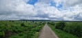
Here is another remarkable stage. It begins in the meadows of the Belgian highlands and then ‘flirts’ with Belgium’s highest elevations in the Hautes Fagnes, reaching a peak of 638 m; from there, the path descends steadily to Eupen and the Vesdre at an altitude of 263 m. It’s a route that also has a few surprises in store, particularly along the stretch beside the River Helle (Hill in German), where the path zigzags between wooden duckboards and muddy, mostly rocky ground – an environment it seeks to avoid by veering off upwards to… well, I’ll let you discover that for yourselves. A bit of suspense never hurt anyone.
La Fagne des Deux Séries
 5.10 mi
+325 ft
-361 ft
2h 40
5.10 mi
+325 ft
-361 ft
2h 40
 Easy
Departure from Baelen (Province de Liège)
Easy
Departure from Baelen (Province de Liège)
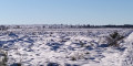
A very beautiful walk through a nature reserve, suitable for all seasons.
Rodt Sank Vith – Losheimergraben
 16.19 mi
+994 ft
-459 ft
8h 20
16.19 mi
+994 ft
-459 ft
8h 20
 Very difficult
Departure from Sankt Vith (Province de Liège)
Very difficult
Departure from Sankt Vith (Province de Liège)
On this twenty-third stage, we’ll head to the German border – the easternmost point of my tour of Wallonia – as the village of Losheimergraben lies on the border. In reality, it isn’t really a village but rather a hamlet that’s ideal as a starting point for hikes or cross-country skiing trips. So you’ll have no trouble finding somewhere to stay there. The lowest point on the route is at an altitude of 500 m, and the highest at 682 m. We are therefore in the highest region of Belgium, to some extent. The first third of the day is spent in the countryside, and the rest in the woods.