Londinières: up hill and down dale

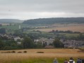
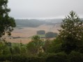
This walk takes you along the Eaulne Valley. You’ll climb the hillside and continue through woods and open countryside. You’ll return to Londinières via Mont Blanc.

Details

670876
Creation:
Last update:
Last review:
  • Walking
    Activity: Walking
  • ↔
    Distance: 6.35 mi
  • ◔
    Average duration: 3h 25 
  • ▲
    Difficulty: Easy

  • ⚐
    Back to start: Yes
  • ↗
    Ascent: + 604 ft
  • ↘
    Descent: - 587 ft

  • ▲
    Highest point: 663 ft
  • ▼
    Lowest point: 213 ft

Photos

Description of the walk

Parking is available in the car park opposite the town hall and the church in Londinières.

(S/E) Facing the town hall, walk past the shops on your right into the car park. At the end of the car park, cross Rue Gaston Decouvert and take the street opposite, Rue du Pont de Pierre.
Carry on straight ahead along the pavement on Rue du Pont de Pierre until you reach the junction with Route de Croixdalle.
At the junction, turn right onto Route de Croixdalle.

(1) Take the second street on your right, Route de Boissay (D117). Continue straight on for about 2 km until you reach the junction with Rue de Béthencourt.

(2) Take Rue de Béthencourt on your right, which crosses over the Eaulne, and continue to the junction with the D920.

(3) Cross the road and take the path opposite, at the foot of the wayside cross. Follow this path as it climbs. At the top of the path, walk alongside the Sapinettes on your left. Carry on straight ahead along this path as it leads into the Bois de Capval. Walk through the woods, staying on the same path as it descends towards the hamlet of Capval (Wanchy Capval).
When you reach the hamlet of Capval, ignore the first road, Route de Capval, on your right and the path on your left.

(4) Take the second road on your right, which turns into a dirt track. Carry on straight ahead along this track, which leads to the hamlet of Villeneuve (Londinières), where you’ll rejoin the tarmac road.
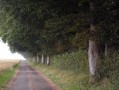
Carry on straight ahead along the tree-lined road.

(5) At the end of the straight stretch, take the path across the plain on your right. Follow this path, which winds left and right before joining the Route de Capval at the end.

(6) Turn left and head down the Route de Capval, which runs alongside Mont Blanc. Follow this road all the way down and enter Londinières at the junction with the Route de Fresnoy Folny (D1314).

(7) Cross the road with care, then take Rue du Courmont opposite and follow it straight down to the junction with Rue de Verdun.

(8) Cross Rue de Verdun and turn left. Walk past the Résidence de la Boullerie and turn immediately right. Cross the garden of the Boullerie and the car park between the fire station and the school, which leads onto Rue Maréchal Leclerc.
Cross Rue Maréchal Leclerc and walk along it on your left until you reach the end, where you’ll find the car park opposite the town hall and the church (S/E).

Waypoints

  1. S/E : mi 0 - alt. 249 ft - Car park opposite the town hall and church. Cross the - Eaulne (rivière) - Affluent de l'Arques
  2. 1 : mi 0.26 - alt. 243 ft - Turn right onto Route de Boissay
  3. 2 : mi 1.56 - alt. 230 ft - Turn right onto Rue de Béthencourt
  4. 3 : mi 1.92 - alt. 249 ft - D920, the track opposite
  5. 4 : mi 3.56 - alt. 446 ft - The hamlet of Capval, second road on the right
  6. 5 : mi 4.6 - alt. 659 ft - On the right
  7. 6 : mi 5.22 - alt. 633 ft - Route de Capval, on the left
  8. 7 : mi 6.04 - alt. 338 ft - Route de Fresnoy Folny (D1314)
  9. 8 : mi 6.22 - alt. 256 ft - Rue de Verdun
  10. S/E : mi 6.35 - alt. 249 ft - Car park opposite the town hall and church

Worth a visit

In Londinières:
* Motocross track on the Route de Saint-Pierre-des-Jonquières.
* Normandy Vol Libre: paragliding and hang-gliding on the Route de Fresnoy Folny.
Sainte-Melaine Chapel in Boissay.
The Béthencourt Ponds.

Paradis Aquatique in Douvrend, a place for relaxation and leisure for all ages.

Reviews and comments

5 / 5
Based on 2 reviews

Reliability of the description
5 / 5
Ease of following the route
5 / 5
Route interest
5 / 5
benoitrando
benoitrando

Overall rating : 5 / 5

Date of your route : May 08, 2018
Reliability of the description : ★★★★★ Very good
Ease of following the route : ★★★★★ Very good
Route interest : ★★★★★ Very good

An excellent route – no problems at all. Thank you

Machine-translated

Claire61
Claire61

Hello Nadège,

Thank you, I’ll be sure to have a look at your other routes,

Thanks again
Have a lovely Sunday

Claire

Machine-translated

lannel
lannel

Hello Claire,
Thank you very much – I’m glad you enjoyed this route. Please do have a look at my other approved routes on Visorando.
Happy hiking.
Kind regards
Nadege Lannel

Machine-translated

Claire61
Claire61

Overall rating : 5 / 5

Date of your route : Jan 29, 2018
Reliability of the description : ★★★★★ Very good
Ease of following the route : ★★★★★ Very good
Route interest : ★★★★★ Very good

A superb, well-described walk; I did a little circular loop as well, through rolling countryside with small streams. Definitely one to do again and again without hesitation

Machine-translated

Other walks in the area

For more walks, use our search engine .

The GPS track and description are the property of this route's author. Please do not copy them without permission.