Following in the footsteps of the Tortillard between Neuville and Londinières

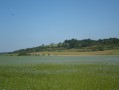
This walk will take you from Neuville to Londinières, following the old route of the Tortillard railway, which once linked Aumale to Envermeu. You will mainly be walking along dirt tracks on the slopes of the Eaulne Valley.

Details

7750793
Creation:
Last update:
Last review:
  • Walking
    Activity: Walking
  • ↔
    Distance: 5.85 mi
  • ◔
    Average duration: 3h 00 
  • ▲
    Difficulty: Easy

  • ⚐
    Back to start: Yes
  • ↗
    Ascent: + 354 ft
  • ↘
    Descent: - 354 ft

  • ▲
    Highest point: 472 ft
  • ▼
    Lowest point: 262 ft

Photos

Description of the walk

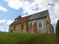
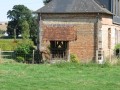
The walk starts at the Sainte-Marguerite Chapel in the hamlet of Neuville (Bailleul Neuville)

(S/E) Opposite the chapel, turn right onto Rue des Mélandes.
Continue along this road until you reach a Fork in the road.

(1) At the Fork in the road, turn left onto Rue du Clos Rose and then turn left onto the cul-de-sac, which becomes a track.
Carry on along this uphill track, ignoring the track on the left, and continue until you reach a crossroads.

(2) Take the track on the left. Follow this track to the end, ignoring the other tracks.

(3) When you reach the end of the tarmac track, turn onto the track on the right. Continue straight ahead along this track for about 1,500 m.

(4) Turn left onto the grassy path. Take care, as it is not very visible. Continue along this path, which leads to the village of Londinières.
At the end of the track, you’ll reach Londinières on Rue des Granges; walk down this street. At the end of the street, you’ll come to a junction.

(5) Turn left onto Rue de Clais. Carry on straight ahead along this street, which climbs and becomes a dirt track.
Follow this track straight on; it ends in a tarmac road near a detached house, and continue until you reach a fork in the road.
At the fork in the road, keep slightly to your right until you reach asecond fork in a bend.

(6) Turn left onto a dirt track.
Carry on straight ahead along this track, ignoring the side tracks, until you reach a T-junction with Route de Neuville.

(7) At the junction, turn left onto Route de Neuville.
Carry on straight along this road until you reach the hamlet of Neuville, on Rue des Mélandes.
Walk through the hamlet along this street until you reach the Sainte-Marguerite Chapel (S/E).

Waypoints

  1. S/E : mi 0 - alt. 325 ft - Sainte Marguerite Chapel in Neuville
  2. 1 : mi 0.14 - alt. 328 ft - Turn left onto Rue du Clos Rose
  3. 2 : mi 0.74 - alt. 472 ft - Crossroads
  4. 3 : mi 1.79 - alt. 364 ft - Turn right
  5. 4 : mi 2.71 - alt. 364 ft - Grassy path on the left
  6. 5 : mi 3.76 - alt. 262 ft - Turn left onto Rue de Clais
  7. 6 : mi 4.48 - alt. 308 ft - Dirt track on the left
  8. 7 : mi 5.42 - alt. 318 ft - Turn left onto the road to Neuville
  9. S/E : mi 5.85 - alt. 325 ft - Sainte Marguerite Chapel in Neuville

Notes

You can start from Londinières due to parking restrictions.
There is no car park in Neuville; you must park at the side of the road.

Worth a visit

Le Grenier de la Mothe in Bailleul Neuville, a visitor centre and reception venue.
Located on the Londinières–Dieppe route, the Étang de Béthencourt is a spot for family walks.
In Lucy, the ‘Jardin du Crapaud à Trois Pattes’, admission charged.

Reviews and comments

4.7 / 5
Based on 2 reviews

Reliability of the description
5 / 5
Ease of following the route
5 / 5
Route interest
4 / 5
did760
did760

Overall rating : 4 / 5

Date of your route : Aug 23, 2026
Reliability of the description : Not used / Not applicable
Ease of following the route : Not used / Not applicable
Route interest : ★★★★☆ Good
Very busy route : No

A pleasant walk along the lowland paths with some lovely views.

Machine-translated

papy diouf
papy diouf

Overall rating : 4.7 / 5

Date of your route : Apr 30, 2022
Reliability of the description : ★★★★★ Very good
Ease of following the route : ★★★★★ Very good
Route interest : ★★★★☆ Good
Very busy route : No

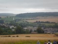
A lovely little walk in the countryside with not too much tarmac; lovely views over the Eaulne Valley

Machine-translated

Other walks in the area

For more walks, use our search engine .

The GPS track and description are the property of this route's author. Please do not copy them without permission.