Between Londinières and Fréauville

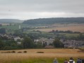
A short family walk around Londinières and Fréauville, small towns in Normandy.

Details

525725
Creation:
Last update:
Last review:
  • Walking
    Activity: Walking
  • ↔
    Distance: 4.23 mi
  • ◔
    Average duration: 2h 10 
  • ▲
    Difficulty: Easy

  • ⚐
    Back to start: Yes
  • ↗
    Ascent: + 213 ft
  • ↘
    Descent: - 194 ft

  • ▲
    Highest point: 400 ft
  • ▼
    Lowest point: 240 ft

Description of the walk

Free car park in front of the Town Hall.

(S/E) Head towards Bures-en-Bray along Rue du Pont de Pierre (D12) and continue along Rue des Canadiens (D12).

(1) At the T-junction, carry on straight ahead along the D12 for about 800 metres to leave Londinières.

(2) Before the second bend, turn left onto the farm track and carry on until you reach the junction with another track.

(3) Ignore the turn-off on the right which joins the D12 and turn left onto this track. Continue for about 700 metres.

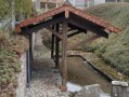
(4) At the crossroads, veer left onto the track that descends into a hollow. Pass a water tower on your right, after which the track becomes a road.

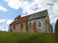
(5) At the junction with the D117, head straight on to reach Fréauville. Turn left onto Rue de l’Église and continue to the D1314.

(6) Cross the road and carry on straight ahead along a road that turns into a track. Follow it for 200 metres, then turn left. Continue for about 1 km in a straight line along the same track. It becomes a tarmac road, Rue de Clais, passing behind the first houses in Londinières until you reach an X-junction.

(7) Carry on straight ahead for 100 metres, still on Rue de Clais, then turn left to return to Londinières, to the town hall and the car park where you started (S/E).


Waypoints

  1. S/E : mi 0 - alt. 249 ft - Free car park in front of the Town Hall - Eaulne (rivière) - Affluent de l'Arques
  2. 1 : mi 0.57 - alt. 279 ft - X-shaped crossroads
  3. 2 : mi 1.09 - alt. 322 ft - Farm track on the left
  4. 3 : mi 1.62 - alt. 381 ft - Junction with another farm track
  5. 4 : mi 2.06 - alt. 400 ft - Crossroads
  6. 5 : mi 2.74 - alt. 269 ft - Junction with the D117
  7. 6 : mi 3.22 - alt. 282 ft - Junction with the D1314
  8. 7 : mi 4.08 - alt. 266 ft - X-shaped crossroads
  9. S/E : mi 4.23 - alt. 249 ft - Free car park in front of the Town Hall

Notes

Bring walking shoes.

Worth a visit

Dieppe: 25 km.
Beach, fishing harbour, marina and cross-Channel ferry terminal. Castle. Museum.

Eu: 24 km.
16th-century castle. Notre-Dame Collegiate Church, parts of which date back to the 12th century, and its crypt.

Le Tréport: 26 km.
Fishing port, marina and shopping.

Reviews and comments

4.3 / 5
Based on 2 reviews

Reliability of the description
4.5 / 5
Ease of following the route
4.5 / 5
Route interest
4 / 5
benoitrando
benoitrando

Overall rating : 5 / 5

Date of your route : May 27, 2018
Reliability of the description : ★★★★★ Very good
Ease of following the route : ★★★★★ Very good
Route interest : ★★★★★ Very good

short but enjoyable

Machine-translated

tatoutchristian
tatoutchristian

Overall rating : 3.7 / 5

Date of your route : Apr 24, 2017
Reliability of the description : ★★★★☆ Good
Ease of following the route : ★★★★☆ Good
Route interest : ★★★☆☆ Average

Things to do as a family

Machine-translated

Other walks in the area

For more walks, use our search engine .

The GPS track and description are the property of this route's author. Please do not copy them without permission.