In the countryside around Douvrend

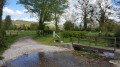
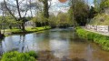
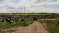
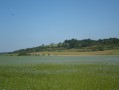
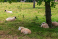
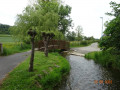
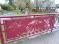
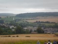
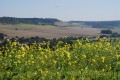
Douvrend, between Londinières and Envermeu: Normandy. A peaceful little walk amongst Normandy cows and Blonde d’Aquitaine cattle. Crosses three charming little bridges over the Eaulne. A short climb (130m).
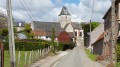
16th-century church.

Details

549749
Creation:
Last update:
Last review:
  • Walking
    Activity: Walking
  • ↔
    Distance: 3.98 mi
  • ◔
    Average duration: 2h 10 
  • ▲
    Difficulty: Easy

  • ⚐
    Back to start: Yes
  • ↗
    Ascent: + 410 ft
  • ↘
    Descent: - 413 ft

  • ▲
    Highest point: 607 ft
  • ▼
    Lowest point: 164 ft
  • ⚐ Country: France
  • ⚐ City: Douvrend (76630)
  • ⚑
    Start/End: N 49.868344° / E 1.32256°
  • ❏
    IGN map(s): Ref. 2008OT, 2009OT
  • Hour-by-hour weather

Photos

Description of the walk

Park at Place de la Mairie in Douvrend.

(S/E) Stand with your back to the town hall and take the road leading uphill opposite.

(1) At the junction with Rue aux Juifs, turn left and continue for 150 metres. Then turn right onto Route de la Chaussée, which leads to the D920, Route de Londinières.

(2) Cross the D920 (take care) but do not take the Route de Bailly opposite; instead, take the path slightly to the right which goes uphill. Continue until you reach the junction with a tarmac road.

(3) Turn right and continue along this tarmac road until you reach a crossroads. Turn right following the sign for Mont Landrin, in the commune of Wanchy-Capval, and continue for 40 metres.

(4) Turn right again onto the path that descends into a wood. When you reach the cemetery, turn left and then immediately right. Head straight down to the Eaulne.

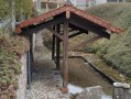
(5) Cross the first bridge on your right. Wind your way along the Chemin de la Source until you reach a second bridge, which you should cross. At the junction with the Route d’Agranville, turn right.

(6) At the next T-junction, turn right towards the village. Cross a third bridge and continue along the Route de la Chaussée.

(7) Before the church, turn right onto Rue de la Mairie, which takes you back to the starting point (S/E).

Waypoints

  1. S/E : mi 0 - alt. 197 ft - Place de la Mairie
  2. 1 : mi 0.04 - alt. 203 ft - Turn left onto Rue aux Juifs
  3. 2 : mi 0.21 - alt. 226 ft - D920 – path veering slightly to the right
  4. 3 : mi 0.7 - alt. 499 ft - Turn right onto the tarmac road
  5. 4 : mi 1.56 - alt. 607 ft - On the right, a path leading into a wood
  6. 5 : mi 2.87 - alt. 174 ft - Bridge on the right over the - Eaulne (rivière) - Affluent de l'Arques
  7. 6 : mi 3.5 - alt. 187 ft - Turn right at the T-junction
  8. 7 : mi 3.91 - alt. 197 ft - Turn right before the church
  9. S/E : mi 3.98 - alt. 197 ft - Place de la Mairie

Notes

Avoid this route in wet weather, as several sections are on marl soil. Wear walking shoes or sturdy footwear.
There is a water point at the cemetery, halfway along the route. Two benches under a chestnut tree on Place de la Mairie – very pleasant!

Worth a visit

Douvrend: a small, quiet village on the River Eaulne.
16th-century church, with a slate gable roof and panelled roof structure.

Dieppe: the town of four harbours: 23 km.
Eu: royal town and its Château Louis-Philippe: 30 km.
Le Tréport: a seaside town: 30 km

Reviews and comments

4.4 / 5
Based on 3 reviews

Reliability of the description
4.7 / 5
Ease of following the route
4.7 / 5
Route interest
4 / 5
mdeger
mdeger

Overall rating : 3.7 / 5

Date of your route : Apr 08, 2019
Reliability of the description : ★★★★☆ Good
Ease of following the route : ★★★★☆ Good
Route interest : ★★★☆☆ Average

Thank you for the help you’re giving us

Machine-translated

lecolosse
lecolosse

Overall rating : 5 / 5

Date of your route : Apr 08, 2018
Reliability of the description : ★★★★★ Very good
Ease of following the route : ★★★★★ Very good
Route interest : ★★★★★ Very good

A very, very good walk, but be careful at the first farm along the way – see description point no. 2: ‘Dogs are off the lead and may be dangerous if you have a dog.’

Machine-translated

Other walks in the area

For more walks, use our search engine .

The GPS track and description are the property of this route's author. Please do not copy them without permission.