Mont Landrin

Starting from Wanchy-Capval, nestled in the Eaulne Valley, this walk will take you up to the heights of Mont Landrin. You’ll cross cultivated plains before reaching the valley again at the hamlet of Capval.

Details

635727
Creation:
Last update:
Last review:
  • Walking
    Activity: Walking
  • ↔
    Distance: 6.78 mi
  • ◔
    Average duration: 3h 30 
  • ▲
    Difficulty: Moderate

  • ⚐
    Back to start: Yes
  • ↗
    Ascent: + 440 ft
  • ↘
    Descent: - 440 ft

  • ▲
    Highest point: 623 ft
  • ▼
    Lowest point: 230 ft

Photos

Description of the walk

Start from the car park of the Wanchy-Capval village hall in the centre of the village.

(S/E) As you leave the car park, turn right onto the C6 towards Mont Landrin. Continue along the C6 until you reach a Fork in the road, where you take the tarmac path on your left that leads uphill.

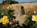
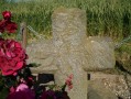
(1) After the wayside cross, the road turns into a grassy track. At the top of the track, you’ll rejoin the C6.

(2) Turn left onto the C6 and continue along this road until you reach another Fork in the road.
At the fork in the road, carry on along the road to your right until you reach the Mont Landrin farm.

(3) At the farm, turn left and carry on to the T-junction with the Route de la Plaine du Mont Landrin. Turn right and follow the road to the junction of roads and paths at the wayside cross.

(4) Cross the junction and take the path diagonally to your right across the Beaumont plain. Continue along this path, which leads onto a tarmac road at the Beaumont Farm.

(5) At the end of the track, carry on along the road opposite the track until you reach the junction of the road and track by the wayside cross.

(6) Cross the D115 road and take the path across the plain opposite. Continue along this path, ignoring the path on the left.

(7) Take the first track on your right, which descends to the hamlet of Capval. Continue along this track, which turns into a tarmac road as you reach the hamlet of Capval. Walk down to the T-junction. At the road, cross over and turn left, then carry on straight ahead.

(9) 100 metres further on, take the first flat track on your right, ignoring the other tracks. Continue along this flat track, which turns into a tarmac road that descends and takes you back to the village of Wanchy-Capval on the D115.

(9) At the T-junction with the D115, turn left onto the Grande Rue.
Follow the Grande Rue until you reach the junction with Rue de l’Église and Rue du Mont Landrin (C6).
Turn right onto Rue du Mont Landrin and you’ll find the village hall car park on your right – your starting point (S/E).


Waypoints

  1. S/E : mi 0 - alt. 236 ft - Village hall car park
  2. 1 : mi 0.39 - alt. 436 ft - Calvary
  3. 2 : mi 0.62 - alt. 587 ft - C6
  4. 3 : mi 1.11 - alt. 617 ft - Mont Landrin Farm
  5. 4 : mi 2.28 - alt. 584 ft - Waymark
  6. 5 : mi 2.9 - alt. 597 ft - Beaumont Farm
  7. 6 : mi 3.29 - alt. 607 ft - Capval Cross
  8. 7 : mi 4.08 - alt. 623 ft - Path on the right
  9. 8 : mi 5.26 - alt. 417 ft - Plain path
  10. 9 : mi 6.41 - alt. 249 ft - D115 Grande Rue
  11. S/E : mi 6.78 - alt. 236 ft - Village hall car park

Notes

You may wish to avoid this walk during the hunting season as there are many open fields.

Worth a visit

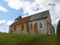
Wanchy-Capval Church.

Sainte-Melaine Chapel in Boissay, a hamlet of Londinières.

The Clockmaking Museum in Saint-Nicolas d’Aliermont.

Reviews and comments

4.6 / 5
Based on 3 reviews

Reliability of the description
4.7 / 5
Ease of following the route
5 / 5
Route interest
4 / 5
bertrand16
bertrand16

Overall rating : 4.7 / 5

Date of your route : May 28, 2018
Reliability of the description : ★★★★★ Very good
Ease of following the route : ★★★★★ Very good
Route interest : ★★★★☆ Good

A lovely walk showcasing the countryside of the Pays de Vaux, with its farmsteads and the pretty village of Wanchy Capva

Machine-translated

gazok54
gazok54 ★
• Edited:

Thank you, SALIO JACQUES
Unfortunately, neither the maintenance of the paths nor the signposting is the responsibility of Visorando. You’ll need to bring this to the attention of the local organisations that look after them.
Otherwise, you found the route enjoyable, and that’s what matters.

Machine-translated

SALIO JACQUES
SALIO JACQUES
• Edited:

Overall rating : 4.3 / 5

Date of your route : Jun 26, 2017
Reliability of the description : ★★★★☆ Good
Ease of following the route : ★★★★★ Very good
Route interest : ★★★★☆ Good

We went on this walk this afternoon. A good route, despite a steep climb at the start. A pleasant walk in lovely sunshine.
Some sections of the paths could do with better maintenance. The signposting – the round purple markers – needs improving.

Machine-translated

ninijules
ninijules

Overall rating : 4.7 / 5

Date of your route : Jun 26, 2017
Reliability of the description : ★★★★★ Very good
Ease of following the route : ★★★★★ Very good
Route interest : ★★★★☆ Good

A lovely route in glorious sunshine -

Machine-translated

Other walks in the area

For more walks, use our search engine .

The GPS track and description are the property of this route's author. Please do not copy them without permission.